| GE2905 ENVIRONMENT AND CONSERVATION - Epicollect Field Data 2019 | |||||||
| Name | Entry Created | Latitude | Longitude | Date | Time | Photograph Note | Photograph URL |
| Adam Reguera | 2019-04-16 00:22 | 42.187021 | 2.488502 | 12/04/2019 | 10:57:00 | This is a picture of a large Catalan independence flag overseeing the town of Olot, which is near to the Garrotxa National Park. The mountains are of great importance to Catalan identity and the use of the independence flag instead of the normal Catalan flag shows how they are being used politically as well. Those visiting the mountains will likely see the flag on the way there, especially those that travel there using public transport. This means a wide range of people will see the flag and demonstrates how tourism is being used to express political views. | https://five.epicollect.net/api/media/ge2905-environment-and-conservation-2019?type=photo&format=entry_original&name=b4c2fec0-5fdd-11e9-9788-4f159bd6b05b_1555374202.jpg |
| Adam Reguera | 2019-04-16 00:23 | 42.147389 | 2.544127 | 12/04/2019 | 13:07:00 | This is a picture of an information board in Catalan at the Garrotxa National Park. This information is of the facts, figures and history of the national parks volcano's, the economic and cultural uses of the volcanoes, along with the natural processes and facts behind the volcanoes. This shows that one of the focusses of the park is on education. This information board is also next to the main road, with a car park, benches and a water spring in the vicinity. This shows how the area has also been developed into a honeypot site for the national park, further evidenced by the group of school children in the area. Due to the car park, this area is also the beginning of many tourists visits to the national park, and this information board provides a good opportunity to educate visitors on the park and introduce the natural science behind it. | https://five.epicollect.net/api/media/ge2905-environment-and-conservation-2019?type=photo&format=entry_original&name=e4e5b020-5fdd-11e9-9788-4f159bd6b05b_1555374270.jpg |
| Adam Reguera | 2019-04-16 00:24 | 42.156769 | 2.539428 | 12/04/2019 | 15:26:00 | This is a picture of a pathway in the Garrotxa National Park. The pathway is made up using minimal resources, with only wood used for the railings and steps. The ground is also made up of the naturally occurring soil. The minimal use of external resources and lack of metals and plastics used shows the desire to not interfere with the local wildlife and represents the ecological focus of the park's management. However, one potential issue can arise from the erosion of the pathway by pedestrians. This destroys the wildlife of the path and can prevent smaller specifies and organisms from crossing, potentially segregating the local biodiversity. However, this is a necessary compromise between conservation and allowing visitors. | https://five.epicollect.net/api/media/ge2905-environment-and-conservation-2019?type=photo&format=entry_original&name=0c9f5da0-5fde-11e9-9788-4f159bd6b05b_1555374811.jpg |
| Adam Reguera | 2019-04-16 00:26 | 42.155991 | 2.539472 | 12/04/2019 | 15:46:00 | This picture at the bottom of the former quarry at the Garrotxa National Park. The wall is of consists of very fragile pyroclastic rocks, which is prone to crumble when touched. The railing is there to show where visitors should not pass. Unfortunately, the picture is quite blurry, but the sign says to not touch the wall, and visitors could be fined up to €350 if caught touching it. The sign is in Catalan, but the meaning of the symbols is clear. The railing and the sign are not only for visitor's safety due to the risk of a soil avalanche, but also to protect the environment and the fragile habitat for flora and fauna which has started to develop since the closure of the quarry. Thus, this represents one of the aims of the national parks management which is to protect the local ecosystems. | https://five.epicollect.net/api/media/ge2905-environment-and-conservation-2019?type=photo&format=entry_original&name=400441b0-5fde-11e9-9788-4f159bd6b05b_1555374439.jpg |
| Adam Reguera | 2019-04-16 00:27 | 42.153767 | 2.516853 | 12/04/2019 | 17:32:00 | This is a picture taken at the Garrotxa National Park is of a monument dedicated to Joan Maragall, a well-known Catalan poet where one of his poems can be read in Catalan (just outside of the photograph). The poem is about the surrounding woodlands, which is a popular location for Catalans to visit. The surrounding area has been developed into a honeypot site for visitors with the monument being next to a main road with a car park, benches, and public toilets on the other side of the road. The popularity of the site can be evidenced by the footpath to cross the road going under the road. This is presumably because of high amounts of visitors parking at the car park to visit the woodland and the monument on the other side and if they were to cross on the road it would prove too disruptive to traffic. | https://five.epicollect.net/api/media/ge2905-environment-and-conservation-2019?type=photo&format=entry_original&name=71669f00-5fde-11e9-9788-4f159bd6b05b_1555374853.jpg |
| Alex Horn | 2019-04-16 18:47 | 42.1822 | 2.488 | 12/04/2019 | 12:00:00 | This area is one of 47 national park regions of spain, and with the local economic and governemental crisis this whole park is supervised by just one person. This region is full of hundreds of volcanoes all of which need to be maintained and protecting in order to continue providing safe heritage. | https://five.epicollect.net/api/media/ge2905-environment-and-conservation-2019?type=photo&format=entry_original&name=1825c020-6078-11e9-9f98-511143fe93c4_1555440541.jpg |
| Alex Horn | 2019-04-16 18:55 | 51.323037 | -0.596363 | 12/04/2019 | 12:51:00 | This image shows a church which was built in the crater of one of the volcanoes we visited. It is still used for special occasions and ceramonies, it has been completely overrun by the environment. We see an abundance of trees and vegatation looking lush on one side of the crater whilst on the other side it is looking very dry and almost dead. This is because of the way that the sun faces during the day and the heat up there. This makes the volcanos crater an ecological gold mine as it is so diverse maintaining habitiats for all kinds of animals and plants which thrive in this variety. The house above the crater was bought so that in the near future it can be turned into an education centre to teach students from around the world all about volcanoes and the natural environment in Catalonia. | https://five.epicollect.net/api/media/ge2905-environment-and-conservation-2019?type=photo&format=entry_original&name=6b0e3a32-fb9b-4991-b616-d30fb1e481e0_1555440712.jpg |
| Alex Horn | 2019-04-16 18:33 | 42.1822 | 2.488 | 12/04/2019 | 14:00:00 | This volcano was quarried massively in ordered to make building materials which were great insulators. This was done in layers which you can see on the right hand side of the volcano to ensure that workers where as safe as possible whilst working and taking away volcanic material. This site was exploited for a long time however when Garoxta became a national park and they could not longer destroy it became a site which was transformed into natural science education, it is a rare site in Europe where you can actually see the inside of a volcano from platforms and education space allowing the knowledge we have to be passed on in an interactive and fun way. | https://five.epicollect.net/api/media/ge2905-environment-and-conservation-2019?type=photo&format=entry_original&name=2544e3f0-6076-11e9-9f98-511143fe93c4_1555440173.jpg |
| Alex Hough | 2019-04-12 11:16 | 42.146132 | 2.543554 | 12/04/2019 | 13:15:00 | Negative
sign rather than positive. Setting a mood? Simple - pictures rather than lots of words. Mainly 1 language but English can be used as well. The signs are negative telling people what not to do but not telling people what they can. The rangers think the signs with things people can do would be beneficial such as don't pick materials or plants but you can take pictures, walk and enjoy yourself. |
https://five.epicollect.net/api/media/ge2905-environment-and-conservation-2019?type=photo&format=entry_original&name=aa8b43b1-66f8-4b51-ae17-25fa3ef541c5_1555067733.jpg |
| Alex Hough | 2019-04-12 11:21 | 42.146112 | 2.542573 | 12/04/2019 | 13:20:00 | Newish building. Treated like a Manor House for the land owner surround by labours | https://five.epicollect.net/api/media/ge2905-environment-and-conservation-2019?type=photo&format=entry_original&name=b9f51b46-360c-4821-abac-b8ee26cb1511_1555068033.jpg |
| Alex Hough | 2019-04-12 11:31 | 42.144095 | 2.541941 | 12/04/2019 | 13:30:00 | Managed for stableisation this is because the side of the hill was unstable and to avoid further collapse the national park places the wooden poles to support the slope. | https://five.epicollect.net/api/media/ge2905-environment-and-conservation-2019?type=photo&format=entry_original&name=a2c5900e-6ae0-4aa5-944d-d8deae0e12fa_1555068640.jpg |
| Alex Hough | 2019-04-12 11:57 | 42.141459 | 2.541926 | 12/04/2019 | 13:57:00 | Got both volcanic and sedimentary (sandstone) as the stone was pushed from beneath. The dark coloured stones are volcanic rocks whereas the lighter rocks that are moulded are made of sedimentary mostly sandstone as it is easier to shape. | https://five.epicollect.net/api/media/ge2905-environment-and-conservation-2019?type=photo&format=entry_original&name=c9a9f411-d2f7-4264-a752-5f7b3331390a_1555070256.jpg |
| Alex Hough | 2019-04-12 12:59 | 42.15303 | 2.539657 | 12/04/2019 | 14:58:00 | Fire protection bark this is an evolution step to protect the tree from forest fires. These fires have become more frequent the big fires used to be every 50-100 years but now these big fires occurred about every 5-10 years. | https://five.epicollect.net/api/media/ge2905-environment-and-conservation-2019?type=photo&format=entry_original&name=299b8ea0-eb04-412e-9118-4853807ca0ad_1555073936.jpg |
| Alex Hough | 2019-04-12 13:17 | 42.156463 | 2.539566 | 12/04/2019 | 15:17:00 | Mined
volcano for 30 years- for insolation for houses (pulmis) Large material means weaker eruption and smaller means more powerful. Water being super boiled due to contact with the magma would make it very explosive The black colour shows that the iron in the material has not yet oxidised. Whereas the red colour in the material has shows that the iron has been oxidised meaning a greater amount of time being exposed to the oxygen in the air. |
https://five.epicollect.net/api/media/ge2905-environment-and-conservation-2019?type=photo&format=entry_original&name=a6a92f0e-75bf-4feb-8ba7-af2ea1aa0ca1_1555075037.jpg |
| Alex Hough | 2019-04-12 13:47 | 42.155836 | 2.539107 | 12/04/2019 | 15:46:00 | Shows the tourist damage, loss of about 5 meters had to change barrier from rope to iron this is due people going over the rope/iron barrier to touch the pyroclastic which would then crumble cause a regression. | https://five.epicollect.net/api/media/ge2905-environment-and-conservation-2019?type=photo&format=entry_original&name=e9aebdf1-0819-4dcf-94c2-b2b418033dcd_1555076776.jpg |
| Alex Hough | 2019-04-12 14:47 | 42.143895 | 2.520989 | 12/04/2019 | 16:45:00 | Allows life to live in the walls, increasing biodiversity and useage rather than a concrete. This is due to the gaps which make it less of a wall for nature as it can pass through with greater ease. | https://five.epicollect.net/api/media/ge2905-environment-and-conservation-2019?type=photo&format=entry_original&name=2bb9fda1-83c8-467d-a86b-0e2e777008c6_1555080363.jpg |
| Alice McDonnell | 2019-04-12 11:16 | 42.146296 | 2.543584 | 12/04/2019 | 13:15:00 | The paths within the park are very wide and are only open to locals and maintenance vehicles to drive down. This means that foottraffic from tourists is more spread and there is a reduction in the number of cars that drive over them, this reduces erosion of the path. It also means that there is access so important management works can be done. A downside to these paths is that vegetation has been removed which can contribute to an accelerated rate of erosion. The sign shown outlines what can't be done in the park via illustrations making it accessible to international visitors. | https://five.epicollect.net/api/media/ge2905-environment-and-conservation-2019?type=photo&format=entry_original&name=b44bfe0f-7df9-4c28-b0e0-26d38075ef30_1555067770.jpg |
| Alice McDonnell | 2019-04-12 11:30 | 42.144362 | 2.542246 | 12/04/2019 | 13:29:00 | In this image management of the park can be seen via hard management techniques. This is via the use of wooden poles into the slope side to support the slope and prevent collapse. This is required as the soil here is very fragile and the lack of vegetation on the slope means increased erosion. This is especially important as the area can experiance a large amount of rainfall, primarily in spring and autumn, which would cause increased erosion of the slope. | https://five.epicollect.net/api/media/ge2905-environment-and-conservation-2019?type=photo&format=entry_original&name=d50bfc72-4378-44cb-aaea-c33de3ded4e9_1555068605.jpg |
| Alice McDonnell | 2019-04-12 11:48 | 42.141119 | 2.541412 | 12/04/2019 | 13:47:00 | Within the crater of the volcano a large group of tourists can be seen equipped in hiking gear with large backpacks. It sounded as though they were speaking something like Swedish. This indicates the appeal of the park to international visitors. The image also shows a variety of vegetation from dry grasses and trees to evergreens and vines, this implies a biodiverse landscape which supports the importance of convserving the area which may be difficult with large groups of tourists spending time in the park, especially during autumn when there is the highest number of visitors in the year. | https://five.epicollect.net/api/media/ge2905-environment-and-conservation-2019?type=photo&format=entry_original&name=1a4a7f06-b68f-488c-99c1-10cbf95bc25f_1555069702.jpg |
| Alice McDonnell | 2019-04-12 12:11 | 42.143931 | 2.541687 | 12/04/2019 | 14:10:00 | Engineering can be seen within this photo there is a waterway built into the oath to direct water and prevent the creation of gullies via erosion from rainwater, which is high in this area especially during spring and autumn. The edge of the slope also has wooden planks to prevent slope failure as the material is very fragile. The park upkeep is currently done by one individual and sometimes groups are hired to help. This highlights how important this engineering is in order to maintain the park. The trees are on the shaded side of the volcano and are therefore deciduous. | https://five.epicollect.net/api/media/ge2905-environment-and-conservation-2019?type=photo&format=entry_original&name=96215bfd-ef05-45c4-9bd1-c1e2b75aebbf_1555071059.jpg |
| Alice McDonnell | 2019-04-12 13:46 | 42.155825 | 2.538894 | 12/04/2019 | 15:45:00 | Tourists have caused the volcanic pyroclastic material to receed back from the original gradient which was located parallel to the metal fencing that can be seen at the bottom of the photo. This erosion is because of tourists touching the slope face which can be clearly seen from the hole in the cliff face in the centre of the image. The material is very lightweight due to gases from the volcano which contributes to its fragility, along with the lack of vegetation to hold it together. The metal industrial style railing is fitting as the area was previously an industrial mine. This highlights that tourists can be ignorant and therefore management is important. | https://five.epicollect.net/api/media/ge2905-environment-and-conservation-2019?type=photo&format=entry_original&name=9b8e3174-5d04-4992-a290-8cfe5f9bbc86_1555076731.jpg |
| Ashley Peeroo | 2019-04-10 11:11 | 42.14636 | 2.543608 | 10/04/2019 | 13:09:00 | Sign preventing people from touching the strata which could lead to further erosion | https://five.epicollect.net/api/media/ge2905-environment-and-conservation-2019?type=photo&format=entry_original&name=ff20ffc5-3362-4c4e-b1b4-9367c8336955_1554894611.jpg |
| Ashley Peeroo | 2019-04-10 11:42 | 42.14558 | 2.543334 | 10/04/2019 | 13:18:00 | Pre peroniese | https://five.epicollect.net/api/media/ge2905-environment-and-conservation-2019?type=photo&format=entry_original&name=f8bd271b-7abd-4eb2-95cf-be904e06b538_1554895155.jpg |
| Ashley Peeroo | 2019-04-10 11:43 | 42.142042 | 2.540011 | 10/04/2019 | 13:43:00 | Strata of the earth in the local reigon | https://five.epicollect.net/api/media/ge2905-environment-and-conservation-2019?type=photo&format=entry_original&name=3cbcdc88-796a-4ad7-86a0-62a13abe6ff2_1554896601.jpg |
| Ben Jones | 2019-04-15 05:40 | 10/04/2019 | 12:09:00 | This photo is an example of ecologically focussed site management. According to David tourists and visitors sometimes damage areas and can get get injured. The sign in the photo is warming people not to climb under this overhang as it is "weak and vulnerable". This is a prime example of how the park is being managed. | https://five.epicollect.net/api/media/ge2905-environment-and-conservation-2019?type=photo&format=entry_original&name=00757cda-f841-4ac9-aa0a-681813e0ed00_1555306681.jpg | ||
| Ben Jones | 2019-04-15 05:29 | 10/04/2019 | 12:36:00 | Example of a honeypot site. These are usually used to keep tourists and visitors in general on the beaten track and helps as a way of preserving the area as people are attracted to This area. As you can see this beautiful building located in the centre of the crater will attract many people as seen in the photo. | https://five.epicollect.net/api/media/ge2905-environment-and-conservation-2019?type=photo&format=entry_original&name=9c14f6a6-1a38-4a39-b6f0-4c5e9a16576a_1555306032.jpg | ||
| Ben Jones | 2019-04-15 05:35 | 10/04/2019 | 13:59:00 | Here we can see David who was our tour guide on our day trip. He is an excellent example of site management in the national park. he keeps people in certain areas and is sensible with where we walk and the information he gives us. Without him people may be inclined to walk of the beaten track and fine themselves destroying the park or other places or even harming themselves. | https://five.epicollect.net/api/media/ge2905-environment-and-conservation-2019?type=photo&format=entry_original&name=0feb3424-0d03-441b-a6a0-54895d2d8e17_1555306347.jpg | ||
| Cameron Young | 2019-04-16 19:26 | 42.16667 | 2.53333 | 11/04/2019 | 11:00:00 | This is another example of an information board in the National Park which shows information regarding the economic impacts, the size of the National Park, the inhabitants, the volcanoes and cultural identity. This provides considerable information to the reader meaning they will have a greater understanding of National Park. | https://five.epicollect.net/api/media/ge2905-environment-and-conservation-2019?type=photo&format=entry_original&name=8be2b5e0-607d-11e9-af7b-b51193e110ee_1555443210.jpg |
| Cameron Young | 2019-04-16 19:22 | 42.16667 | 2.53333 | 11/04/2019 | 12:00:00 | One of six display boards found in the Information Centre. These are used as educational tools for both members of the public and school groups alike. | https://five.epicollect.net/api/media/ge2905-environment-and-conservation-2019?type=photo&format=entry_original&name=f2f0cf70-607c-11e9-af7b-b51193e110ee_1555442659.jpg |
| Cameron Young | 2019-04-16 18:49 | 42.200779 | 2.688898 | 11/04/2019 | 12:00:00 | In the rural areas there is still significant evidence of Catalan propaganda with multiple signs, one sign saying "now is the time", implying that the Catalan identity is very strong in both rural and urban areas. It also suggests that rural settlements are trying to promote the importance of Catalan identity to tourists in rural areas who pass through the small towns and villages on their walk through the National Park, again reinforcing and educating the importance of Catalan to the visitors. | https://five.epicollect.net/api/media/ge2905-environment-and-conservation-2019?type=photo&format=entry_original&name=528e72c0-6078-11e9-96d9-919dabb39287_1555441262.jpg |
| Cameron Young | 2019-04-16 18:47 | 42.171989 | 2.47283 | 11/04/2019 | 12:00:00 | In the remains of the volcanic quarry there is evidence of a designated footpath that is no longer in use due to erosion. Fences surround the sides of the volcano to ensure that visitors do not touch as it is a very fragile environment and may result in a landslide which is demonstrated by the footpath where the land has subsided and is significantly lower. | https://five.epicollect.net/api/media/ge2905-environment-and-conservation-2019?type=photo&format=entry_original&name=1e4ac770-6078-11e9-96d9-919dabb39287_1555440941.jpg |
| Cameron Young | 2019-04-16 18:46 | 42.200779 | 2.688898 | 11/04/2019 | 12:00:00 | A wide gully has started to form outside the church in the crater of the volcano as a result of tourism. Designated footpaths have been made to allow tourists to visit the crater of the volcano in order to stop soil erosion. The footpaths have been constructed using lose rocks and wooden panels, stopping filtration. During heavy periods of rain surface run off occurs as very little water can infiltrate causing a weakness to be exposed forming a gully. In an attempt to stop the gully from increasing in size, a digger was utilised to deposit sediment. There are also other examples of gullies forming on a smaller scale in the National Park with one being found at the end of the footpath just before the Information Centre. | https://five.epicollect.net/api/media/ge2905-environment-and-conservation-2019?type=photo&format=entry_original&name=f6270d80-6077-11e9-96d9-919dabb39287_1555440682.jpg |
| Cameron Young | 2019-04-16 18:44 | 42.200779 | 2.688898 | 11/04/2019 | 12:00:00 | Groups of more than 5 people must be accompanied by a tour guide (David, bottom right) so that the fragile environment is protected and ensures the rules are followed such as following designated paths and not removing anything from the park. These large groups tend to visit the National Park for educational purposes and the guide can provide students with a more in-depth knowledge and understanding into the creation of the landscape, the history and the importance of the landscape. Tour guides play a crucial role in protecting the environment and minimising any negative impacts as well as educating tourists on the importance of the National Park. | https://five.epicollect.net/api/media/ge2905-environment-and-conservation-2019?type=photo&format=entry_original&name=b11f3d20-6077-11e9-96d9-919dabb39287_1555440349.jpg |
| Cameron Young | 2019-04-16 18:43 | 42.200779 | 2.688898 | 11/04/2019 | 12:00:00 | Throughout the National Park there a number of boards explaining the history and importance of the National Park. An information centre can be found in the National Park (shown in the background of the photo) where there are six display boards providing information on the National Park which tourists can read to gain a better understanding of the environment; formation of the volcanoes, associated impacts and the volcanic quarry. This was demonstrated by a school group being informed by a tour guide in conjunction with reading the boards as an educational tool to enhance their learning and understanding. | https://five.epicollect.net/api/media/ge2905-environment-and-conservation-2019?type=photo&format=entry_original&name=833c90b0-6077-11e9-96d9-919dabb39287_1555440267.jpg |
| Cameron Young | 2019-04-16 18:41 | 42.200779 | 2.688898 | 11/04/2019 | 12:00:00 | The picture shows a display board at the Garroxta National Park in Catalan. The board provides information on the eruption of the Croscat Volcano. This highlights the National Park's attempt to educate visitors. The board is displayed in a prominent position in the honeypot area so that many people will see and read the board. It is located by the car park and the main road and this will be the first information tourists will encounter. This is further supported by a group of school children reading the display board with the tour guide. | https://five.epicollect.net/api/media/ge2905-environment-and-conservation-2019?type=photo&format=entry_original&name=37bbcca0-6077-11e9-96d9-919dabb39287_1555440118.jpg |
| Cameron Young | 2019-04-16 18:40 | 42.200779 | 2.688898 | 11/04/2019 | 12:00:00 | A predominant tree species found in the National Park is "Querucs Suber" also known as cork oak. Its primary usage is corks in wine bottles, cores of cricket balls and cork flooring. It is adapted to live in hot dry regions and is able to survive forest fires. Local wine producers still use locally sourced corks, contributing to the local economy, however, on a more global scale, corks are not in such high demand as they are being replaced with cheaper alternatives such as plastic. | https://five.epicollect.net/api/media/ge2905-environment-and-conservation-2019?type=photo&format=entry_original&name=11ff27a0-6077-11e9-96d9-919dabb39287_1555440820.jpg |
| Cameron Young | 2019-04-16 18:28 | 42.200779 | 2.688898 | 11/04/2019 | 12:00:00 | The land in the crater is very fertile as volcanic ash contains high concentrations of minerals and nutrients which provide ideal conditions for plant growth. In the past, the land was utilised for farming to grow sweet corn to provide food for the locals | https://five.epicollect.net/api/media/ge2905-environment-and-conservation-2019?type=photo&format=entry_original&name=7fa746e0-6075-11e9-96d9-919dabb39287_1555439996.jpg |
| Cameron Young | 2019-04-16 18:24 | 42.200779 | 2.688898 | 11/04/2019 | 12:00:00 | A honeypot site is a place which attracts a large number of tourists and due to their high numbers puts a significant pressure on that environment and local people. Honeypots are a way of protecting a fragile environment and concentrating large numbers of tourists in one place, thereby reducing the damage to other areas of the National Park. Garrotxa National Park's honeypot site has toilets, benches for people to sit and each lunch, rubbish bins, natural spring water, informative sign posts, educational boards and a car park. The National Park has a maintenance team who work hard to keep the area clean in the honeypot site and other popular areas in the National Park. The remains of a volcanic quarry have been converted into a honeypot site and this part of the National Park attracts many tourists. | https://five.epicollect.net/api/media/ge2905-environment-and-conservation-2019?type=photo&format=entry_original&name=d319b160-6074-11e9-96d9-919dabb39287_1555439209.jpg |
| Cameron Young | 2019-04-16 18:27 | 42.200779 | 2.688898 | 11/04/2019 | 12:00:00 | There are many signs, fenced off areas and designated paths laid out by the local authorities and National Park as a way of protecting the environment, endeavouring to make tourism sustainable. Parts of the National Park have been left untouched in order to create that balance of environmental conservation and tourism. | https://five.epicollect.net/api/media/ge2905-environment-and-conservation-2019?type=photo&format=entry_original&name=568a5fe0-6075-11e9-96d9-919dabb39287_1555439319.jpg |
| Charlotte Turner | 2019-04-16 14:51 | 42.154103 | 2.53591 | 11/04/2019 | 13:00:00 | Within the Croscat volcanic site, the large volcanic crater with a chapel situated in the centre could be said to be the honeyspot here. During peak visiting times, the ground which forms the footpaths becomes compact and water is therefore unable to infiltrate through the surface. This has formed a gully where a significant amount of soil has been eroded, located behind the building. To manage this impact, soil is transported down into the crater via a tractor and deposited here. | https://five.epicollect.net/api/media/ge2905-environment-and-conservation-2019?type=photo&format=entry_original&name=2c107c90-6057-11e9-af94-15543cbffe5d_1555426478.jpg |
| Charlotte Turner | 2019-04-16 14:54 | 42.154103 | 2.53591 | 11/04/2019 | 15:03:00 | Recycling by the park important because rubbish deposited there leads to ground followed by water pollution, such as that of sources of drinking water like the local springs and wells, after precipitation. This is an effective form of ecological site management as the surrounding land such as that displayed in the photograph is no longer used as a dump for waste. | https://five.epicollect.net/api/media/ge2905-environment-and-conservation-2019?type=photo&format=entry_original&name=98239200-6057-11e9-af94-15543cbffe5d_1555426579.jpg |
| Charlotte Turner | 2019-04-16 14:56 | 42.154103 | 2.53591 | 11/04/2019 | 15:06:00 | Croscat volcano museum provides tourists with plentiful information regarding the background of the historic volcanic activity along with the importance of protecting this unique landscape. This is a useful natural science educational tool because people's awareness and understanding will be increased, and so their respect for the signed rules may be also. | |
| Chelsea Gardner | 2019-04-15 14:07 | 50.898944 | -1.336834 | 10/03/2019 | 14:06:00 | This is a tourist information board what gives information of what's in the national park and how its being looked after. The interesting thing here is that it shows a good relationship between a landscape and national identity. The reason for this being is that the language is in Catalinion which indicates the authority cares more about the people who support the Catalonia identity. | https://five.epicollect.net/api/media/ge2905-environment-and-conservation-2019?type=photo&format=entry_original&name=5d022289-1dce-4d88-b0fa-16a313d9feda_1555337223.jpg |
| Chelsea Gardner | 2019-04-15 14:06 | 50.898962 | -1.33645 | 10/04/2019 | 13:05:00 | This is some method to stop the erosion of the mountain sides without being unsustainable at the same time. This is imparently new within the last year- the reason for it being here is that its very popular with tourist. In fact 90% of all school children in Catalonia visit this location so it's important to preserve the site. | https://five.epicollect.net/api/media/ge2905-environment-and-conservation-2019?type=photo&format=entry_original&name=6ee58a5b-e7ec-4c05-aa09-dab1d9c178e6_1555337174.jpg |
| Chelsea Prior | 2019-04-16 00:16 | 42.15375 | 2.53988 | 11/04/2019 | 03:14:02 | Tour guides, such as David, are another example of sustainable conservation of the Garrotxa Volcanic Parks. The duty of Garrotxa tour guides included registering any groups larger than 5 members that are visiting certain parts of the park, this is so authority figures can monitor the number of visitors as sites that are particularly threatened by erosion and similar degradation problems that can be enhanced by human activity. Other duties include ensuring tourists stick to paths, don't take any resources away from the park and respect the rules of the park. Overall tour guides play an important park in minimising the impact of visitors, and the footprint they leave, on the site as well as ensuring tourists are thoroughly educated as to the importance of the sites. | https://five.epicollect.net/api/media/ge2905-environment-and-conservation-2019?type=photo&format=entry_original&name=ebd06de0-5fdc-11e9-8cd6-4f0389f91ded_1555373940.jpg |
| Chelsea Prior | 2019-04-11 09:56 | 42.18708 | 2.488578 | 11/04/2019 | 11:55:00 | This
restaurant is located at the top of the Volcano, although not currently open
as a result of in being 'out of season', during the summer months the
restaurant is popular with tourists. As can be seen in this image all of the
materials used to contrast the restaurant are natural looked and blend in
with the environment so as not to create an eyesore. This restaurant suggests
one way in which economic flow can be generated from visitors, as other than
this there is very little in the way of tourist based businesses; the
volcanic park itself is free to visit and the surrounding towns are often
driven through by travelling tourists but not visited and so no cash-flow in
generated. The restaurant also provides evidence of the ways in which the local economy is adopting itself to the changing economic structure and the growth tourism within the area. |
https://five.epicollect.net/api/media/ge2905-environment-and-conservation-2019?type=photo&format=entry_original&name=ac8953ef-1d86-4329-a23a-3958f4da5693_1554976563.jpg |
| Chelsea Prior | 2019-04-11 11:24 | 42.147186 | 2.544335 | 11/04/2019 | 13:24:00 | This
map indicates the different levels of protection put in place throughout
different areas of the park; despite these different categories all land
within the park is protected to some extent. Due to the fact that the zone is
named as a 'natural park' there is very little other than visual appreciation
and walking that can be done at the volcanic sites that can be done without
gaining permission from authorities, for example you cannot; farm, build or
take natural resources (even on a small scale e.g. single rock for personal
memorabilia) without gaining permission. IUCN and those in charge of Spanish National Parks have aligned some sites meaning that they are protected by national Spanish rule and international European protocol for conservation. AT present the park does not fall into the UNESCO unit nor is there any plans in place to give it this status; if it was to be given this status in the future it would mean the sight would be entitled to a global level of protection. |
https://five.epicollect.net/api/media/ge2905-environment-and-conservation-2019?type=photo&format=entry_original&name=5e37365e-de6f-4ae0-b227-070bf14e63ea_1554981865.jpg |
| Chelsea Prior | 2019-04-15 23:44 | 42.146236 | 2.543575 | 11/04/2019 | 13:28:53 | This
signpost is one of many that can be found at regular intervals around the
site; it indicates to visitors activities that inappropriate within the site,
although it is written in Spanish the use of clear illustrations makes its
message universal. It is pivotal that the rules are understood by all
visitors to ensure sustainable management and conservation of volcanic sites
across the national park. Conservation of the area is vital not only because of the importance the physical environments hold but also because of the high level of biodiversity they are home to. Species variety in this region is the highest in Catalonia due to of the range of different altitudes which results in a variety of ecosystems being created. The mountain altitude ranges act as a biological corridor so animals can travel across different areas of the park. |
https://five.epicollect.net/api/media/ge2905-environment-and-conservation-2019?type=photo&format=entry_original&name=5d6b7990-5fd8-11e9-8cd6-4f0389f91ded_1555372205.jpg |
| Chelsea Prior | 2019-04-15 23:59 | 42.144367 | 2.542225 | 11/04/2019 | 14:37:41 | This image shows an example of sustainable management within the national park. Here a bank has been reinforce with slats made from natural wood to protect it against erosional pressures. This strategy ensures the safety of the site for tourists and preservation of natural features; particularly important during tourist season when human pressures on the environment reach their peak. The fact that this strategy uses only natural resources is sustainable in terms of the environment as it means there is no introduction of foreign materials and so minimal interruption to natural landforms, in addition these natural materials ensure that no eyesores are created. | https://five.epicollect.net/api/media/ge2905-environment-and-conservation-2019?type=photo&format=entry_original&name=88daa310-5fda-11e9-8cd6-4f0389f91ded_1555373040.jpg |
| Chelsea Prior | 2019-04-16 00:09 | 42.161683 | 2.590363 | 11/04/2019 | 14:41:23 | The area is relitiavely economically wealthy meaning that only high income families can afford to buy here; this is mixture of primary and secondary homes - there are no laws in place to prevent people having second homes in the park, locals see this is unfortunate because tourists end up pricing out locals making the area unaffordable for those whose families have lived in the area for many decades. As locals retreat to new settlements, tourism continues to rise. Research suggest that in the Catalan Pirinese second houses are used on average 11 days per year but taxes are being paid like they are living there all year - this is economically unsustainable. | https://five.epicollect.net/api/media/ge2905-environment-and-conservation-2019?type=photo&format=entry_original&name=eb4b2dc0-5fdb-11e9-8cd6-4f0389f91ded_1555373501.jpg |
| Chelsea Prior | 2019-04-16 07:00 | 42.153747 | 2.539878 | 11/04/2019 | 15:14:06 | The
tree shown here is 'Quercus Suber' this is the species of tree that the
material cork is derived from. The tree is well adapted to very hot climates,
as its properties are slow burning meaning that it is not at risk of
starting, or burning during, a forest fire. Many of these tree species can be found growing through the national park, therefore there is an industry for cork bottle tops. On a global scale this industry is declining as corks have been replaced by plastic and metal screw tops. and now often only found in top of the range wines. However, if you visit any of the villages located within the park and look inside their shops, all bottles of wine will use a cork, no matter their price. This is sustainable management strategy both for the economy as it protects the industry and in terms of waste as cork is a natural product. |
https://five.epicollect.net/api/media/ge2905-environment-and-conservation-2019?type=photo&format=entry_original&name=4ec2a6b0-6015-11e9-a5de-876ae9bd8d44_1555398157.jpg |
| Chelsea Prior | 2019-04-16 07:11 | 42.154944 | 2.5405 | 11/04/2019 | 15:22:20 | Throughout
the park examples can be found to show how the landscape has been adapted to
make it safer, and more accessible to tourist groups. Here steps can be seen
built into the hillside with an accompanying handrail; both of which make
descending the volcano less risky. It is important to not whilst the authorities have found it important to adapt the area to make it suitable for new uses (tourism) it is clear that whilst doing this sustainability and conservation have also been at the forefront of their minds; this is shown through the building materials that they have chosen to use. In this imaged both the steps and adjacent handrail have been modelled out of natural wood; a naturally occurring would which blends in well with the natural environment whilst also being safe and structurally supportive. Similarly to iron, as these wooden features weather they will blend in further to match their surroundings. |
https://five.epicollect.net/api/media/ge2905-environment-and-conservation-2019?type=photo&format=entry_original&name=dbca8360-6016-11e9-9ae2-bb16d73b11ed_1555398778.jpg |
| Chelsea Prior | 2019-04-11 13:44 | 42.155664 | 2.538201 | 11/04/2019 | 15:43:00 | This
section of the Volcano was transformed into a quarry in the 1950s, it was
active for around 40 years until activity ceased in the 1990s; activity ended
because the Catalan government made the decision to regenerate the site and
turn in into a national park at the request of locals, hikers, ecologists
etc. all of whom utilised the area for various reasons. When the quarrying ceased and the company who had been working at the site left it was a mess and architects were bought in to transform the space; this was done through the formation of paths, introduction of barriers for safety and placement of bins to encourage responsible waste disposal. The materials that were used by architecture consists largely to iron, this was used as over time it rusts and becomes blended in with the soils - so it is not an eyesore to focal point. |
https://five.epicollect.net/api/media/ge2905-environment-and-conservation-2019?type=photo&format=entry_original&name=1cdffe1f-cf0e-47da-9ae5-db5f379feca3_1554990252.jpg |
| Chelsea Prior | 2019-04-16 07:19 | 42.148114 | 2.530775 | 11/04/2019 | 16:36:37 | This
signpost shown highlights some important facts about the volcanic park and
the region that it sits within. This signpost presents very different
information that displayed at the visitors centre which had a strong focus on
the physical environment; this suggests those in charge feel it is important
that tourists both learn about the physical and human geography of the area.
Some of the information highlight by this sign includes; - The area is one of the richest parts of Catalonia (Catalonia is one of the richest parts of Spain). - There is a low unemployment rate - 3.5% lower than Catalonia and Catalan is lowest in Spain - 98% of the land is privately owned - GDP is 4% above Catalina - Catalonia is the highest Much of the investment provided by the Spanish government is going to Madrid region not Catalonia because they see Catalonia as rich enough already - this can make conservation in areas like this a challenge. |
https://five.epicollect.net/api/media/ge2905-environment-and-conservation-2019?type=photo&format=entry_original&name=fb3d8ca0-6017-11e9-a34c-3d44760d5d54_1555399281.jpg |
| Chelsea Prior | 2019-04-11 15:27 | 42.150463 | 2.51456 | 11/04/2019 | 17:27:00 | If
we were stood here 11,000 years ago we would be stood in a marsh as this was
the what the area was previously dominated by. When the volcano erupted in
produced a violent lava flow that travelled down through the marshland. When this lava came into contact with the
water held within the marshlands steam was created. This steam formed
underneath the lava and was trapped, as it moved upwards trying to escape the
blanket of lave lying above, it created peaks and high points within the
lava. As the lava cooled an solidified over time these peaks and points of
height were preserved and as a result the ground in the beech forest is
uneven and hilly. If you dig down more than a couple of centimetres you will find nothing more than igneous rock that has formed as a result of the past volcanic eruptions. This has been covered by plant matter dropped from the trees the cove the ground, moss and in part an extremely thin soil layer. |
https://five.epicollect.net/api/media/ge2905-environment-and-conservation-2019?type=photo&format=entry_original&name=87bb6390-4be4-4449-8287-26987a7c9464_1554996445.jpg |
| Connor Harbour | 2019-04-16 09:19 | 10/04/2019 | 12:00:00 | natural
science educational approach In this photo a sign that has been put up to direct visitors to the park as to the correct ways to behave in it in order to protect the natural environment, these educate people so they do not damage the fragile volcanic formations. |
https://five.epicollect.net/api/media/ge2905-environment-and-conservation-2019?type=photo&format=entry_original&name=95cea3af-2527-4586-9c20-2f5308b6ab43_1555406287.jpg | ||
| Connor Harbour | 2019-04-16 09:17 | 10/04/2019 | 12:00:00 | Ecological
Approach In this photo logs have been laid against the eroding sediment banks of a volcano, preventing further damage and acting as indicator to tourists to avoid the bank. |
https://five.epicollect.net/api/media/ge2905-environment-and-conservation-2019?type=photo&format=entry_original&name=98e74bd8-cb41-460d-ba5e-1a3edaa02920_1555406104.jpg | ||
| Connor Harbour | 2019-04-16 09:14 | 10/04/2019 | 12:00:00 | Honeypot
Site In this photo the remnants of a volcanic quarry, converted into a honeypot site. The cross section of the volcano acts as a significant source of tourist attraction, and means that tourists will be more likely to follow designated paths laid out by local authorities to see these sights, while leaving other areas of the national park undisturbed, balancing public enjoyment and environmental conservation. |
https://five.epicollect.net/api/media/ge2905-environment-and-conservation-2019?type=photo&format=entry_original&name=c4bc1df2-d359-4e8e-8ca8-6a6c96ffc642_1555405897.jpg | ||
Emily Harding |
2019-04-12 11:36 | 42.143491 | 2.541042 | 12/04/2019 | 13:36:00 | Volcan de Santa Margarida- in terms of management signs are an important method here, although they are written in Catalan (As most speak Catalan here) symbols are also used as people of all languages can understand. The signage is dominantly negative, signalling what your can't do rather than what you can do. Included in this is not taking and rock away from the with hundreds of thousands of visitors a year this is emphasised for preservation reasons to keep the volcano in the same state it was found in when becoming part of the National Park. Advertisement material in national park shop is in English (most popular language) road signs to the park in both English and Catalan to help tourists. Up keep of signage, paths and handrails at least once a year this is paid for by money accumulated in the gift shop and via the car park. | https://five.epicollect.net/api/media/ge2905-environment-and-conservation-2019?type=photo&format=entry_original&name=739f7899-174c-4a2b-9c32-7de6d2027a2d_1555069003.jpg |
Emily Harding |
2019-04-16 13:56 | 42.173048 | 2.517549 | 12/04/2019 | 15:00:00 | Croscat Volcano was formed from hydro-magnetic process where 100s of pulses created the layers seen today, the colour of the rock changes from red to black, surprisingly they’re both iron but the red has oxidised from intense heat of the volcano. Prior to Garrotxa becoming a national park, Croscat was quarried for 30 years and shipped to European companies where it was mixed with concrete to make lighter concrete. However 1978 marked the start of a new democracy following Franco's dictatorship, plans were put forward for a national park which was approved. Mining seized and the park became an educational site for tourists. Due to the fragile state of the volcano management is strict, supplying tour guides for big groups of tourists to ensure rules on signs are being followed. Strong emphasis on children through the small scale instillation explaining volcanic processes, paths and metal barriers are also implemented to ensure the public stick to the paths and erosion's minimised. | |
Emily Harding |
2019-04-12 15:04 | 42.147903 | 2.513995 | 12/04/2019 | 17:04:00 | This honeypot site, has been developed within the last 11,500 years ago. The beech forest was once covered in 7km thick lava flow via the Croscat Volcano but is now heavily vegetated. This occurred when lava spilled out onto the marshlands and on meeting water evaporated and as a result steam and bubbles occurred. Over time the liquid solidifies to form the sharp peaks of topography evident today. Therefore all rock below the ground we stand on is igneous. The forest that can be seen today is a result of human and wind processes transporting minerals which the rain spreads. Lichens are also significant as they hold key minerals for soil creation when they die. The tree system also helps conserve the volcanic soils due to its vertical root system which requires a lot of water usually produced by night fog. To further ensure human interference is minimal man made walkways have been created to funnel tourists and reduce interference to the biodiversity here. | https://five.epicollect.net/api/media/ge2905-environment-and-conservation-2019?type=photo&format=entry_original&name=c8bd42f7-f71d-4a02-a9fd-f4e127a652fa_1555081480.jpg |
Emily Harding |
2019-04-16 12:54 | 42.186949 | 2.488429 | 12/04/2019 | 10:11:00 | At the top of Volca del Montascopa sits the national flag of Catalonia overlooking the surrounding town of Olot. Primarily symbolising their national identity, which is often associated with their mountainous and sea history. This flag along with the yellow ribbons also located here is a poignant image seen across the entirety of Catalonia symbolising their support for the exiled politicians currently on trial over the independence of Catalonia. The size of the flag means it can be seen from a long distance, but mainly intended for those visiting the national park i.e. tourists, we can analyse it as a continuation of the political narrative created for tourists that's replicated throughout Girona and Barcelona too. | |
Emily Harding |
2019-04-15 14:05 | 42.182218 | 2.489021 | 12/04/2019 | 13:00:00 | Ecological
Management- Deciduous trees growing on the outside of Santa Margarida Volcano Vs evergreen trees in the inside of the crater down to direction of sun and minerals in the soil. Evergreen's adapt to weather, usually cold in England, but in Spain they adapt to dryness and sun, increasing the biodiversity as the food web differs between the two types of trees. Therefore ecological management is needed to preserve the biodiversity and protect the volcano's species. One way this is controlled is via dry stone walls allowing flora and fauna to flourish, this human interference changes the use of land, boarders create a mix of open and closed spaces eg fields and forests each with different characteristics. Without the wall only closed space species would survive as they can adapted to the environment. Paths are also used to guide tourists around the National Park, so erosion of the volcano can be avoided as the rock is extremely fragile. |
|
Emily Harding |
2019-04-16 12:24 | 42.156375 | 2.539755 | 12/04/2019 | 14:00:00 | Croscat Volcano was formed via hydro-magnetic processes, the colour of rock changes from red to black, surprisingly both are iron but the red has oxidised from intense heat of the volcano. Prior to becoming a national park, Croscat was quarried for 30 years and sold to Europe companies where it's mixed with concrete to make a light concrete for building. However 1978 saw the start of a new democracy following the death of Dictator Franco, a proposal for a national park was put forward and accepted. All mining seized and Garrotxa became an educational site for tourists and conservation. Some ways of managing the volcano is by having tour guides for large groups to ensure all rules on signs are being followed, also strong emphasis on children via the small scale lava flow instillation at base of volcano. Guided paths and metal barriers have been implemented to avoid erosion and stop people touching the fragile rock. | |
| Fleur Kilshaw | 2019-04-11 08:23 | 42.220315 | 2.556683 | 11/04/2019 | 10:23:00 | The 40,000 year old basalt collums result from the superposition of two larger lava flows crystalising to develop a resistant rock. This young pliestecene environment, formed from sandstone was burnt by the lava flows that occured throughout previous volcanic erruptions. This level of volcanism created basalt Collumns which are evident today within the landscape. Due to the composition of the rock, cracks often appear leading to potential weaknesses where weathering could occur. | https://five.epicollect.net/api/media/ge2905-environment-and-conservation-2019?type=photo&format=entry_original&name=ac12315d-c4fa-4290-ab40-1b4bdf8e4d65_1554971028.jpg |
| Fleur Kilshaw | 2019-04-15 12:11 | 51.374813 | -1.067287 | 11/04/2019 | 12:53:00 | Architects
designed the quarry with layers to i) instigate sustainabale management to
maintain the structure of the volcano. With minimal vegetation binding and
fragile land, slides and slumps can occur, so by splitting the land into
layers, it maintains a structure. ii) design a rigid structure that
integrated aesthetically into the landscape as it is one that has vast
aestethic value. Architects use iron as a building material as it rusts overtime to become a similar colour to the volcanic material; this was as iron was a mineral within the pyroclast. This minimises the rate of erosion from human impact to this environment. |
https://five.epicollect.net/api/media/ge2905-environment-and-conservation-2019?type=photo&format=entry_original&name=08ce9200-5bdb-4e16-81a3-1e7ab47264cc_1555329255.jpg |
| Fleur Kilshaw | 2019-04-11 11:58 | 42.142125 | 2.540117 | 11/04/2019 | 13:57:00 | Across
the Perimeter of the Garroxta National Park, there is signage of this source
consistently placed around the national park. Although groups of 5 or more
must be guided around the park (Martinez, 2012), smaller groups must be
regularly reminded of the expectations when exploring this incredible
environment. As a nature reserve that is managed by the IUCN, it must correspond with the rules and regulations this institute prides itself on for sustainable management. The Garroxta National Park was one of the first national parks to have these regulations implemented. This therefore act as a sustainable method to protect the diverse and intracate biodiversity. This is one affective way of integrating human access and conservation within this national park. |
https://five.epicollect.net/api/media/ge2905-environment-and-conservation-2019?type=photo&format=entry_original&name=060dc462-7a2a-42a1-ad25-f182e5a79965_1554983887.jpg |
| Fleur Kilshaw | 2019-04-11 11:57 | 42.142138 | 2.53998 | 11/04/2019 | 13:57:00 | Santa
Margarida crater was formed through a phreatomagmatic eruption and holds one
of the most unique values amongst the Garroxta National Park as it is one of
the only craters that has maintained its natural circular formation whilst
remaining undamaged by post erruptive lava flows. The Crater is not entirely formed of volcanic material, as the crater is embedded in pre-volcanic stratum. Within this location we identified a variance of both sedimentary igneous rock and volcanic rock, distributed during the initial Strombolian explosion. Within Santa Margarida, pre-volcanic layers of soil and silt are succeeded by ash and compacted brown and red lithic sandstone. The temperature inversion evident within this location causes different ecosystems and biospheres to develop leading to the encouragement in growth of biodiversity within this region. Essential for maintaining the stability of this region. |
https://five.epicollect.net/api/media/ge2905-environment-and-conservation-2019?type=photo&format=entry_original&name=e231377f-2564-4fcf-b4e2-c95c312ef16f_1554983847.jpg |
| Fleur Kilshaw | 2019-04-11 12:33 | 42.142556 | 2.54237 | 11/04/2019 | 14:33:00 | This
National park is an area of national pride, that is unfortunately incredibly
vulnerable from human impact. To avoid long term unsustainable changes to be made from human use within this environement, sustainable management needs to be implemented. Through developing low level management strategies of this sort, shown in this image, it's integrated into the landscape whilst catering for the maintainance of this incredible environment. This supports the integration in this location of conservation, the economy and public access. |
https://five.epicollect.net/api/media/ge2905-environment-and-conservation-2019?type=photo&format=entry_original&name=8442b9ce-5ad0-497e-ad04-c9d81046b2f2_1554985998.jpg |
| Fleur Kilshaw | 2019-04-11 13:09 | 42.152491 | 2.541976 | 11/04/2019 | 15:09:00 | https://five.epicollect.net/api/media/ge2905-environment-and-conservation-2019?type=photo&format=entry_original&name=4f3ad7e5-1348-4034-80e6-22a747d8be9e_1554988162.jpg | |
| Fleur Kilshaw | 2019-04-11 13:43 | 42.155836 | 2.538359 | 11/04/2019 | 15:42:00 | On
the top of the Croscat, lays a quarry, a segmented part of the volcanic
structure that was dug up to extract minerals to transport to Norway and
Sweden. It was transported there to mix with concrete to develop into a
material which insulated homes. Instigated in the 1950's and ending in the 1990's, it provided a supportive economy to the locals within Garroxta. The incredible value of the minerals here were to be managed. When Catalonia became a Democracy, the locals and hikers insisted on the protection of the land, as it was rapidly loosing value and so the Catalonian parliamanent did so by developing a National Park. This acts as a method of protection when integrating human impact and sustainability within tourism. |
https://five.epicollect.net/api/media/ge2905-environment-and-conservation-2019?type=photo&format=entry_original&name=1e9d13ae-1967-448f-af3d-bcb192a5ef0c_1554990176.jpg |
| Fleur Kilshaw | 2019-04-11 13:56 | 42.156889 | 2.539291 | 11/04/2019 | 15:56:00 | Each
Mineral rock; Scoria/ Bomb is a different colour. Rain water carbonates the
different minerals within the pyroclast, leading to further different colours
being formed. The smaller stones 6mm-6.4cm (lapilli) are crystallised
minerals. Anything bigger is a block and anything smaller is an ash or a
cinder. These minerals are part of what gives the landscape its iconic aesthetics. These aesthetics are what draw tourists to the location, therefore, essential management is crucial to ensure the landscape isn't damaged, whilst the economy is maintained. Each of the rocks have holes in as is air bubbles compacted them. When compacting all the different minerals a variance of sounds are produced. |
https://five.epicollect.net/api/media/ge2905-environment-and-conservation-2019?type=photo&format=entry_original&name=6c070f87-c5df-455c-9b91-03f1413ce403_1554990973.jpg |
| Fleur Kilshaw | 2019-04-11 15:24 | 42.150582 | 2.51424 | 11/04/2019 | 17:23:00 | These
woodland rocks developed over 11,500 years ago. During the volcanic
eruptions, the lava flow hit the marsh land at the base of the volcano where
the water evaporated, producing steam and bubbles. These bubbles then
solidified leading to the rock structure that outlines the topography of the
land we see today. The soil within this woodland was produced through wind transporting dust and minerals. The process of developing this landscape occurs naturally over centuries. It is evident that the rock structure covers the depth of the land, as the roots of the trees are a horizontal system, creating a weak stucture, making them vulnerable in the wind. |
https://five.epicollect.net/api/media/ge2905-environment-and-conservation-2019?type=photo&format=entry_original&name=50b5af24-1f7a-41b5-ab19-7d9cb122ee6d_1554996238.jpg |
| Hannah Pullin | 2019-04-10 12:30 | 42.147371 | 2.544479 | 10/04/2019 | 14:29:00 | Rebuild of 14th century church at the centre of one of the volcanoes. Many churches in Catalonia tend to be built at sites which people have a spiritual connection to and when they were unable to explain their presence in the landscape. This explains why the church was built here. | https://five.epicollect.net/api/media/ge2905-environment-and-conservation-2019?type=photo&format=entry_original&name=df5dccd5-ec7a-49a7-a425-351ccbb15f20_1554899390.jpg |
| Hannah Pullin | 2019-04-10 12:31 | 42.147405 | 2.544531 | 10/04/2019 | 14:30:00 | Sign showing what visitors are prohibited to do. This is important in the preservation of the site, due to the fact that it is a place that has a high number of visitors. | https://five.epicollect.net/api/media/ge2905-environment-and-conservation-2019?type=photo&format=entry_original&name=118c2402-c597-45ec-b223-1178d3ba0b9a_1554899446.jpg |
| Hannah Pullin | 2019-04-10 12:32 | 42.147408 | 2.544535 | 10/04/2019 | 14:31:00 | Image
of management of the volacano to prevent erosion. Put in the last year.
The geological material which makes up the volcano is very prone to erosion due to the fact it has not had the time to compact due to to them being young in geological time. |
https://five.epicollect.net/api/media/ge2905-environment-and-conservation-2019?type=photo&format=entry_original&name=509dab2f-727c-46ea-a203-6cede8140803_1554899492.jpg |
| Honor Blaber | 2019-04-12 09:05 | 42.18694 | 2.48843 | 12/04/2019 | 11:02:00 | Capella
de Sant Francesc The political flag of Catalan independence. Catalonian identity as it is in the mountains, and Catalan natives are people of the sea and the mountains. |
https://five.epicollect.net/api/media/ge2905-environment-and-conservation-2019?type=photo&format=entry_original&name=c8b2319e-8224-498f-8637-b7b393dd17c9_1555059762.jpg |
| Honor Blaber | 2019-04-12 11:17 | 42.146232 | 2.543617 | 12/04/2019 | 13:14:00 | Negative
sign telling people what to do. If instead it said what people can do could be better because it encourages people to come here. In contrast to this by saying what people aren't allowed to do, they are protecting the national park from any damage caused by tourists. For example people aren't allowed to take rocks because it belongs here and not anywhere else. There are hundreds of thousands of visitors a year, if everyone took a rock, the landscape would change significantly, and the laek would be at risk. |
https://five.epicollect.net/api/media/ge2905-environment-and-conservation-2019?type=photo&format=entry_original&name=3ffbd69e-b335-4015-820e-01bc23785e23_1555067698.jpg |
| Honor Blaber | 2019-04-12 11:34 | 42.143428 | 2.541077 | 12/04/2019 | 13:32:00 | Signs are in Catalonian, because it is simply saying a direction and where to go. Having icons instead of making the signs in every language is a better idea because the icons and symbols can be understood by everyone. If the signs were to be in every language then they would be very big, which could change and spoil the aesthetics of the park. | https://five.epicollect.net/api/media/ge2905-environment-and-conservation-2019?type=photo&format=entry_original&name=5739f4bc-f869-4cd5-a8a0-c57222a20718_1555068750.jpg |
| Honor Blaber | 2019-04-12 11:38 | 42.143426 | 2.541044 | 12/04/2019 | 13:34:00 | Mix
between deciduous and evergreen to increase the amount of moisture that each
tree gets. This also increases the biodiversity because each species has it's
own preference of food, so each has it's own food web. The amount of people visiting the park has an impact on the animals and the diversity. Any loss in biodiversity from visitors is bad, so by keeping these trees, rangers are increasing the biodiversity, and reducing any damage done by tourists to this ecosystem. |
https://five.epicollect.net/api/media/ge2905-environment-and-conservation-2019?type=photo&format=entry_original&name=3c418e53-6a35-45d7-b61e-6dea11cac80d_1555068910.jpg |
| Honor Blaber | 2019-04-12 12:13 | 42.144183 | 2.542167 | 12/04/2019 | 14:11:00 | The
layers of rock are very fragile due to them not being compacted and as a
result can be eroded away easily. Defences and vegetation are needed to stabilise the soil layers. The erosion not only occurs from natural processes and factors like rainfall and weathering, but by people and tourists. As people walk through the park, the paths, surrounding areas and ground beneath them is eroded away. This need me to be protected, hence the defences in place. |
https://five.epicollect.net/api/media/ge2905-environment-and-conservation-2019?type=photo&format=entry_original&name=ff83f968-cf63-414e-91c1-ad4d5f851aed_1555071112.jpg |
| Honor Blaber | 2019-04-12 13:16 | 42.14596 | 2.544498 | 12/04/2019 | 15:06:00 | Paths
need to be regenerated, due to the wear from tourists. As people walk on the
paths the ground is eroded away. In addition to this, the French and hand
rail also need to be regenerated because of the amount to people using them.
This regeneration happens about once every year, but this is a parkwide
process that takes a lot of time, money and effort. The money for this comes from selling items in the gift shop, as well as from people using the car parks. Entry to the park itself is free, so any funds can help towards it's upkeep. |
https://five.epicollect.net/api/media/ge2905-environment-and-conservation-2019?type=photo&format=entry_original&name=aa0977e6-e990-44a8-b82d-f365bcaacafd_1555135273.jpg |
| Honor Blaber | 2019-04-12 13:23 | 42.15641 | 2.539587 | 12/04/2019 | 15:17:00 | Example
of volcano inside. Used to mine stone for 30+ years. The volcanic cone is
very fragile, so terraces were made by the mining company to stabilise the
wall as well as enabling vehicles and machinery to quarry. In these 30 years
the park was not protected, but in 1975-78 locals asked the Catalan
government for protection of these areas, and as a result the government made
the park. Different rock strata caused by an eruption of 3 phases. Cone created in 1 month. In each period hundreds of pulses which created a layer of strata. |
https://five.epicollect.net/api/media/ge2905-environment-and-conservation-2019?type=photo&format=entry_original&name=aea09815-d220-43bf-9070-1a7b149025e3_1555075050.jpg |
| Honor Blaber | 2019-04-12 13:28 | 42.156518 | 2.539553 | 12/04/2019 | 15:27:00 | Step rocks have been put in place to help water runoff, rather than eroding the path. This is a more natural way of dealing with the water, as it doesn't require much human involvement and infrastructure. This is in keeping with the feel of the park, as it is a very natural and untouched space. | https://five.epicollect.net/api/media/ge2905-environment-and-conservation-2019?type=photo&format=entry_original&name=9e2551f3-4ede-463b-9600-74f8cf540778_1555075690.jpg |
| Honor Blaber | 2019-04-12 13:37 | 42.156232 | 2.538755 | 12/04/2019 | 15:36:00 | Rather than creating new pathways that are not in keeping with the volcano, pathways are marked subtlely by iron blocks, which matches the environment of this part of the park. It also allows tourists to interact with this area, improving their experience. | https://five.epicollect.net/api/media/ge2905-environment-and-conservation-2019?type=photo&format=entry_original&name=e30593aa-69d3-44bd-9e42-079ca423a3f5_1555076197.jpg |
| Honor Blaber | 2019-04-12 13:45 | 42.156181 | 2.537906 | 12/04/2019 | 15:44:00 | New
limits and fences have been put in place to stop people eroding away the
cliff. Where the sediment is very fragile it is easily eroded and can
collapse easily due to the weakness. These new fences are not k my to protect the volcano, but also to protect tourists. Due to the instability of the volcano, it is possible that parts of it could collapse on top of people, as well as it sliding if they are standing near the edge of the path. By putting the barriers in, it is prove ring and balancing the needs of the park with those of the tourists. |
https://five.epicollect.net/api/media/ge2905-environment-and-conservation-2019?type=photo&format=entry_original&name=5a56e68c-6777-4890-a8ff-428a1faa2f03_1555137040.jpg |
| Honor Blaber | 2019-04-12 14:48 | 42.143889 | 2.521021 | 12/04/2019 | 16:47:00 | These walls are better for biodiversity and conservation, due to a large amount of species being able to reside in the gaps between the rocks and survive in this ecosystem. This supports the needs of the national park. If a solid wall was in place, these species wouldn't have a habitat. | https://five.epicollect.net/api/media/ge2905-environment-and-conservation-2019?type=photo&format=entry_original&name=47289e2b-4ff8-47ce-9c4b-b2252337e553_1555080444.jpg |
| Honor Blaber | 2019-04-12 15:07 | 42.143895 | 2.520878 | 12/04/2019 | 17:03:00 | Beech forest created on path of lava flow. Animals spread the seed of plants, but this cannot grow of the rock. Everyone it rains, a little amount of water falls and minerals fall. Wind brings soil. Lichen grows on the rocks, which means that soul is able to form when the lichen dies. When anything dies, soil can form. The beech tree needs a lot of water. In this region there is a lot of water and fog falls down at night. | https://five.epicollect.net/api/media/ge2905-environment-and-conservation-2019?type=photo&format=entry_original&name=2efef6cf-51a7-4ba0-bf64-4a5331d67187_1555081443.jpg |
| Isabel Smythe | 2019-04-16 17:20 | 41.979301 | 2.819944 | 11/04/2019 | 01:30:00 | Having a tour guide, like David, is not only fundamental to help understand the physical geography of the area from a knowledgeable local, but also acts as a sustainable tourism management strategy. Together with this, although you do not have to pay to enter the national park, they do register the number of tourists entering and this is a good way to regulate the site and is a good example of a tourism management scheme. | |
| Isabel Smythe | 2019-04-16 17:50 | 41.979301 | 2.819944 | 11/04/2019 | 02:00:00 | There is a church in the middle of the crater which is 500 years old. This was chosen and selected as a site to build a church as locals saw this as a special plac of immense beauty, yet they did not understand this was a volcano crater. Volcanic and sedimentary rock was used to build the church, however the 15th century earthquake damaged the church and it had to be rebuilt. | |
| Isabel Smythe | 2019-04-11 08:30 | 42.220444 | 2.557094 | 11/04/2019 | 10:21:00 | Castellfollit
de la Roca Sand stone and basalt columns as a result of two lava flows and subsequent erosion by the river Fluvia and Turonell. The cliff has been receding for thousands of years mostly due to river erosion and frost weathering (freeze thaw) Late lava flows oozed down the valley |
https://five.epicollect.net/api/media/ge2905-environment-and-conservation-2019?type=photo&format=entry_original&name=8e70211b-38e8-45d7-979b-462c4f452c9c_1554970919.jpg |
| Isabel Smythe | 2019-04-16 16:50 | 42.182218 | 2.489021 | 11/04/2019 | 10:25:00 | Restaurants
and services such as toilets are present around the sites of interest. This
restaurant is using architecture with large glass windows as a way of
inviting tourists in to enjoy some food whilst still being able to take in
the surrounding natural beauty of the area. Cycle paths are another service that have been introduced in the area catering for recreational tourists. To do this there is road maintenance works. Local management of the park has asked for money from the government to invest in bike paths as part of sustainable development Here it is important to think about aspects such as congestion and de-congestion of the area. Encouraging bikes and public transport is one way to de-congest the parking. More options could form surrounding renting bikes (more ecologically friendly), which in turn creates opportunities. Overall, cafes and restaurants are a pull to the area as people can make a day trip out of visiting. |
|
| Isabel Smythe | 2019-04-15 15:32 | 11/04/2019 | 12:26:00 | There
are plenty of information boards around the national park to give you more of
an insight into the natural environment around you. These information boards tend to be in Spanish and this shows how this national park is typically used by Spanish tourists rather than British. |
https://five.epicollect.net/api/media/ge2905-environment-and-conservation-2019?type=photo&format=entry_original&name=a9c423b5-9d85-46bb-aea6-556f9d346c01_1555342287.jpg | ||
| Isabel Smythe | 2019-04-11 11:57 | 42.142113 | 2.540309 | 11/04/2019 | 13:57:00 | In order to cater for tourism pathways have been inscribed into the natural landscape to facilitate this and direct tourist in a certain way to the key sites of interest. In order to provide for the needs of tourists and to abide by natural park and conversation guidelines the walk ways and tourists areas have been created using natural wood, with colours and textures that blend into the natural landscape. This is one example of the balance between tourism and conservation. However it is also prevalent here to see how tourists can damage the natural landscape through erosion. Not sticking to the paths or creating short cuts and desire lines creates foot path erosion. The rock formation here is weak meaning it is highly susceptible to damage. This explains why management strategies are crucial at this site. | https://five.epicollect.net/api/media/ge2905-environment-and-conservation-2019?type=photo&format=entry_original&name=07108d75-2333-4a3e-9329-a368599f69a1_1554983873.jpg |
| Isabel Smythe | 2019-04-11 11:58 | 42.142053 | 2.539991 | 11/04/2019 | 13:58:00 | This car park is another service provision for tourists. The main tourists that visit this site are local Spanish schools who are learning about physical geography. In order to manage this and the issues surround big groups of tourists such as litter, vandalism and destruction of habitats, your guides are introduced to take the groups around the sites. This is fundamental in the protection of the area, whilst still allowing the physical geography to be seen and learnt about. | https://five.epicollect.net/api/media/ge2905-environment-and-conservation-2019?type=photo&format=entry_original&name=df34d1ad-0126-42f2-a5f9-934cba6c4119_1554983923.jpg |
| Isabel Smythe | 2019-04-11 11:58 | 42.142079 | 2.540122 | 11/04/2019 | 13:58:00 | The
land surrounding the volcanic zone is very fertile so is often cultivated. It
is fertile as volcanic ash contains very high concern rates of minerals and
when mixed with soil produces the growth of healthy plants due to the
presence of phosphates and nitrates. The use of this fertile soil however has
to be balanced with the protection of the land in the national park. Pig manure is often used on crops yet the national park now have regulations as to how much can be used as too much manure means plants can not access the nutrients from the ground. |
https://five.epicollect.net/api/media/ge2905-environment-and-conservation-2019?type=photo&format=entry_original&name=3850b803-074b-4a1f-8e7e-04ee079c1ff6_1554983898.jpg |
| Isabel Smythe | 2019-04-16 17:25 | 41.979301 | 2.819944 | 11/04/2019 | 02:13:00 | This
tree is known as a Quercus suber and is commonly called the cork oak. This
tree is often found in Mediterranean climates where the land is susceptible
to forest fires. This cork is slow burning so acts as a natural defense and
protection against fires. These trees can not grow in limestone areas as they
needs some kind of acidity PH in the soil so this explains why they are found
in the volcanic zone. Due to this being a national park, the trees are protection from deforestation, but it is interesting to think here about how the cork wine bottle top industry may be reducing due to the introduction of plastic screw on tops. However after staying in the city of Girona, it was interesting to see that most bottles in supermarkets are still traditional and have corks |
|
| Isabel Smythe | 2019-04-16 18:12 | 41.979301 | 2.819944 | 11/04/2019 | 03:00:00 | Once
the company were no longer permitted to quarry at this site they left all of
the debris and the land destroyed. Architects then came in and used iron to
create a natural landscape as Iron fitted in with the colours of the volcano
in order for this site to be used by tourists and teach people about the
exploitation of natural landscapes. Due to being exploited for so long, the fragility of the volcano is so high. Erosion through wind and rain erodes the pyroclast layer and creates slides on the section of the volcano where the quarry has cut in. Although vegetation has helped stabilize the edges. many rick falls and slides occur. |
|
| Isabel Smythe | 2019-04-16 18:09 | 41.979301 | 2.819944 | 11/04/2019 | 03:00:00 | So why did the quarrying get stopped? In the mid 70s Franco died and after 2 or 3 years Spain became a a democracy and people from the region and hikers who were aware about the value of this land and and resources complained about the exploitation and asked for protection. The Catalan government was created and the new parliament made a law of the creation of national parks. This happened in several places in Spain after the dictatorship ended. | https://five.epicollect.net/api/media/ge2905-environment-and-conservation-2019?type=photo&format=entry_original&name=d18b3410-6072-11e9-8c2c-75e37513fa3e_1555438319.jpg |
| Isabel Smythe | 2019-04-16 17:41 | 41.979301 | 2.819944 | 11/04/2019 | 03:00:00 | Some people have second homes and holiday homes in the country and the national park have no rules on this. This could create issues for the local economy. Studies in the Pyrenean Mountains have found that some people only stay in holiday homes for 11 days a year. This is incredibly unsustainable and often prices out local people meaning they cannot enter on the property ladder. This is a very rich region occupied by wealth, with 50/60 square meters costing £450 per month. This is only worsened by second homes. | |
| Isabel Smythe | 2019-04-16 18:14 | 42.181 | 2.4901 | 11/04/2019 | 04:00:00 | This is a volcanic bomb (rounded shape/edges) which would be thrown up in a eruption and then rolled in a parabolic movement. Contrary to this, when a rock is sharp edged and a irregular shape it's called scoria. | |
| Isabel Smythe | 2019-04-16 17:59 | 41.979301 | 2.819944 | 11/04/2019 | 04:00:00 | The quarrying of this volcano began in the 1950s and was continued through to the 90s. This was done by a company who carried the resources from the quarry to the coast and took them to countries like Norway where the products were mixed with cement that was used for building houses. This exploitation meant the cone of the volcano was destroyed and a large cake slice has been removed and exposed the variance of lines, colours and composition in the build up of the layers of the volcano that are present due to the temperature of the water and steam that once heated up the inside and oxidized the volcano. | |
| Isabel Smythe | 2019-04-16 18:22 | 42.181 | 2.4901 | 11/04/2019 | 05:00:00 | The field next to quarry was previously used by the company and workers as a waste land drop hole. At the time they did not think (or care) that this land drains very quickly so the waste pollution drained down into ground water and wells. This was stopped with the national park. Now there is a move towards incinerating waste, yet this still isn't ideal for the environment and causes other issues. | |
| Isabel Smythe | 2019-04-16 18:19 | 42.181 | 2.4901 | 11/04/2019 | 05:00:00 | These rocks are known in Spanish as La pillo. They are prycrolasts from 2mm to 6.4 centimeters. These are crystallized minerals found on the on the ground that were erupted form the volcano. They are very light due to the gas bubbles that make up their composition. Anything bigger than this is called a block, and anything smaller than 2mm is ash. | |
| Isabel Smythe | 2019-04-16 18:26 | 42.181 | 2.4901 | 11/04/2019 | 05:10:00 | Facts
120km2 11 villages 26 natural reserves 40,000 inhabitants 3.5% less unemployed rate here compared to Girona and Girona is the lowest in Catalonia 4% GDP above the Catalan averaged and vast country 98% of the land is private Cultural identity - artists (poets sculptures), Romanesque buildings and chapels |
https://five.epicollect.net/api/media/ge2905-environment-and-conservation-2019?type=photo&format=entry_original&name=1f4cd580-6075-11e9-a4c8-370e7635a0e8_1555439228.jpg |
| Isabel Smythe | 2019-04-16 18:28 | 42.181 | 2.4901 | 11/04/2019 | 05:20:00 | Woodland forest - the wavy nature of the landscape was made up from the crater emitting lava and this pyroclastic flow spread out to this area. This area was previously a marshland so the lava reacted with the water and boiled and evaporated and created a up and down landscape of basalt. Moss then grew on rocks and then grew into shrubs and then trees. The trees have horizontal roots rather then vertical. | |
| Isabel Smythe | 2019-04-16 17:11 | 41.979301 | 2.819944 | 11/04/2019 | 10:49:00 | Map of the area: Green is a protected area and national park, yet there are different levels of protection. Dark green are volcano (almost 50 in the area) with many natural reserves. It is helpful for tourists to have this visualization of the are before visiting sites of interest, and it may also be a good way to get school groups thinking about why are some areas protection more than others? | |
| Isabel Smythe | 2019-04-16 17:17 | 41.979301 | 2.819944 | 11/04/2019 | 11:00:00 | Boards and signs like this have been put in place to remind tourists that this is a site of conservation. Although in Spanish, the use of drawing and symbols, this sign can be read by anyone no matter what language they speak. | https://five.epicollect.net/api/media/ge2905-environment-and-conservation-2019?type=photo&format=entry_original&name=8b685af0-606b-11e9-9973-cb2a3640a159_1555435163.jpg |
| Isabel Smythe | 2019-04-16 17:33 | 41.979301 | 2.819944 | 11/04/2019 | 13:00:00 | Why
are there volcanoes here? - Plate tectonics and boundaries following the faults and riffs coming through north of Germany through France and Spain to Morocco - European reef - this is why some of the volcanoes are in line. - The thickness of the earths crust here is thinner so less distance for the magma to appear.This is helped by micro faults that cause earthquakes. - This park is one of the first European sustainable parks. Meetings were held to discuss the sustainability and the nature of protecting around 2000 species Interesting questions to think about: Does Spain try to align the national parks with the IUNC? - Is there any UNESCO biosphere protection to make the site more internationally protected? No not yet, however there are areas in the Pyrenean Mountains that are protection under the UNESCO |
|
| Jack Burford | 2019-04-16 12:40 | 11/04/2019 | 13:07:00 | This management approach allows for there to be an educational benefit within the Garroxta National Park. All groups great than 5 must be accompanied by a guide to ensure that the environment is protected. But these groups tend to also be for educational visits. Various information is relayed by guides in order to offer a greater insight into the landscapes creation, history and importance. Despite the academic information on the boards, tour guides allow for extra detail to be passed on to tourists such as the specific formation processes and history uniquely found in that area. | https://five.epicollect.net/api/media/ge2905-environment-and-conservation-2019?type=photo&format=entry_original&name=d36d4474-c745-4999-9e42-4e74cc2d0393_1555416500.jpg | ||
| Jack Burford | 2019-04-11 11:33 | 42.146245 | 2.543599 | 11/04/2019 | 13:29:00 | As a natural reserve it means there is certain paths that can be used freely through horse riding and cycling. Yet some can only be used solely for walking to help protect habitats and the surrounding area . Large volumes of foot traffic can increase erosion rates of paths dramatically without any management. It is a very popular destination within Catalonia for walkers and cyclists. Most people who visit tend to be those who are walking but have arrived Via public transport. Signs such as these are located around various areas of the natural park explaining what areas can and can't be walked on and what environments are fragile and must not be interfered with. | https://five.epicollect.net/api/media/ge2905-environment-and-conservation-2019?type=photo&format=entry_original&name=870c0ff1-eb30-431f-878c-da603e5230da_1555416001.jpg |
| Jack Burford | 2019-04-11 11:58 | 42.143332 | 2.541067 | 11/04/2019 | 13:50:00 | Volca de Santa Margarida. Large amounts of ground water underneath volcano heated causing a Phreatic erupiton. Most volcanoes around area are Strombolian eruptions, little/no water activity. | |
| Jack Burford | 2019-04-11 12:06 | 42.142058 | 2.540044 | 11/04/2019 | 13:58:00 | Rocks within crater either from volcanic debris from eruption, sedimentary rock from millions of years ago originally under the volcano. Or from cooled lava from an eruption. African and European tectonic plates. | |
| Jack Burford | 2019-04-11 12:33 | 42.141359 | 2.542101 | 11/04/2019 | 14:30:00 | Gully caused by rainwater water travelling down footpaths and finding the weakest spot in soil. Evidence of conservation through repairing and replenishing soil with large scale industrial machinery. Large diggers and trucks carried large amounts of soil to remove the gulley and try to revert back to its original flatter terrain. This process is increasingly important as door traffic will also increase this erosion if no action is taken. | https://five.epicollect.net/api/media/ge2905-environment-and-conservation-2019?type=photo&format=entry_original&name=6d200c87-a2e2-4798-a72d-198ff7954b21_1554985857.jpg |
| James Burnett | 2019-04-15 07:22 | 15/04/2019 | 08:19:00 | A sign on the ascent of Santa Margarita Volcano showing control methods to help reduce erosion, by forbidding the use of bicycles or horses up the path. As well as this, the sign expects visitors to not pick up rocks or snatch bits of plant as they walk along due to the sensitivity of the ecosystem, especially as volcanic rock is very easy erodible and transportable - if every person took a rock each, the loss would be significant, something which the volcano cannot afford to allow. | https://five.epicollect.net/api/media/ge2905-environment-and-conservation-2019?type=photo&format=entry_original&name=5c487bb1-a211-4fb0-9410-d0262c8b0c67_1555312769.jpg | ||
| James Burnett | 2019-04-15 07:26 | 15/04/2019 | 08:23:00 | Wooden slats put in place on the ascent of SM volcano. The wood has only been installed within the last 12 months to help prevent miniature landslides and thus the loss of the very fertile soil along the path. The wooden slats also allow the soil to help maintain its structural integrity, whilst also using natural materials to create the barrier, so it’s appearance ties in with nature more and does not look unsightly. There were at least 2 of these newly created barriers installed on the path, showing that erosion here is a serious concern. | https://five.epicollect.net/api/media/ge2905-environment-and-conservation-2019?type=photo&format=entry_original&name=ca7b9143-73e6-4431-a497-5ab3f160da51_1555313005.jpg | ||
| James Gill | 2019-04-12 13:10 | 42.155753 | 2.540864 | 12/04/2019 | 15:10:00 | Park management have built a series of pathways for the national park for tourist to follow to experience all that it has to offer. It looks like the hand rails used to direct the flow of people have been designed in a sense to reflect the natural and mostly untouched landscape, through the use of natural materials and minimal use of metals. The design also doesn't look out of place in the area and so respectfully encourages tourism | https://five.epicollect.net/api/media/ge2905-environment-and-conservation-2019?type=photo&format=entry_original&name=fdb63c16-1e2d-437b-91ac-8f722bebf78d_1555074614.jpg |
| James Gill | 2019-04-12 15:03 | 42.156489 | 2.539572 | 12/04/2019 | 15:21:00 | The
layers of the volcano at the quarry was a method of ensuring safety during
the excavation of the quarry. Originally, there was a low lying rope to block off access to the wall of the excavation site, but this was often ignored by the public and due to its fragility, has since degraded from constant interaction. In recent years the rope has been replaced with a metal barrier to protect the wall and ensure safety of the public, as further degradation will cause the overhang to collapse, potentially seriously injuring the people beneath. |
https://five.epicollect.net/api/media/ge2905-environment-and-conservation-2019?type=photo&format=entry_original&name=5e54aaee-a286-4450-bc7b-dda06660a0db_1555344637.jpg |
| James Gill | 2019-04-12 15:29 | 42.147875 | 2.513984 | 12/04/2019 | 17:03:00 | This
entire area was once originally all marshland, but with the eruption of the
close-by volcanoes, the subsequent lava flows caused the formation of the
forest area we see today, whilst the soil was formed through the
biodegradation of plant life and wind erosion brushing over the
landscape. It was extreme build-up of lava flows which created the mounds visible throughout the forest. |
https://five.epicollect.net/api/media/ge2905-environment-and-conservation-2019?type=photo&format=entry_original&name=6e784abf-3e84-4cdd-8507-ba3a3c105751_1555081453.jpg |
| James Gill | 2019-04-12 12:11 | 42.141231 | 2.541728 | 12/04/2019 | 12:00:00 | The
church lying at the centre of the crater used to be used as a venue for
numerous events and occasions. However following an earthquake, the church
became damaged and the roof had to be repaired. Since then, the church has
been used only as a sight-seeing monument as part of the national park. The majority of the church walls were constructed using rocks from the crater itself, whilst the larger corner stones are made from sandstone. This shows that some of the materials present were formed in the sea. The most likely explanation for this is that the site of the volcano was originally underwater, and the Mediterranean sea receded in the past to where it is today, leaving the rock behind. |
https://five.epicollect.net/api/media/ge2905-environment-and-conservation-2019?type=photo&format=entry_original&name=6badbcb3-63af-4bdc-a239-87a01beb2293_1555345531.jpg |
| James Gill | 2019-04-12 16:45 | 42.153474 | 2.517025 | 12/04/2019 | 17:31:00 | Due to the increased influx of tourists visiting the forest area of the national park, especially in the summer months, park officials have chosen to construct an underpass to allow pedestrians to cross the road. This is because a zebra crossing on the road would limit vehicle flow through the area, causing build-ups of traffic which would then disrupt the tranquillity of the area. An underpass can allow people to cross without causing traffic flow to slow. | https://five.epicollect.net/api/media/ge2905-environment-and-conservation-2019?type=photo&format=entry_original&name=c7510c04-b51f-48f9-954a-962e0614728e_1555084573.jpg |
| James Gill | 2019-04-12 11:18 | 42.146201 | 2.543639 | 12/04/2019 | 13:15:00 | There are numerous signs posted around the volcano on the rules of the park. Most signs seem to have a generally negative outlook on the area, displaying what people aren't allowed to do there. This gives the area a restrictive atmosphere, as well as preventing people from walking off the beaten track, and may discourage people from visiting in general | https://five.epicollect.net/api/media/ge2905-environment-and-conservation-2019?type=photo&format=entry_original&name=b304d039-45c5-4a29-bab2-9f777c0df8ab_1555067729.jpg |
| James Gill | 2019-04-12 11:14 | 42.147349 | 2.544238 | 12/04/2019 | 13:03:00 | The
area is home to around 50 volcanoes which are all monogenetic. There are also
many microfaults along the region which connect all of these volcanoes Many of the volcanoes in the area are hydromagmatic, meaning there is a strong underground water presence in thr region, whilst the volcanoes are explosive-type, meaning eruptions produce large amounts of steam. |
https://five.epicollect.net/api/media/ge2905-environment-and-conservation-2019?type=photo&format=entry_original&name=4f294c8a-99d2-4e16-8ebd-f684662ef584_1555416237.jpg |
| Jess Lomas | 2019-04-11 08:27 | 42.220668 | 2.55711 | 11/04/2019 | 10:26:00 | The hill side terrace found in the picture is made from an amalgamation of two rock formations, the bottom appears to be sedimentary rock and was most likely formed prior to the Holocene. It is interesting how the houses situated upon the terrace are probably a lot fewer than was once there. The cliff formation undoubtedly attracts people however, the formation means the living there isn't very practical i.e. cliff slides. | https://five.epicollect.net/api/media/ge2905-environment-and-conservation-2019?type=photo&format=entry_original&name=bd88b7a5-affd-4d18-a76c-6f196308e561_1554971212.jpg |
| Jess Lomas | 2019-04-11 11:33 | 42.14631 | 2.543537 | 11/04/2019 | 13:30:00 | The sign shows how the local authority/government are trying to encourage sustainable tourism within the area. There is also an interest in the Green Lion railway, many people come predominantly for walking and to visit the volcanoes and produce from the volcanoes ie fruit and vegetables grown in ash rich soil. | https://five.epicollect.net/api/media/ge2905-environment-and-conservation-2019?type=photo&format=entry_original&name=5eeae050-eb13-4770-9a35-88aef94a923b_1554982223.jpg |
| Jess Lomas | 2019-04-16 16:55 | 42.155664 | 2.53826 | 11/04/2019 | 13:38:00 | The image shows rocks formed from the volcano, however interestingly they are differing sizes. For any strata ranging from 2mm to 6.4cm, it is classed as "la pele". Anything larger than this is referred to as a block or boulder, in this case the large rock in the image would be a block/boulder. Anything smaller than 2mm is considered to be ash. There are two ways of describing the large bloc, one being a bomb, the other being scoria. A bomb means that the rock typed is smooth and round whereas scoria means it is angular. In this case the rock is a bomb. The reddish color is indicative of dried magma, and the smoothness of the sample means that the gas has already escaped hence why no/little gas bubbles are clearly visible, this would of happened whilst the rock was within the volcano as magma. The reddish wall below the sample shows evidence for how the sight is maintained for tourists i.e. the geologies are moved to make way for visitors, meaning that not all the strata is in its original place. | https://five.epicollect.net/api/media/ge2905-environment-and-conservation-2019?type=photo&format=entry_original&name=bb85fb81-5a1f-4d47-afe4-2b8b1aee28f4_1555436524.jpg |
| Jess Lomas | 2019-04-11 12:05 | 42.142052 | 2.539986 | 11/04/2019 | 13:59:00 | Typical depression or Crater in the volcano. The fertile soil has allowed for differing types of vegetation to grow. Some of the rocks found here present evidence of a differing paleoclimate I.e. that water (the sea) was once present here. However the rocks have been moved by the pushing of the plates (1cm a year) and over time pushed up. Hence why differing rock types are found together I.e. metamorphic rock. | https://five.epicollect.net/api/media/ge2905-environment-and-conservation-2019?type=photo&format=entry_original&name=8c6e8444-71a2-4a84-ad94-26bbaf098d77_1554983997.jpg |
| Jess Lomas | 2019-04-16 16:45 | 42.155664 | 2.53826 | 11/04/2019 | 16:30:00 | The photograph shows part of the Talud Del Croscat. This is a cut away section of the volcano, in which mining used to occur. The rock types present shows evidence of previous explosive gas. Given that this volcano is Strombolian, some lava can reach up to 30km, to put that into perspective, airplanes reach over 10,000m . Every layer is indicative of a singular past event. most lily an eruption. A compilation of such layers creates a volcano, volcanisms worked out this only took a month of inextricable pressure. This created a flow of lava which broke the crater and created a horse shoe shape. This was predicted to flow for 7km, occurring approximately 11,500 years ago. | https://five.epicollect.net/api/media/ge2905-environment-and-conservation-2019?type=photo&format=entry_original&name=da75d77d-e9d6-474d-ac52-3a74e7cd7572_1555436564.jpg |
| Katie Tucker | 2019-04-14 22:41 | 10/04/2019 | 23:39:00 | Honeypot site - Santa Magarita Volcano, you need a guide, has a chapel at the centre on the Crater, a protected site that is very important to the locals and brings tourists to the area. Used to have useful resources like water (and still does) and farming land for crops. | https://five.epicollect.net/api/media/ge2905-environment-and-conservation-2019?type=photo&format=entry_original&name=1b72f6d7-5e11-40d8-b920-da5c10848875_1555281587.jpg | ||
| Katie Tucker | 2019-04-14 22:42 | 10/04/2019 | 23:41:00 | Ecologically
site - management of the site by using signs to conserve the area. Also another ecologically focused site was the second volcano we visited with the fountain water. |
https://five.epicollect.net/api/media/ge2905-environment-and-conservation-2019?type=photo&format=entry_original&name=28591623-fb42-4cbd-98da-24ffd928624a_1555281716.jpg | ||
| Katie Tucker | 2019-04-14 22:45 | 10/04/2019 | 23:42:00 | A room with educational notice boards and space for children to adults are able to learn about the National Park of Garrotxa. A educational learning space. | https://five.epicollect.net/api/media/ge2905-environment-and-conservation-2019?type=photo&format=entry_original&name=1474b029-4355-4598-907b-9a312fb4f889_1555281800.jpg | ||
| Leonie Hadden | 2019-04-16 18:05 | 42.173048 | 2.517549 | 12/04/2019 | 14:00:00 | Photo of Croscat. This shows the low impact tourist management of paths up to the volcano. The paths and boundaries are made of natural materials such as dirt and wood. This suggests impacts from tourism are not high in this particular area. | https://five.epicollect.net/api/media/ge2905-environment-and-conservation-2019?type=photo&format=entry_original&name=2a9ea8d0-6072-11e9-8925-f52bf354e481_1555438014.jpg |
| Leonie Hadden | 2019-04-12 15:55 | 42.15398 | 2.517591 | 12/04/2019 | 17:55:00 | Santa Margarida was less managed than the other volcanoes, there were no warning signs like the other two volanoes. There were paths around the crater however visitors could travel beyond. Most of the visitors were locals and not international tourists. Therefore, this suggests tourism impacts this volcano less so there is a lower need for management. | https://five.epicollect.net/api/media/ge2905-environment-and-conservation-2019?type=photo&format=entry_original&name=e43e97f8-1210-4216-8342-bcc92bbd41ed_1555436430.jpg |
| Leonie hadden | 2019-04-12 15:55 | 42.153981 | 2.517768 | 12/04/2019 | 17:55:00 | Shows the earlier human impact by quarrying for matireal on the volcano. The area has strict areas for where tourists are able to walk with paths and barriers and are told not to touch or pass areas which could cause damage to the landscape. Shows how there's high management here to protect the weaker parts of the volcano. | https://five.epicollect.net/api/media/ge2905-environment-and-conservation-2019?type=photo&format=entry_original&name=1cc0121b-d6b2-4ed6-8817-693d288b0dd1_1555436200.jpg |
| Leonie Hadden | 2019-04-12 15:56 | 42.153941 | 2.517582 | 12/04/2019 | 17:56:00 | This area had clear paths to follow and had more farm houses and buildings nearby. The nearby signs were in Catalan and warned against impacting the landscape such as removing matireal or vegetation. These could be easily understood through the simple photos. The area is protected however hasn't been heavily impacted by tourism. | https://five.epicollect.net/api/media/ge2905-environment-and-conservation-2019?type=photo&format=entry_original&name=8c60002a-5d6a-48ab-aa8f-01a32c7a27bd_1555437493.jpg |
| Leonie Hadden | 2019-04-12 15:56 | 42.153953 | 2.517601 | 12/04/2019 | 17:56:00 | Shows how land use has changed. One old church has been built but the area is now protected from further building. This part has the most visitors and this is maybe why there is a large focus on protecting the landscape. Apart from the church and vegetation removal there is little impact on the landscape for tourism. | https://five.epicollect.net/api/media/ge2905-environment-and-conservation-2019?type=photo&format=entry_original&name=545b4a98-b016-4996-95bb-38e8ce24311d_1555437208.jpg |
| Leonie Hadden | 2019-04-12 15:56 | 42.153939 | 2.517673 | 12/04/2019 | 17:56:00 | Shows an information bored at the bottom of La Fageda d’en Jorda. As you can see it is in Catalan with no other languages. However, it provides simple illustrations for tourists to understand the importance and key information of the site. This shows how tourism hasn't effected the site to the extent different languages have to be used. | https://five.epicollect.net/api/media/ge2905-environment-and-conservation-2019?type=photo&format=entry_original&name=61f6b76d-7590-4e58-a58d-cd42dfccd15a_1555436896.jpg |
| Max Dennes | 2019-04-12 11:18 | 42.146339 | 2.543445 | 12/04/2019 | 13:18:00 | These signs help to form the basis that while tourism is important, it is necessary to provide rules. These help to show the management in place and create an understanding that actions have consequences. The fact that are given in picture format means there is a universal understanding but the main language given is Catalan although online you are able to download English versions of the map of the site meaning the site is accessible to all. It is also a major part of conservation that visitors are educated on the correct etiquette. | https://five.epicollect.net/api/media/ge2905-environment-and-conservation-2019?type=photo&format=entry_original&name=0694b8f9-f4fd-4427-a726-66b314dfdf20_1555067981.jpg |
| Max Dennes | 2019-04-12 11:19 | 42.146407 | 2.542679 | 12/04/2019 | 13:19:00 | Locals only sign' allows for the recuperation of the site since heavy driving on the area of incline will eventually cause deformation and slope destabilisation. This is because the material is mostly  basalt so by making the area locals only it helps to balance traffic. This is also important in terms of conservation because this will require constant maintenance. A route to housing is necessary if residents are living on site and this alongside increased tourism is damaging to the national park so in certain cases, property has been bought by the national park to reduce damage and increase preservation. | https://five.epicollect.net/api/media/ge2905-environment-and-conservation-2019?type=photo&format=entry_original&name=74ad8f3e-e438-4e7e-877a-80a878071f70_1555067968.jpg |
| Max Dennes | 2019-04-12 11:30 | 42.144156 | 2.541913 | 12/04/2019 | 13:30:00 | Stabilisation methods declare how overused the site is and the increased pressure tourism is putting on the soft rock. These pieces of wood are used to hold up the banks that as more footfall arises, the slope begins to fall. This is important to ensure footways are kept clear and heath and safety that slopes do not fall on tourists. This ensures that visitors are still able to use the national park while using materials that fit in aesthetically and are not costly or damage the environment. This is however because of over usage and is the price paid as a result of tourism. | https://five.epicollect.net/api/media/ge2905-environment-and-conservation-2019?type=photo&format=entry_original&name=119c077e-fa1f-44ad-b250-4839ba4a662c_1555068640.jpg |
| Max Dennes | 2019-04-12 14:13 | 42.149052 | 2.532966 | 12/04/2019 | 16:13:00 | Residents
are living here on site which shows the multi usage of the site and the
importance to ensure access for residents. Materials used are natural and aesthetically pleasing so do not look out of character, also reflect the economic side of the national park, the farm is used for economic gain and also farming in both the past and present is responsible for the changing landscape of the national park since due to arable land, crops can be grown here. |
https://five.epicollect.net/api/media/ge2905-environment-and-conservation-2019?type=photo&format=entry_original&name=ce267cc5-ba69-439f-854d-5f127e889ebf_1555427088.jpg |
| Max Dennes | 2019-04-12 15:05 | 42.147702 | 2.513958 | 12/04/2019 | 17:04:00 | There is a cleared footpath within the forest that was created from previous lava flows. This allows visitors to follow a particular to ensure that nature isn't damaged but there is little infrastructure in terms of barrier but this allows for little damage to the environment since the area is untouched. There is an underlying notion that you should stick to pathways as laid out through signage. This allows for the environment to take care of itself since seeds and plants are transferred from different areas by the wind and animals, creating a sustainable habitat. | https://five.epicollect.net/api/media/ge2905-environment-and-conservation-2019?type=photo&format=entry_original&name=f8d493cf-9fa9-4d07-9565-4086744aaa1e_1555081504.jpg |
| Megan Buckle | 2019-04-12 08:59 | 42.187016 | 2.488812 | 12/04/2019 | 10:58:00 | Here is the flag of Catalonia is here at capella de sant francesc. Catalanois associate themselves with the mountains and the sea as this is symbolizing there national identity. Placing it here visualises it for tourists in this location. As tourists and those who come here are mainly Catalan it highlights the significance to have a flag here, however alloes for an nternational audience. | https://five.epicollect.net/api/media/ge2905-environment-and-conservation-2019?type=photo&format=entry_original&name=df86ee0b-c516-4a7b-9930-50537bbfdbb2_1555059532.jpg |
| Megan Buckle | 2019-04-12 11:17 | 42.1463 | 2.543594 | 12/04/2019 | 13:15:00 | Displayed around the national park are negative signs. This sets a trend throughout the national park so that you should keep what is here, here. People can't take anything to protect and manage the national park effectively. On occasion, the park allows schools to take one per school. 100,000 visitors come to the national park, so if people were not discouraged to take what is there, on a large scale it would be noticeable and the park would not be protected. | https://five.epicollect.net/api/media/ge2905-environment-and-conservation-2019?type=photo&format=entry_original&name=631cfe28-dc0c-4865-96cc-a112c898bd57_1555067759.jpg |
| Megan Buckle | 2019-04-12 11:27 | 42.145659 | 2.543115 | 12/04/2019 | 13:26:00 | The signs around the park are written in Catalan, mainly due to 70%of the visitors being from Catalonia, therefore the available space for information prioritised Catalan. However the use of symbols allows information to be understood internationally to ensure maximum protection of the national park by all visitors. However the website for the garotxxa national park has an English option, therefore information about the park can be read there. | https://five.epicollect.net/api/media/ge2905-environment-and-conservation-2019?type=photo&format=entry_original&name=6a4e356f-4211-40e3-b04e-c68c22c48c62_1555068387.jpg |
| Megan Buckle | 2019-04-12 11:31 | 42.144145 | 2.541944 | 12/04/2019 | 13:30:00 | Here the side of the path has eroded, the reasoning for this is due to the loose volcanic soil. The volcano is farely recent, and so the soil and rock deposits have not had enough time to form rock. Due to the instability of the soil and large volumes of tourists especially during the summer periods, it is important for regular management to withstand and strengthen areas of weakness. | https://five.epicollect.net/api/media/ge2905-environment-and-conservation-2019?type=photo&format=entry_original&name=962938c7-12cb-441e-886e-96a65ff1e8b5_1555068657.jpg |
| Megan Buckle | 2019-04-12 12:02 | 42.141232 | 2.541852 | 12/04/2019 | 13:57:00 | This path has only been placed here in the last week in preparation for the large volumes of tourists expected to come. It is located in the crator of a volcano which is a honey pot site for many visitors. Therefore it is important to accommodate that and also reduce any impact on the national park. The path requires upkeep and due to the many visitors creates potential damage. The visitors will trampen the path and reduce the rate of infiltration of precipitation during heavy rainfall. The surface run off will run into the crator and will often form small and large eroded gullies. Upkeep of the path reduces this impact. | https://five.epicollect.net/api/media/ge2905-environment-and-conservation-2019?type=photo&format=entry_original&name=398d5418-2381-460e-8f22-e97ed9cb0658_1555070546.jpg |
| Megan Buckle | 2019-04-12 12:21 | 42.146468 | 2.543112 | 12/04/2019 | 14:19:00 | Large trees are often kept at the side of paths. Firstly, farmers use the trees to shade the surrounding area and for the acorns. However, more importantly the tree roots help to stabilise the volcanic soil, as the soil in this volcanic location is not stable. The trees are generally larger than the forest nearby,as those trees are used for logging and are cut often. | https://five.epicollect.net/api/media/ge2905-environment-and-conservation-2019?type=photo&format=entry_original&name=97c62c7b-7449-4b59-8331-493cff71127c_1555071624.jpg |
| Megan Buckle | 2019-04-12 13:10 | 42.154677 | 2.54012 | 12/04/2019 | 15:05:00 | According to the guide, around the park something must be fixed/replaced or changed every year. This is done little by little, which may include signs, paths, fences or information. However, this meyhod of upkeep relies on visitors to highlight and bring issues to attention. This may result in broken and dangerous things to be left unfixed for potentially longer, as not all visitors will highlight this to staff or guides, especially as the park is so large. Alot of people come here to this particular honey pot site, therefore continuous upkeep is essential to accomate visitors especially furing busy periods. | https://five.epicollect.net/api/media/ge2905-environment-and-conservation-2019?type=photo&format=entry_original&name=6af43df4-634e-4220-99e7-f659c1549968_1555074410.jpg |
| Megan Buckle | 2019-04-12 13:25 | 42.1565 | 2.539623 | 12/04/2019 | 15:20:00 | This area was previously used for mining during the franco dictatorship. During this time, the national park was not protected, however local Catalans are aware of the natural value and so they demanded protection. Therefore, laws were passed for catalans to protect the area. The terraces were made by the company to stabilise the wall as volcanic soil is fragile and to ensure safety. Left part isnt terraced, as from the ground it can be collected as it can go by itself. | https://five.epicollect.net/api/media/ge2905-environment-and-conservation-2019?type=photo&format=entry_original&name=ab8e1a0e-5d6d-4238-acc5-5b3b923d4979_1555075250.jpg |
| Megan Buckle | 2019-04-12 13:29 | 42.156874 | 2.538665 | 12/04/2019 | 15:28:00 | Here the rocks have been placed, replicating what was done by farmers that once used the land, ad a management technique. This management stops erosion from downward flowing water. Sexondly, thefe are wooden pole fences to encourage visitors to keep to the path and reduce their impact. Importantly the colour and materials used for the management, match the environment as they have used stones wood and metal. Therefore the management makes the management sustainable and authentic. | https://five.epicollect.net/api/media/ge2905-environment-and-conservation-2019?type=photo&format=entry_original&name=0dbf3349-afe9-4dc2-ad2e-3635b1ed8d49_1555075711.jpg |
| Megan Buckle | 2019-04-12 13:37 | 42.156427 | 2.539128 | 12/04/2019 | 15:36:00 | In this honeypot location, there exists an activity for school groups, as lots of people come here, often in large guided groups. Paths are noted by discrete metal markers that blend in to the environment, which helps to guide those large volumes of walkers to follow a directed path,to reduce erosion of paths. | https://five.epicollect.net/api/media/ge2905-environment-and-conservation-2019?type=photo&format=entry_original&name=7cb0f8ba-d9c1-40db-92ae-ef23f4575b5c_1555076182.jpg |
| Megan Buckle | 2019-04-12 13:46 | 42.155723 | 2.53892 | 12/04/2019 | 15:45:00 | Here the wall has eroded over time due to tourists,as they desire to touch the rock strata that is close to the path. There is visual holes In the wall, due to tourists touching it. There originally was ropes to guide people in a specific way. However, due to the experience erosion, iron metal fences are in place to guide visitors, to ensure people don't touch the wall. This is to prevent further erosion, and because it acts as a safety hazard to visitors if it were to collapse. | https://five.epicollect.net/api/media/ge2905-environment-and-conservation-2019?type=photo&format=entry_original&name=f4f193bf-1752-434b-828b-1e6a84505696_1555076740.jpg |
| Megan Buckle | 2019-04-12 14:48 | 42.143787 | 2.520993 | 12/04/2019 | 16:46:00 | Here is a limestone wall that provides two types of management. Firstly, it helps and encourages species to accumulate here through the cracks of the limestone wall, which benefit the local biodiversity. Secondly, it acts as as a protective wall. Therefore the wall is sustainable and effective in this location. | https://five.epicollect.net/api/media/ge2905-environment-and-conservation-2019?type=photo&format=entry_original&name=37282177-a61e-493f-8d47-02e80a5dd828_1555080371.jpg |
| Nicole Pullum | 2019-04-11 08:26 | 42.220355 | 2.557183 | 11/04/2019 | 10:21:00 | Castellfollit de la Roca - This is an observation of the basalt and natural sandstone cliff structure, formed from a major phase where lots of volcanos were erupting at the same, and is shaped like this due to frost weathering and erosion causing it to recede | https://five.epicollect.net/api/media/ge2905-environment-and-conservation-2019?type=photo&format=entry_original&name=e9eec641-ac78-4a9f-baec-2a9766f5af3b_1554970926.jpg |
| Nicole Pullum | 2019-04-11 09:55 | 42.186392 | 2.484877 | 11/04/2019 | 11:53:00 | Bins are dotted around the craters and alongside public pathways to try and prevent litter and to encourage tourists to oblige in maintaining the preservation of the environment as a national park site, plus to also keep the environment looking as natural as it can be | https://five.epicollect.net/api/media/ge2905-environment-and-conservation-2019?type=photo&format=entry_original&name=3cd381af-ca01-4bee-b53c-f74b66a10c0c_1554976409.jpg |
| Nicole Pullum | 2019-04-11 12:04 | 42.142075 | 2.540029 | 11/04/2019 | 13:58:00 | Crater of the volcano | https://five.epicollect.net/api/media/ge2905-environment-and-conservation-2019?type=photo&format=entry_original&name=5eb5ff68-284a-42cf-a72d-ed5651b15351_1554983906.jpg |
| Nicole Pullum | 2019-04-11 13:37 | 42.155754 | 2.538841 | 11/04/2019 | 15:35:00 | Franco died, so the people of this region wanted this area to be protected, thanks to them we now have this national park where tourism can thrive with efficient and sustainable management implemented. Paths were designed, with varying levels to match the layers of the volcanic structure, erosion was halted iron was used as it rusted over time to match the colour of the mineral which helped the environment setting | https://five.epicollect.net/api/media/ge2905-environment-and-conservation-2019?type=photo&format=entry_original&name=39c834a0-ff12-4862-8949-a2447481b525_1554989721.jpg |
| Stephanie Lakin | 2019-04-15 22:41 | 10/04/2019 | 12:10:00 | This photo shows just some of the rules that the visitors to the volcanoes need to respect in order for the volcanoes to remain a good place for tourists to go. The rules on the sign are no cycling, not only for the volcanoes safety but if there are always cyclists about tourists may not want to visit there. No horseriding, this could disturb the ground and the soil, leading to quicker soil erosion. No picking of plants, to protect the wildlife on the volcano and no picking up rocks so that the speed of deterioration of the volcano is slowed down. | https://five.epicollect.net/api/media/ge2905-environment-and-conservation-2019?type=photo&format=entry_original&name=6e339b52-dc71-4891-b26e-441c6fe1e0a0_1555367924.jpg | ||
| Stephanie Lakin | 2019-04-15 22:45 | 10/04/2019 | 12:27:00 | In his photo you can see how the national park authorities are trying to keep the erosion at bay. They have put in wooden bars which gives the bank some added strength and it also gives means that it is harder for the soil to fall down around the wooden posts. This is a fairly new installation which has been put in place in the past year which shows how much work the national park is doing all year round to make sure that the volcano is safe to visit all year round. | https://five.epicollect.net/api/media/ge2905-environment-and-conservation-2019?type=photo&format=entry_original&name=e0610402-3f3c-4238-b3ef-985b439c6ee5_1555368184.jpg | ||
| Stephanie Lakin | 2019-04-15 22:50 | 10/04/2019 | 14:20:00 | This was taken at the last volcano that we visited. This volcano you have to have a guide to be able to explore it. Which shows just how fragile and dangerous this volcano could be. In the photo you can quite clearly see the fences surrounding the walls of part of the volcano to make sure that the visitors that do come don't touch the side especially as the sides could be prone to landslides. These fences and the requirement to have a guide to show you around just shows you how seriously the national park takes the relationship between the national parks and the volcanoes but also the need for the tourists to have a look and explore. | https://five.epicollect.net/api/media/ge2905-environment-and-conservation-2019?type=photo&format=entry_original&name=ad5361d6-340f-4e12-b0c0-3d72006bea51_1555368457.jpg | ||
| Theodore Hobby | 2019-04-16 18:53 | 42.182218 | 2.489021 | 11/04/2019 | 13:06:00 | There were a distinct lack of cars and vehicles surrounding the national park, with the tour guide stating how the authorities had invested heavily in the 'Green line' which is a sustainable management technique of the area as it replaces the unused railroad with a greener cycle path promoting ecologically sustainable tourism. | |
| Theodore Hobby | 2019-04-16 18:42 | 42.182218 | 2.489021 | 11/04/2019 | 13:07:00 | The Numerous signs that were located around the national park were installed to inform both the locals and tourists of the importance of the national park both economically and ecologically with regards to the high biodiversity and why the sustainable preservation of the area is so key to the region. It Reflects the educational tourism perspective as it expresses how beneficial the volcanoes are for the economy as a tourist attraction and thus requires conservation for sustained economic and environmental benefits. | |
| Theodore Hobby | 2019-04-16 18:58 | 42.182218 | 2.489021 | 11/04/2019 | 14:05:00 | The national park is unique in Catalonia in containing over 50 volcanoes and thus is a major tourist attraction. However, despite the 'honeypot' nature of the average 200,000 annual visitors, the majority of these are either guided tours or school trips either from Spain, France or Catalonia itself. The guided nature of these tours means that the large footfall of the national park can be managed in the most sustainable nature as the guide can advise the visitors on the appropriate behaviour at the national park. similar to the ecological management, it shows the link with educational management as the 2 information centres and the clear signage of the national park are the focal point in controling the large demand. | |
| Theodore Hobby | 2019-04-16 17:15 | 50.726648 | -1.587121 | 11/04/2019 | 14:15:00 | The national park is unique in Catalonia in containing over 50 volcanoes and thus is a major tourist attraction. However, despite the 'honeypot' nature of the average 200,000 annual visitors, the majority of these are either guided tours or school trips either from Spain, France or Catalonia itself. The guided nature of these tours means that the large footfall of the national park can be managed in the most sustainable nature as the guide can advise the visitors on the appropriate behaviour at the national park. similar to the ecological management, it shows the link with educational management as the 2 information centres and the clear signage of the national park are the focal point in controling the large demand. | https://five.epicollect.net/api/media/ge2905-environment-and-conservation-2019?type=photo&format=entry_original&name=46d833d8-f3b1-431c-968b-5411f87dd5e1_1555434921.jpg |
| Theodore Hobby | 2019-04-16 17:16 | 50.726648 | -1.587175 | 11/04/2019 | 14:17:00 | The footpaths from tourism has led to increasing surface run off from rainfall leading to greater erosion of the ladscape and gullies forming. This shows a negative environmental impact of tourism. However, a further observation of the gullies showed that the authorities were very aware of the environmental degredation and were suitabley managing the erosion as to not be ecologically damaging. | https://five.epicollect.net/api/media/ge2905-environment-and-conservation-2019?type=photo&format=entry_original&name=063fd4ba-bcf6-4508-84c4-9e05626e1860_1555435064.jpg |
| Theodore Hobby | 2019-04-16 17:13 | 50.726658 | -1.587014 | 11/04/2019 | 14:19:00 | There were a distinct lack of cars and vehicles surrounding the national park, with the tour guide stating how the authorities had invested heavily in the 'Green line' which is a sustainable management technique of the area as it replaces the unused railroad with a greener cycle path promoting ecologically sustainable tourism. | https://five.epicollect.net/api/media/ge2905-environment-and-conservation-2019?type=photo&format=entry_original&name=3fb6fce5-e9cf-4c18-ad46-f69940e37874_1555434648.jpg |
| Theodore Hobby | 2019-04-16 18:59 | 42.182218 | 2.489021 | 11/04/2019 | 15:00:00 | The footpaths from tourism has led to increasing surface run off from rainfall leading to greater erosion of the landscape and gullies forming. This shows a negative environmental impact of tourism. However, a further observation of the gullies showed that the authorities were very aware of the environmental degradation and were suitably managing the erosion as to not be ecologically damaging. | |
| Theodore Hobby | 2019-04-11 13:36 | 42.155758 | 2.538965 | 11/04/2019 | 15:35:00 | Mining of the volcano due to the value of the volcanic rock but the importance of sustainable management overode the economic value of the resource.The photo illustrates the different levels of oxidisation leading to the distinctive colour divisions and portrays the value of educational tourism in the region. | https://five.epicollect.net/api/media/ge2905-environment-and-conservation-2019?type=photo&format=entry_original&name=c4ce36f2-7615-4673-b23a-7e04d99c3b1d_1554989742.jpg |
| Theodore Hobby | 2019-04-16 17:20 | 50.726655 | -1.587156 | 11/04/2019 | 16:19:00 | Photo reflects the ecologically managed area of the national park as the mining that was undergone on the volcano was ceased in order to preserve the landscape. The cross section of exposed volcano also leads into the educational aspect of the national park management as it allows people to understand the mechanics of the volcanic activity and thus shows the importance of the different management techniques being used in conjunction with each other. | https://five.epicollect.net/api/media/ge2905-environment-and-conservation-2019?type=photo&format=entry_original&name=2dc87924-a580-43d9-a867-144e723f2466_1555435199.jpg |
| William Schofield | 2019-04-11 11:17 | 42.147474 | 2.54415 | 11/04/2019 | 13:13:00 | This picture shows the map at the bottom of the volcano before tourists climb begins, this is vital so that people stay to the footpaths provided to avoid erosion and trampling. It also explains the rules that ensure the balance between conservation and tourism. It also allows interpretation to take place and a better idea of the volcano before it is climbed, almost like creating respect for the volcano before the climb is attempted. As this is a national park it is protected by law from development, and any type of tourist activity that will deprive the area. Signs and maps are vital to keep the current successful balance between conservation and tourism. This is purely education based and links to the conservation of the area, if education levels are high, the more sustainable the area will be as people know how to behave and what to do and what to not do to ensure sustainability. | https://five.epicollect.net/api/media/ge2905-environment-and-conservation-2019?type=photo&format=entry_original&name=93524dfd-bfc1-44a9-a956-c6616619580a_1554981212.jpg |
| William Schofield | 2019-04-11 11:32 | 42.146375 | 2.543721 | 11/04/2019 | 13:30:00 | The majority of tourists that visit the area travel to the area in either a car or on a bicycle. This volcano gets extremely busy in the summer and needs signs to protect the honey pot site and make sure the ecology remains intact. This sign states no bicycles or horses and no taking plants or rocks. These protect the ecology of the honey pot site and ensure that the area remains sustainable, and the balance between tourism and conservation is still in place. Without these signs the volcano would reply on the fact everyone has tour guides or has the local knowledge to know what actions are not sustainable to the area. Therefore this is primarily local education based to ensure conservation. | https://five.epicollect.net/api/media/ge2905-environment-and-conservation-2019?type=photo&format=entry_original&name=fd91259d-bbe3-4d60-ba69-bb282d19c6df_1554982220.jpg |
| William Schofield | 2019-04-11 11:53 | 42.143443 | 2.541111 | 11/04/2019 | 13:49:00 | For those that are visiting this honeypot national park site without a tour guide will need guidance explaining what to do and what not to do, to ensure the conservation of the location. The aquifers here are hot due to the underlying magma, and this creates pressure as it heats to over 2000 degrees, it continues to heat and build pressure until it eventually explodes. Providing tourists with signs including information, is key to the conservation of the area due to the fact if they are aware then they will look to protect instead of unintentionally destroying. Education in tourists is key for conservation and this is what this sign aims to achieve, however it should possibly be shown in different languages so that everyone understands. | https://five.epicollect.net/api/media/ge2905-environment-and-conservation-2019?type=photo&format=entry_original&name=e6e676ea-3274-448d-a285-321d61cb3c3f_1554983367.jpg |
| William Schofield | 2019-04-11 12:03 | 42.142007 | 2.539975 | 11/04/2019 | 13:58:00 | This is the crater of the volcano, the rock here is magmatic, and used to be a mountain site, then the volcanos appear due to the tectonic plates. It is now regarded as a hiking site and is protected by law as it is a national park. Groups can only be taken up by a qualified tour guide to ensure the conservation of the area. Therefore, at this site it is successful at balancing both tourism and the conservation of the area, to ensure it can be enjoyed by lots of future generations to come. By only allowing people up with a guide ensures that the area is not taken advantage of, and remains in perfect condition for people that wish to visit in the future. | https://five.epicollect.net/api/media/ge2905-environment-and-conservation-2019?type=photo&format=entry_original&name=e9ca8a1a-7c31-481f-bf68-8c2b8ce9d094_1554983927.jpg |
| William Schofield | 2019-04-11 12:18 | 42.141253 | 2.541551 | 11/04/2019 | 14:09:00 | This photographic evidence was taken inside the dome of the volcano. This volcano is dormant due to the plate boundaries, but the area in which it sits is still active. Volcanos can have an effect on the weather when erupting due to the particles in the air blocking out the sun's rays. There is a chapel built here due to the special area in which it is in. There are both volcanic and sedimentary rocks at this location. Due to no physical tourist impacts I would argue that the conservation and link between tourism is balanced well, as there is also no litter at this location, this conservation is a product of a high level of education about the geology. | https://five.epicollect.net/api/media/ge2905-environment-and-conservation-2019?type=photo&format=entry_original&name=b94d85a2-50d9-4dfd-94cf-ada36be72439_1554984600.jpg |
| William Schofield | 2019-04-11 13:42 | 42.155845 | 2.538803 | 11/04/2019 | 15:32:00 | This volcano quarry started production in the 50's exploiting the volcano and the area. The companies carry the rocks using lorries and boats creating a large amount of air pollution. The bill needed to be passed to ensure the protection of volcanos, this bill was passed, and all national parks were protected under law. This has an old tradition of hiking. In the inside of the volcano there is oxidised rocks which is red. The volcano spirts out lava layer by layer which can be clearly seen in the rock today. Fences have been placed and no climbing signs to ensure the volcano is not eroded and altered by tourists, therefore ensuring the balance between conservation and tourism. Therefore showing a successful balance. Conserving ecology and geology is key for further teachings of an untouched natural environment or how quarries negatively effect the area. These teachings will ensure nothing like this occurs in the future. | https://five.epicollect.net/api/media/ge2905-environment-and-conservation-2019?type=photo&format=entry_original&name=a348e531-76ea-4a80-9702-1f4ffa466720_1554989582.jpg |
| William Schofield | 2019-04-11 13:56 | 42.156736 | 2.538992 | 11/04/2019 | 15:55:00 | This photograph shows volcanic rocks, due to the fact that these rocks have holes in they are very distinctive, which is not a good thing for conservation as people will take the rocks home as a souvenir negatively impacting the area. Therefore rules have been introduced stating that group visits need a guide and people are not allowed to take rocks away from the site, minimalizing the impact, therefore this is a good management strategy that works to minimalize the negative impact of tourism. If a rock is below 2mm it is classed as ash. Ecology attracts tourism, and through this boosts the economy, and conservation of these rocks is key to the survival of the ecology and the geology at this location, this will allow further teachings to take place. | https://five.epicollect.net/api/media/ge2905-environment-and-conservation-2019?type=photo&format=entry_original&name=e943b2b2-d7b1-42b0-812f-0b8a8ce6d993_1554990935.jpg |
| William Schofield | 2019-04-11 15:26 | 42.15033 | 2.514202 | 11/04/2019 | 17:24:00 | This photo shows a dried-out lava flow, as a result of standing their centuries, soil has formed on top of the lava flow and vegetation has formed. Nothing however has been done to protect this site, and considering we were the only group at that particular location suggests it does not get extremely busy with tourists. Therefore, if tourists stick to paths there is a good balance between the environment and tourism. This demonstrates high level ecology, in every aspect through the landscape. This ecology needs to be protected to the highest level to ensure sustainability and so that education can thrive here and studies can happen. | https://five.epicollect.net/api/media/ge2905-environment-and-conservation-2019?type=photo&format=entry_original&name=722b0dce-d1f9-4bc9-b3bd-1badfab3bfc1_1554996298.jpg |
| Zach Cavill | 2019-04-12 09:03 | 42.186949 | 2.488429 | 12/04/2019 | 10:58:00 | Catalunyas political flag, located on top of capella de sant fransesc, possibly a political message to show the relation to the mountains and national identity in Catalonia. Being the flag that is used to represent independence, it shows the significance the national park has to the Independence and national identity of people in catalonia, and being a tourist Honeypot site, it gives a message on an international scale. | https://five.epicollect.net/api/media/ge2905-environment-and-conservation-2019?type=photo&format=entry_original&name=8e35b132-0949-484c-93b4-da78ec0349a3_1555059559.jpg |
| Zach Cavill | 2019-04-12 11:17 | 42.146231 | 2.54362 | 12/04/2019 | 13:15:00 | Signs around the national park telling you what not to do rather than what you can do, interesting to not as a form of conserving the area, it's more of a presidence rather than it damaging the area, it belongs here so it stays here approach is used to maintain the park. | https://five.epicollect.net/api/media/ge2905-environment-and-conservation-2019?type=photo&format=entry_original&name=3baf13e0-5af4-4846-8a09-466d05ba1a29_1555067729.jpg |
| Zach Cavill | 2019-04-12 11:39 | 42.143511 | 2.54107 | 12/04/2019 | 13:35:00 | In relation to management in the park, paths are directed for visitors by subtle means as shown in the image. This helps preserve the image and identity of the national park without obstructing or intruding on nature. This is evident across the park and shows a important balance between tourism and protection of the volcanoes. | https://five.epicollect.net/api/media/ge2905-environment-and-conservation-2019?type=photo&format=entry_original&name=c32d7512-c113-4854-b0c1-1a1ed1e92bfe_1555069061.jpg |
| Zach Cavill | 2019-04-12 13:23 | 42.156375 | 2.539755 | 12/04/2019 | 15:16:00 | Example of how the volcanic park was used to mine the stone for 30+years, shows how it was once used but also how it can be managed for the enjoyment of visitors for educational purposes, again the use of fences and metal sheets to secure layers are very subtle to the environment aroun it, using red and deep red colours in order to blend in and not obscure the environment around it. The mining of the volcano began in the 50s with the Franco dictatorship but ended when he died in the 70s when the natural values of the volcanoes were recognised and hence laws were passed to form the national park, this come was formed in a month, layers show explosiveness of eruption. | https://five.epicollect.net/api/media/ge2905-environment-and-conservation-2019?type=photo&format=entry_original&name=07ac463d-1f24-40e2-b039-1bd47dcdcaf0_1555074986.jpg |
| Zach Cavill | 2019-04-12 13:38 | 42.156523 | 2.538979 | 12/04/2019 | 15:35:00 | The incorporation of maintaining the natural environment and involving the visitors in learning about the volcanoes is very clear here. The piles of la pilli are used for school children to learn about volcano shape and formation and the discrete pathmarkers show a key balance between managing erosion and access to educationally valuable areas | https://five.epicollect.net/api/media/ge2905-environment-and-conservation-2019?type=photo&format=entry_original&name=488aa71d-4cc7-4055-b346-6491e6eacc7a_1555076147.jpg |
| Zach Cavill | 2019-04-12 13:47 | 42.155791 | 2.538898 | 12/04/2019 | 15:45:00 | Metal fences put in place to stop visitors eroding away the fragile layers of pilli and Ash, the hole in the picture is not done by an animal but by a visitor so it shows the vulnerability of the area and the potential negative effects of tourism, a 540 Euro fine is in place for touching the soils beyond the boundaries. | https://five.epicollect.net/api/media/ge2905-environment-and-conservation-2019?type=photo&format=entry_original&name=30adb336-b70e-458e-8f89-8309887343b5_1555076754.jpg |
| No Name 1 | 43567.37639 | 42.186968 | 2.48856 | 12/04/2019 | 11:01:00 | Political vesion of the catalan flag. Placed it here to be seen by many. Shown the importance of national parks and the mountains to Catalan heritage. | https://five.epicollect.net/api/media/ge2905-environment-and-conservation-2019?type=photo&format=entry_original&name=a15a820a-eb0e-4340-b6da-debd37b5dce6_1555059707.jpg |
| No Name 2 | 2019-04-11 12:40 | 42.05101 | 3.20009 | 11/04/2019 | 14:40:00 | Edit later | https://five.epicollect.net/api/media/ge2905-environment-and-conservation-2019?type=photo&format=entry_original&name=8e2c3043-14da-433b-8ed3-68d1b50d2b4e_1554986442.jpg |
| No Name 3 | 42.187832 | 2.487716 | 10/04/2019 | 11:16:00 | Caldera - edit later | https://five.epicollect.net/api/media/ge2905-environment-and-conservation-2019?type=photo&format=entry_original&name=64e6c372-aaa2-4335-ac94-8889a17f88c4_1554887792.jpg | |
| No Name 4 | 2019-04-16 15:38 | 42.153655 | 2.536024 | 10/04/2019 | 15:31:00 | A guideline to the tourists to stick to the path due to the conservation of the landscape. The need to preserve such land is essential in balancing the access of the public, the local economy due to tourism as well as conserving the grounds in order to maintain how the area first looked. They also do this through the use of tour guides such as the one we had who ensured we were always sticking to the path and not deviating from its course. | https://five.epicollect.net/api/media/ge2905-environment-and-conservation-2019?type=photo&format=entry_original&name=b2ab0c10-605d-11e9-b4fa-9f56c6fde2ca_1555429218.jpg |
| No Name 5 | 2019-04-12 13:26 | 42.156508 | 2.5396 | 12/04/2019 | 15:25:00 | This photograph shows the quarried section of the third volcano. This is an important spot for tourists as the uniqueness of essentially having a cross section of a volcano gives a great insight into how a volcano looks from the inside. The red from the iron deposits are only visible the closer to the centre of the volcano. This is because the outsides are burnt. The lapili and walls where the paths runs ajacent to are incredibly fragile. This means that tourists can easily break apart and erode the walls of the volcano. This is an issue as this becomes dangerous for tourists as the wall could collapse due to toursists digging sticks into it and eroding it in other ways. | https://five.epicollect.net/api/media/ge2905-environment-and-conservation-2019?type=photo&format=entry_original&name=8a300168-e1cb-4933-a1c2-cea2c3f8c755_1555075565.jpg |
| No Name 6 | 2019-04-12 15:06 | 42.147679 | 2.51375 | 12/04/2019 | 17:03:00 | This is a beech forest which has grown on a lava flow from the nearest volcano from where the side collapsed. The lava flow covers an area of 7km. Management problems could occur durring the busy season where many tourists will visit the national forest. The heavy footfall from tourists can degrade paths and trample vegitation. Also during the summer months, when tourism is at its highest, the canopy will be full of leaves which makes the forest darker. This means that when it hmgets darker later on in the day it can be vefy dark in the forest meaning thst tourists who are hiking through the forext can easily stray from the path. The danger of this is that they can trample plants and wildlife. To mitigate this signs showing diffefent routes are put up however people can still get lost in the forest. | https://five.epicollect.net/api/media/ge2905-environment-and-conservation-2019?type=photo&format=entry_original&name=8476e4d0-aeb8-4ac9-a63c-8a4730082462_1555081428.jpg |
| No Name 7 | 2019-04-16 15:40 | 42.187292 | 2.488754 | 11/04/2019 | 11:24:00 | The approach to education through the museums as well as the inclusion to multiple languages such as Spanish, English and Catalan. It also includes a coloured key on what to expect in these areas. Finally, in addition to this there are also rules and regulations to obey by in order to preserve the volcano and the monument around it, this would be encouraged and seen to be the correct way to behave in order to conserve the historical buildings at the top of the building. | |
| No Name 8 | 2019-04-10 12:29 | 42.147336 | 2.544531 | 10/04/2019 | 14:28:00 | Will edit later. | https://five.epicollect.net/api/media/ge2905-environment-and-conservation-2019?type=photo&format=entry_original&name=4d7e9890-3636-4ecf-9783-5be36f761b31_1554899357.jpg |
| No Name 9 | 2019-04-12 11:19 | 42.146406 | 2.543253 | 12/04/2019 | 13:19:00 | Signs are only in Catalan which could be limiting considering the ampunt of tourists from other regions of Spain or other countries such as France or England. However where it is possible, symbols are used such as an image of someone walking to indicate a walking trial. This is an efficient way to communicate rules and information to all tourists without having lots if different languages on one sign. Also it allows to Catalan language to be used which is a symbol of regional pride. | https://five.epicollect.net/api/media/ge2905-environment-and-conservation-2019?type=photo&format=entry_original&name=20b2b0f0-0e6c-4308-a725-41b623d90dff_1555067989.jpg |
| No Name 10 | 2019-04-12 13:08 | 42.155506 | 2.540718 | 12/04/2019 | 15:07:00 | Every year at least one type of infrastructure in the national park needs to be replaced or built. This photo shows a new path which was built to accommodate the amount of tourists to the area. | https://five.epicollect.net/api/media/ge2905-environment-and-conservation-2019?type=photo&format=entry_original&name=ee2d7330-b358-4086-b59a-56e950ff1df8_1555074470.jpg |
| No Name 11 | 2019-04-16 15:34 | 42.153655 | 2.536024 | 11/04/2019 | 15:43:00 | The honey pot site would be the segment of the volcanic quarry which has been taken away from the hill. Not only showing the natural beauty of the landscape but also showing just how beautiful and attractive it would be to tourists and students as it is a prime example of oxidisation from the lava flow. Well maintained which would only encourage tourists to come. | https://five.epicollect.net/api/media/ge2905-environment-and-conservation-2019?type=photo&format=entry_original&name=26b434c0-605d-11e9-b4fa-9f56c6fde2ca_1555428987.jpg |
| No Name 12 | 2019-04-10 13:30 | 42.15581 | 2.540784 | 10/04/2019 | 15:30:00 | At an elevation of nearly 800 metres, the Croscat volcano is heavily obscured by its woodland surface and difficult to discern as a volcano rather than a mountain. A quarry extends outward from its side, unveiling the rock that composes much of its interior. This amalgam of red and black rock is the result of rapid cooling and the prevention of oxidation on the outer layers. | https://five.epicollect.net/api/media/ge2905-environment-and-conservation-2019?type=photo&format=entry_original&name=bb42aeb6-5307-4334-869c-0a1520cfd044_1554903031.jpg |
| No Name 13 | 2019-04-12 11:54 | 42.141253 | 2.541725 | 12/04/2019 | 13:52:00 | The site of the second volcano has a large caldera where durring rhe busy season, tourists gather in great quantities. One management issue is that when it rains. Gullies form as the rain water runs off the hard copacted soil of paths and creates channels which water flows down. This has to be filled in in order to be safe for tourists to use. | https://five.epicollect.net/api/media/ge2905-environment-and-conservation-2019?type=photo&format=entry_original&name=639abfe6-747f-46cd-af8e-738da03ac855_1555069994.jpg |
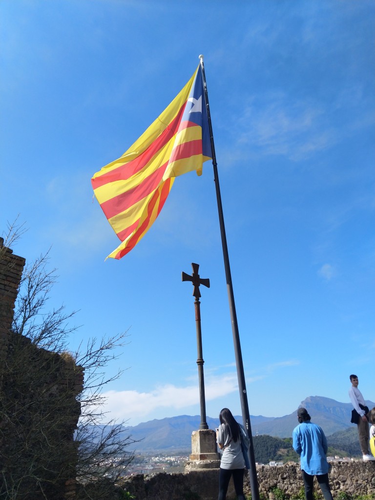
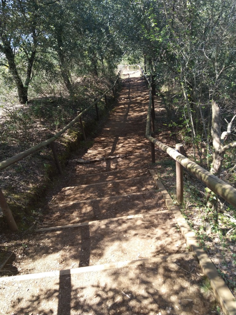
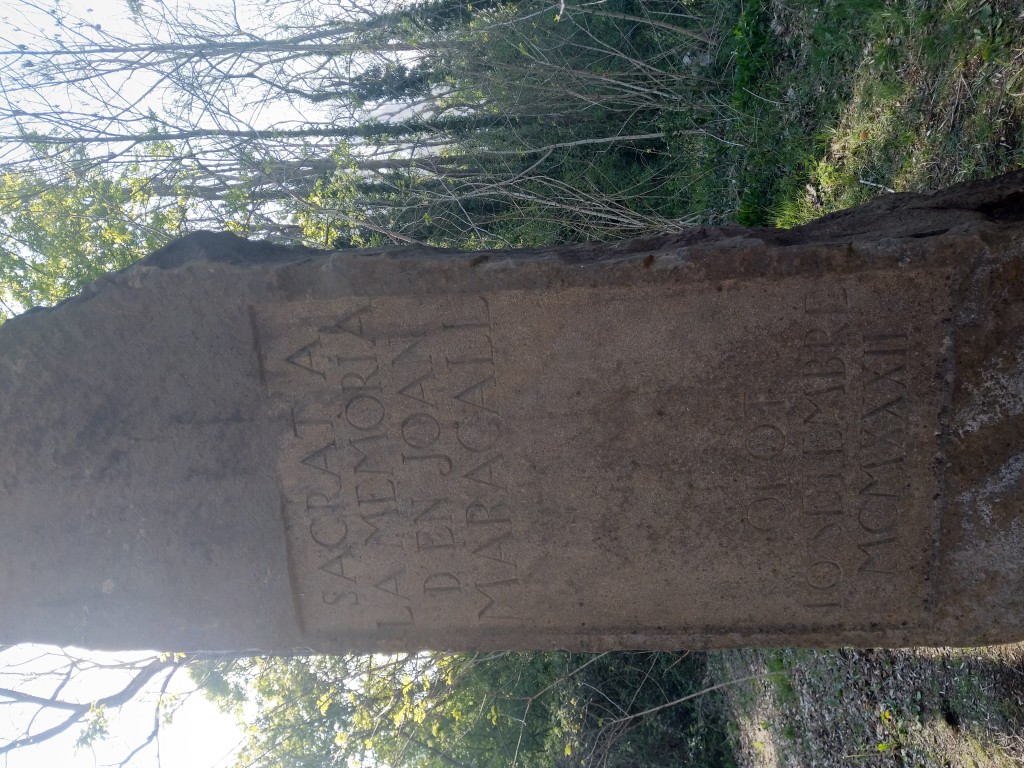
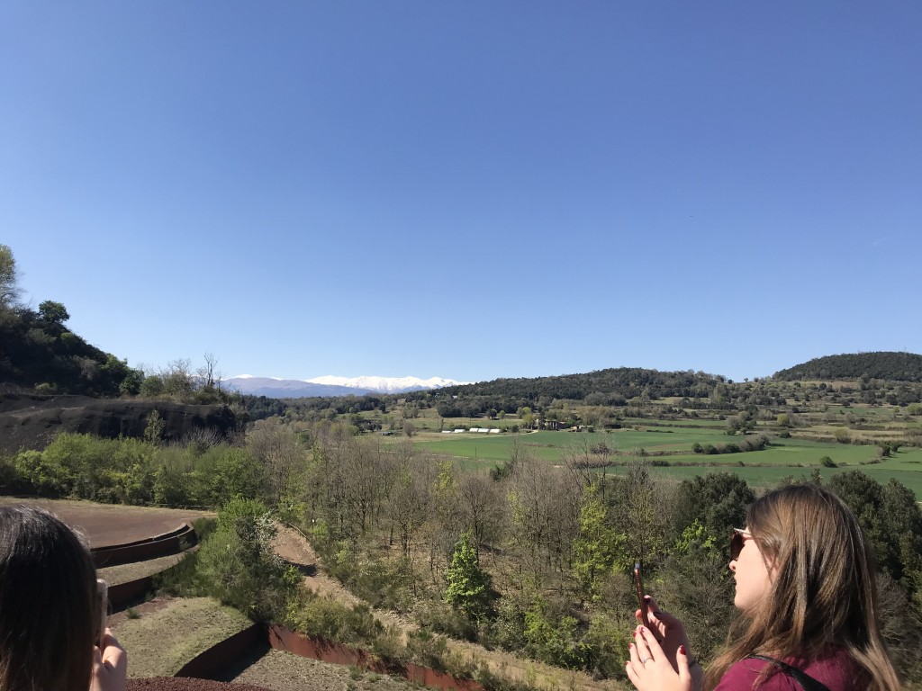
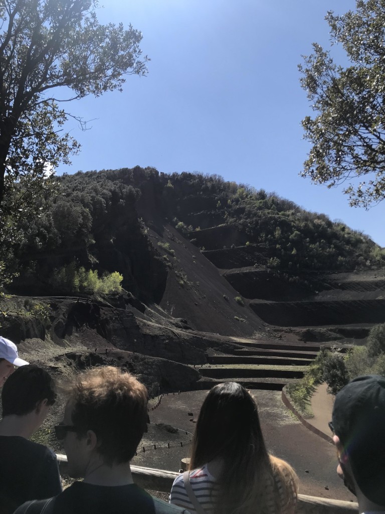
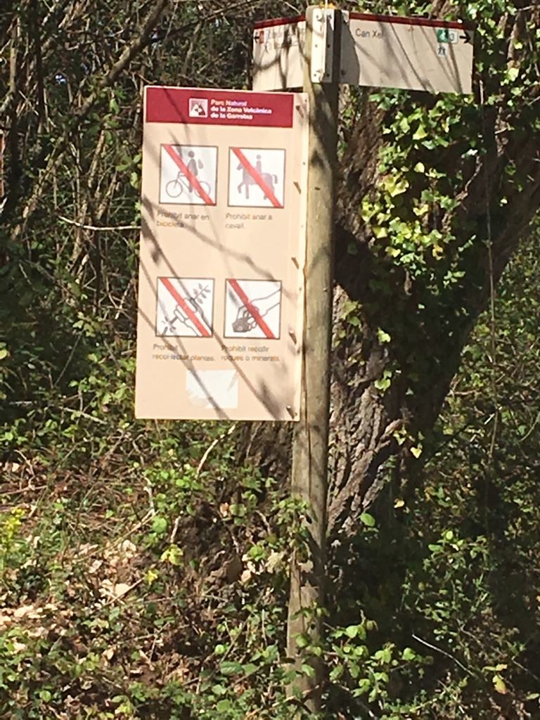
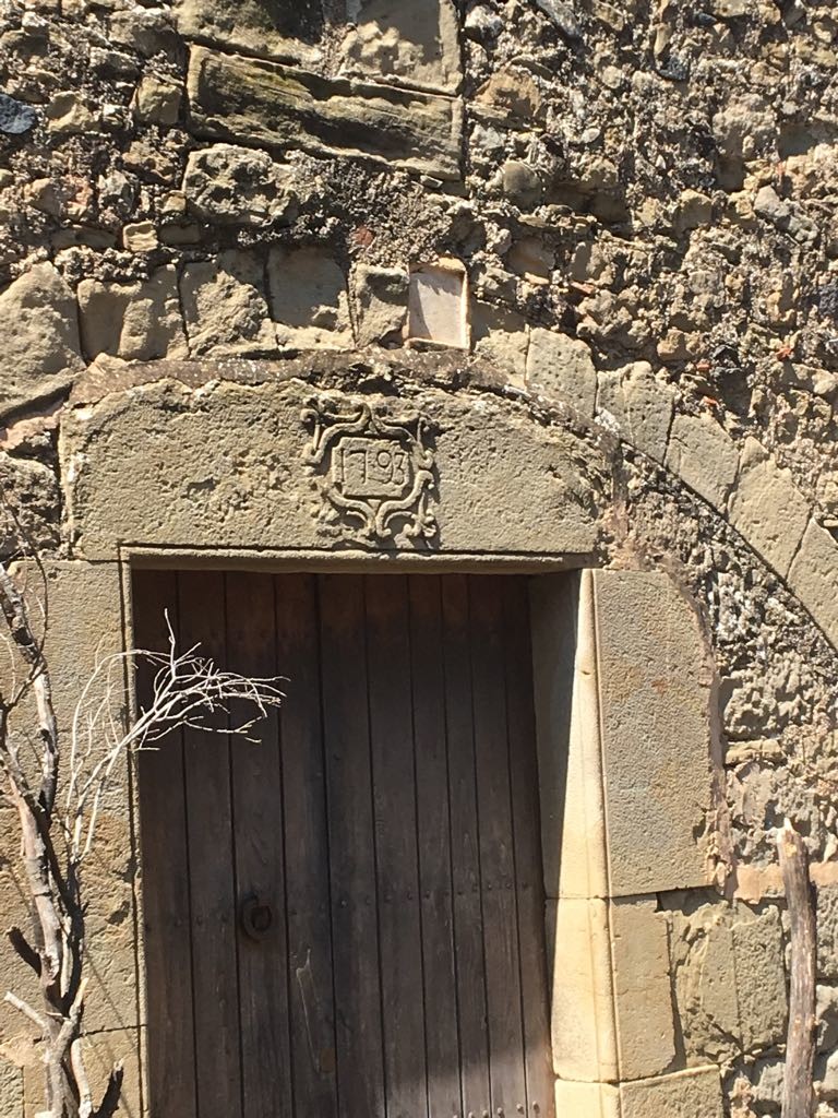
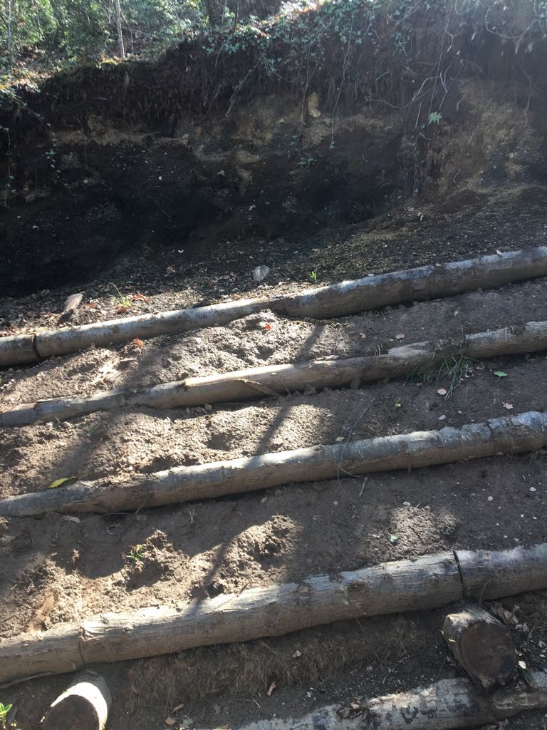
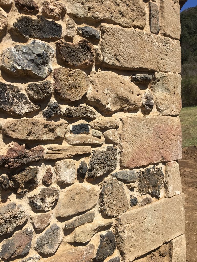
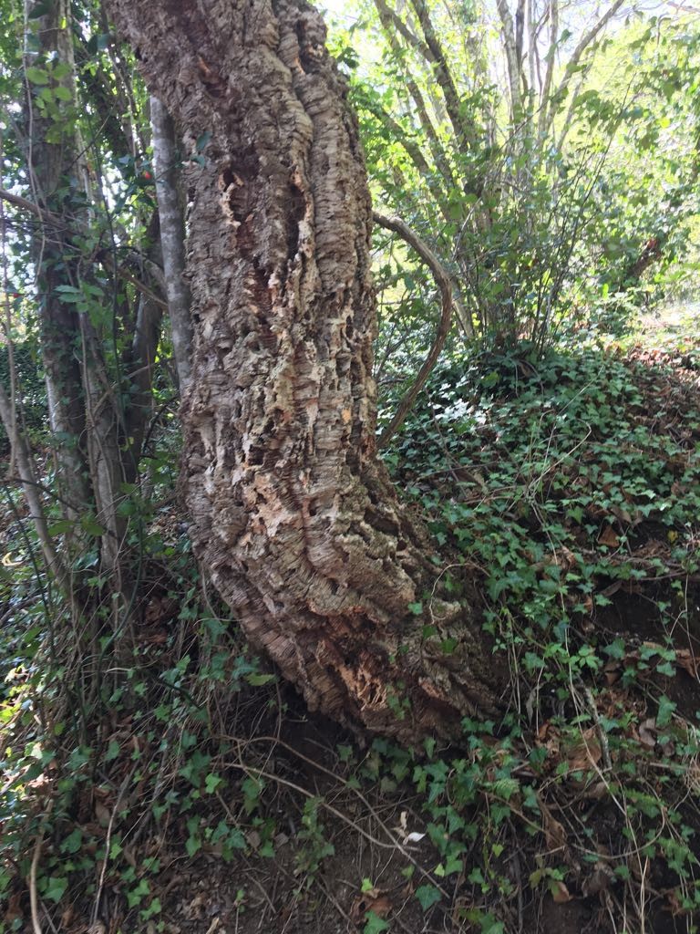
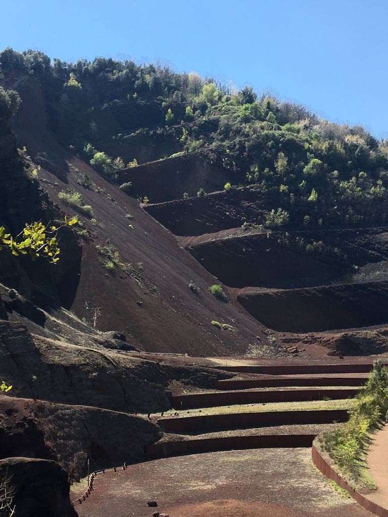
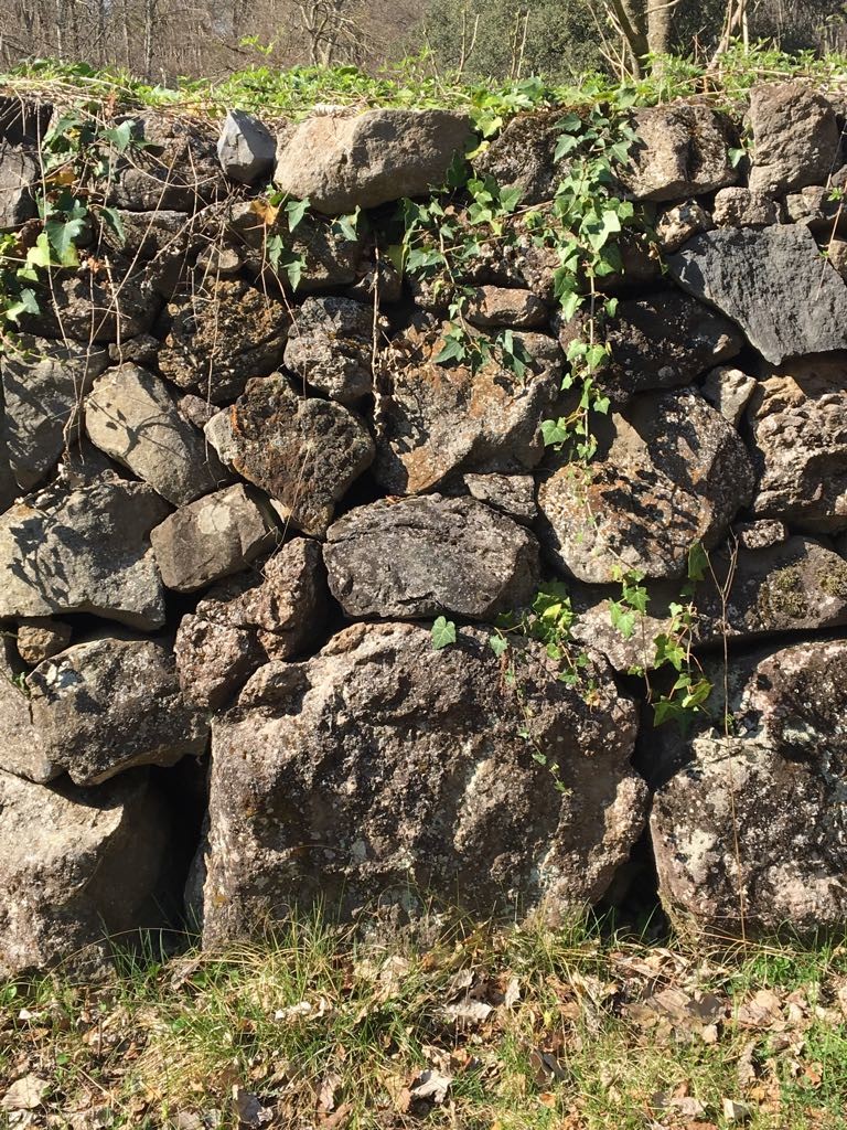
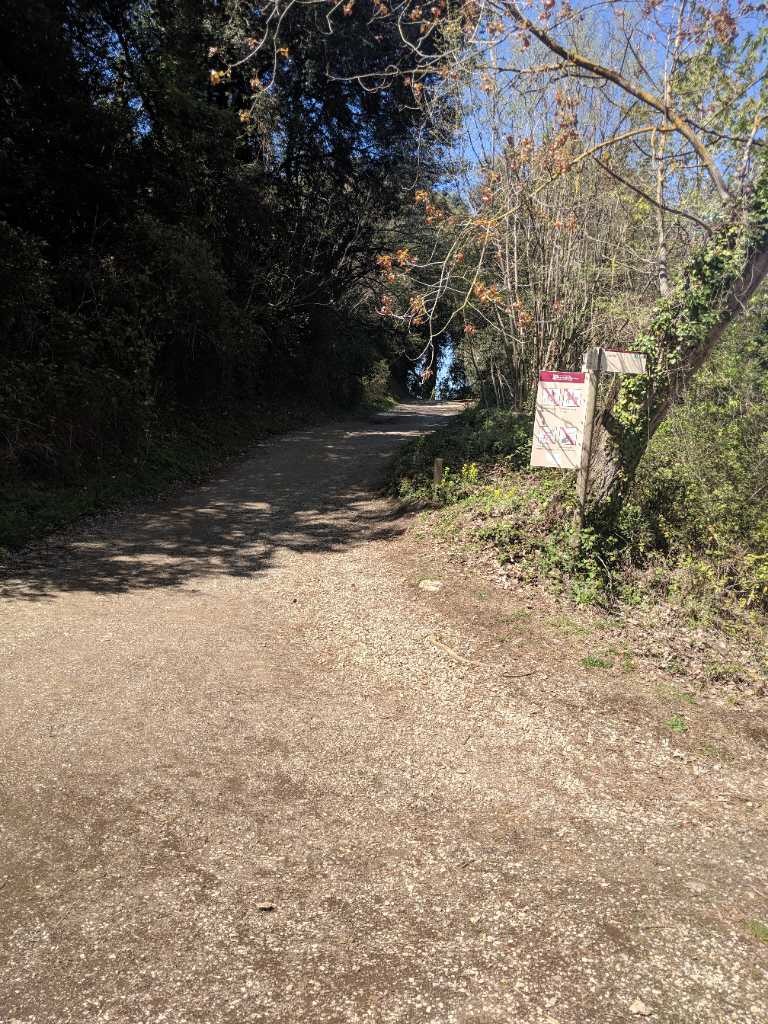
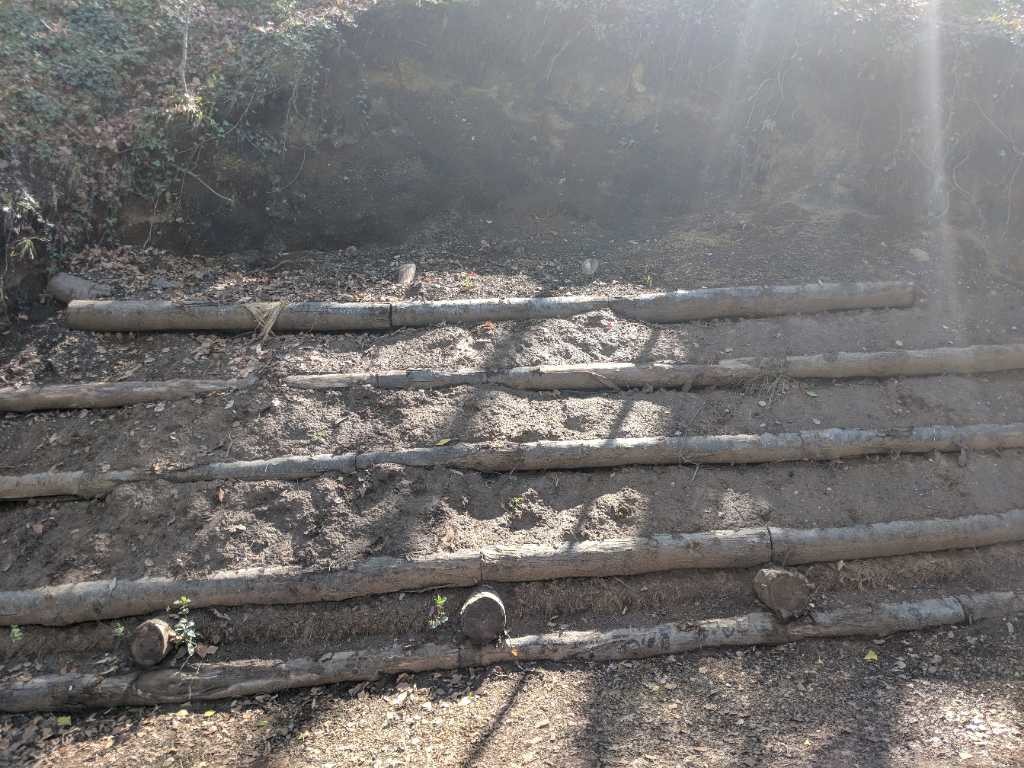
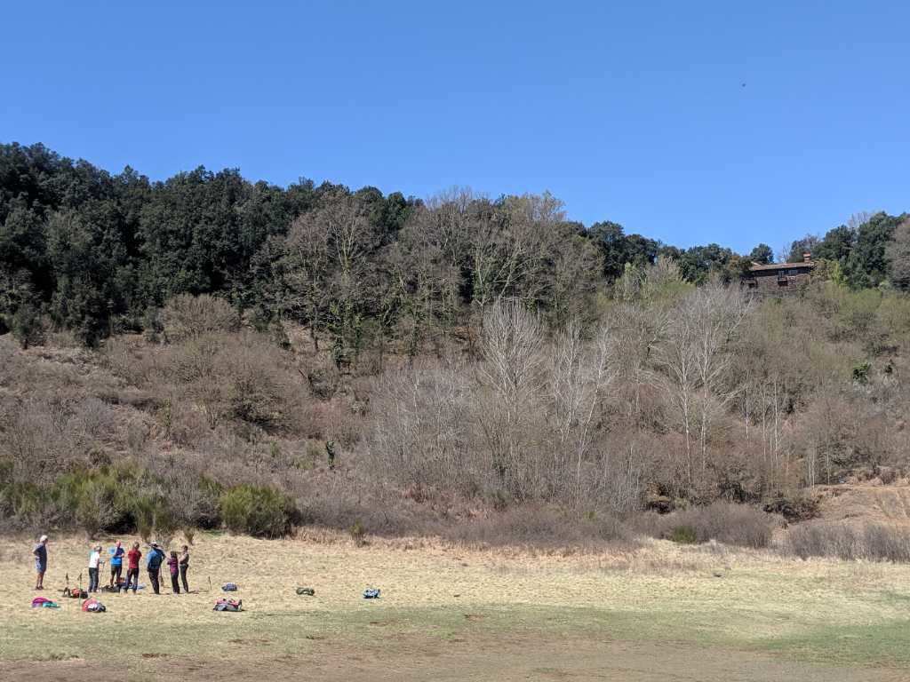
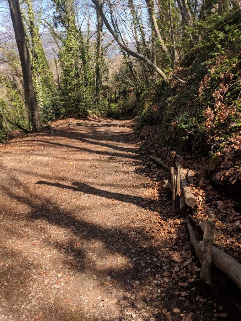
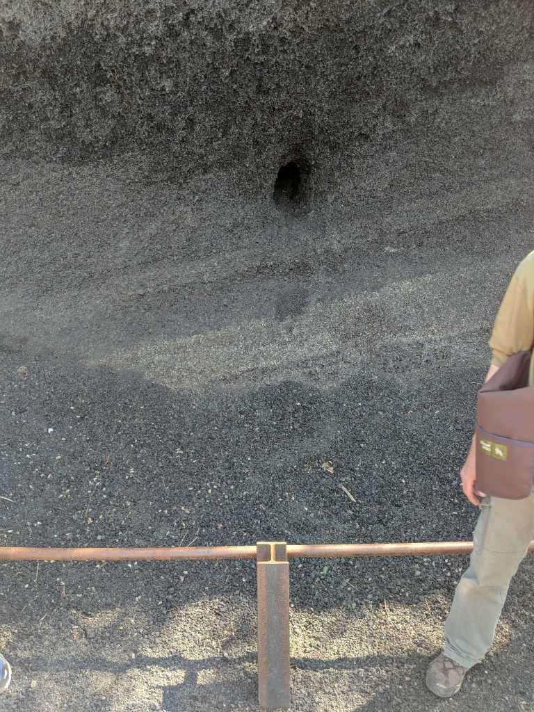
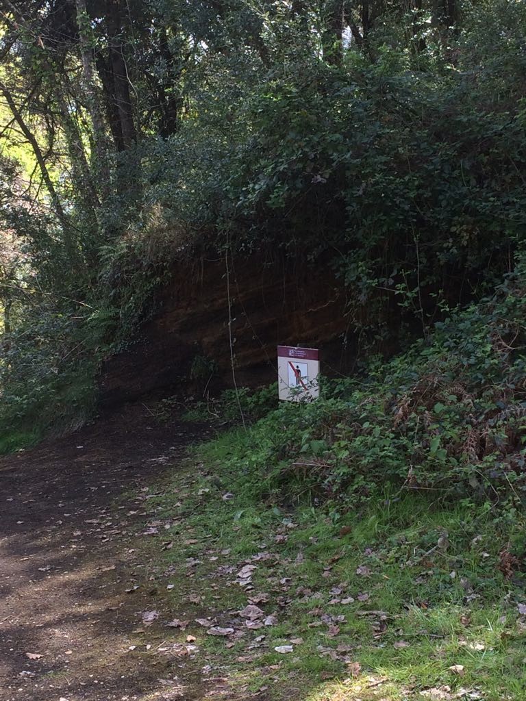
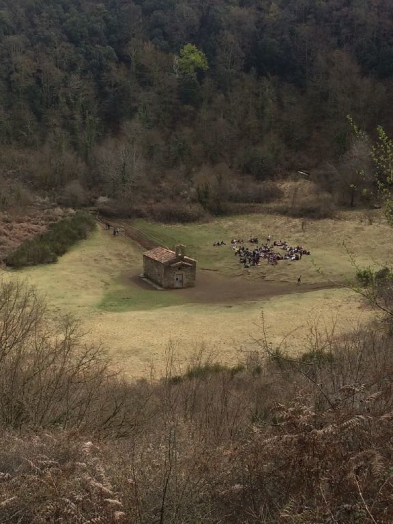
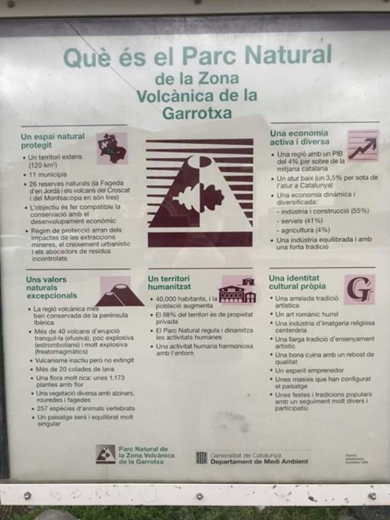
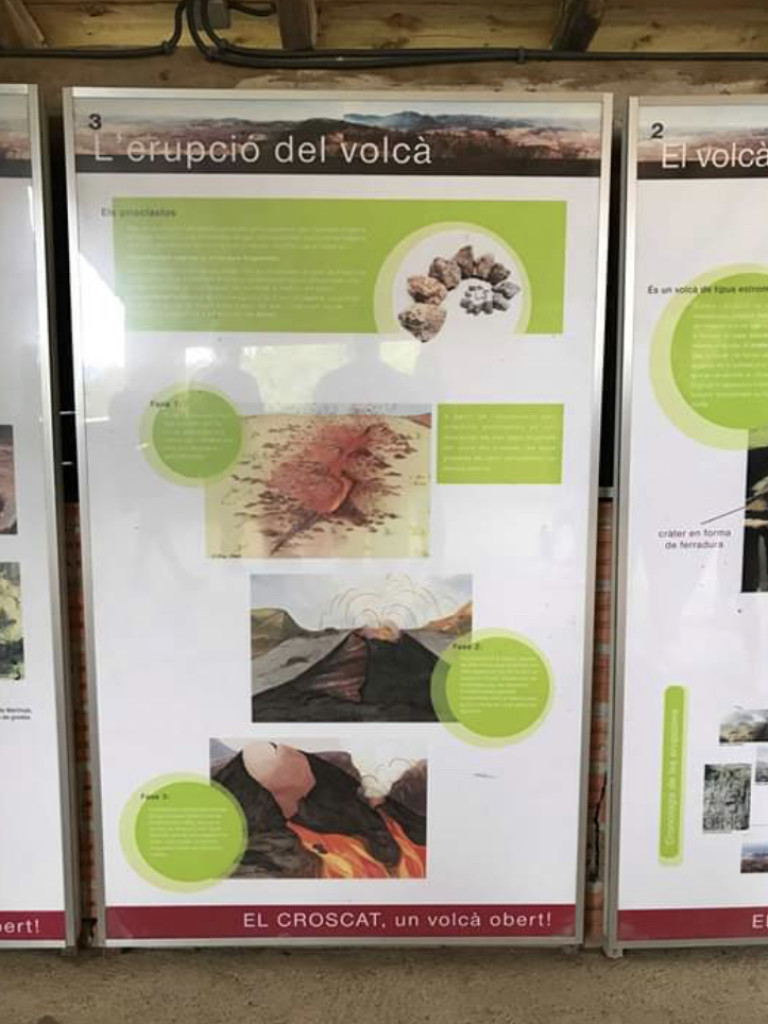
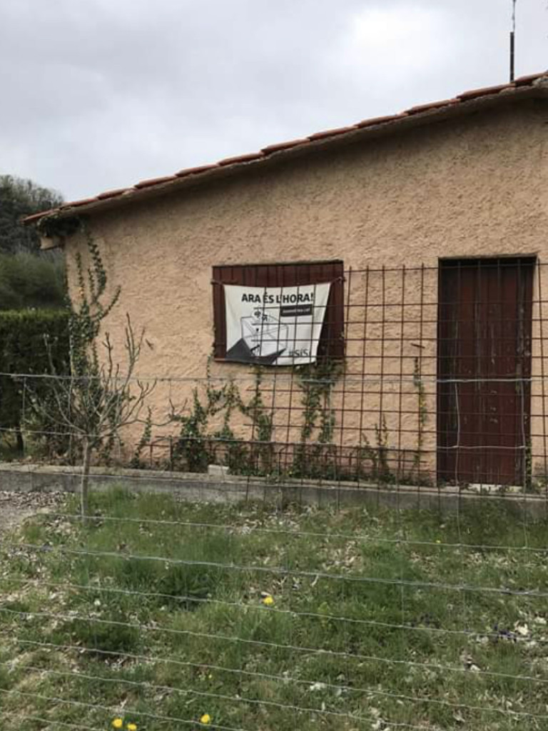
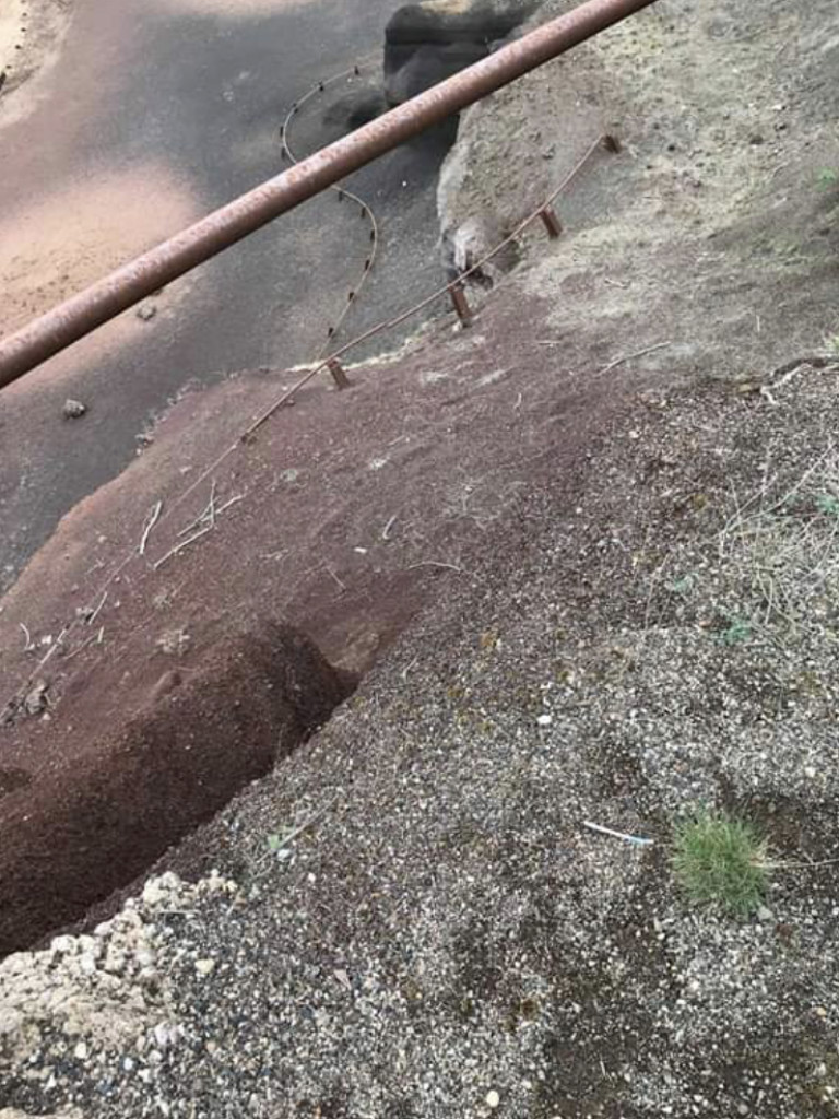
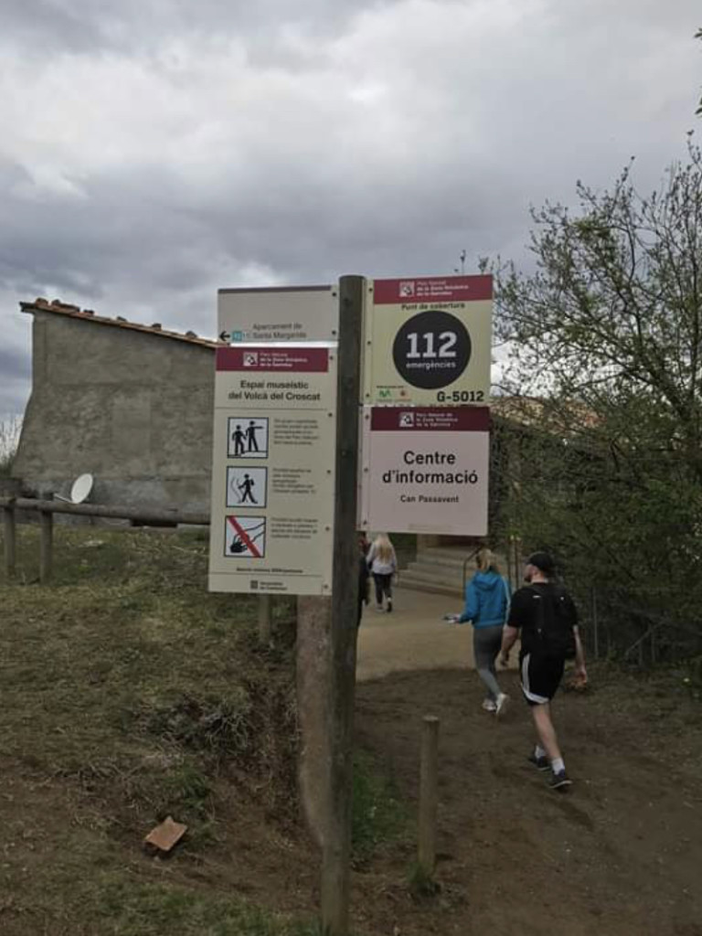
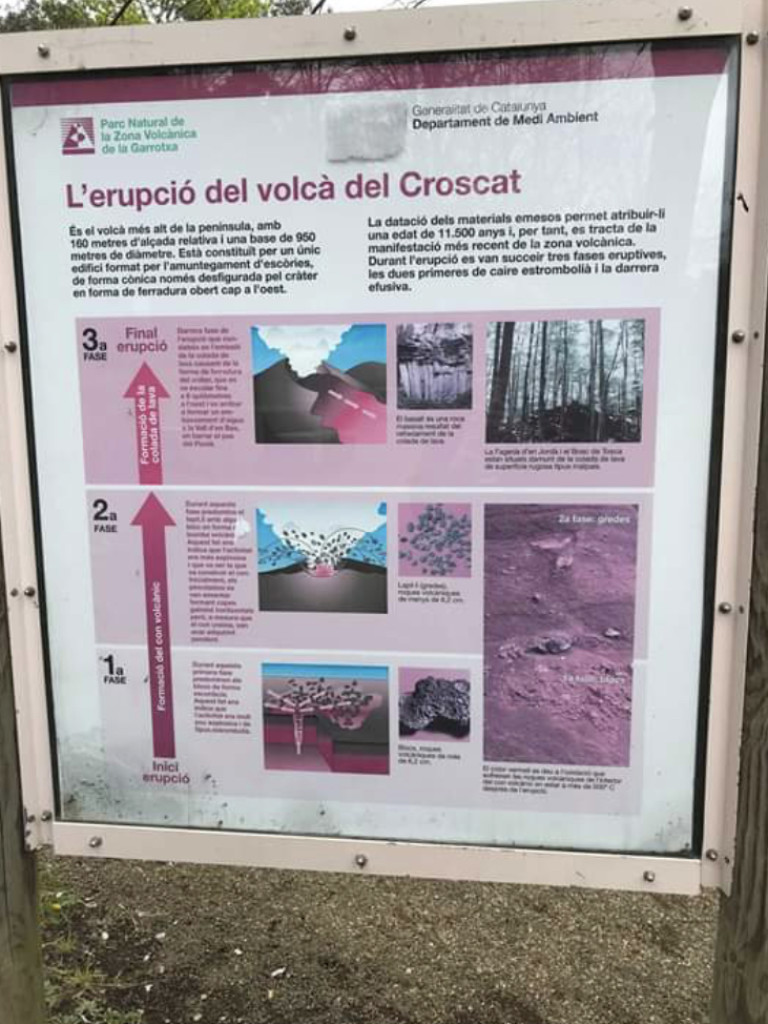
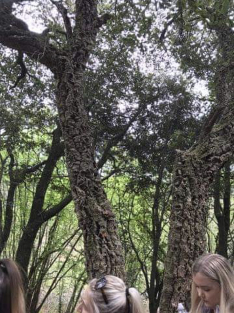
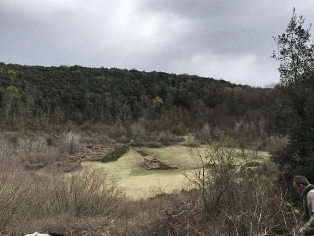
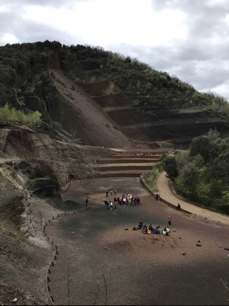
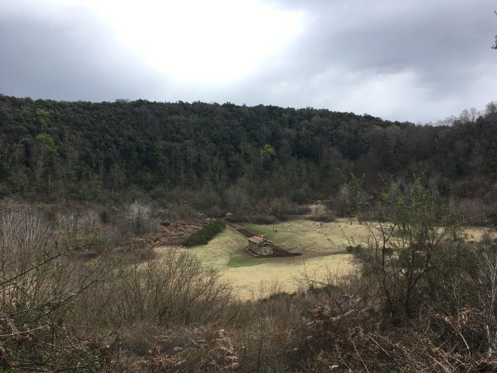
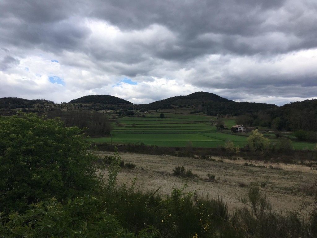
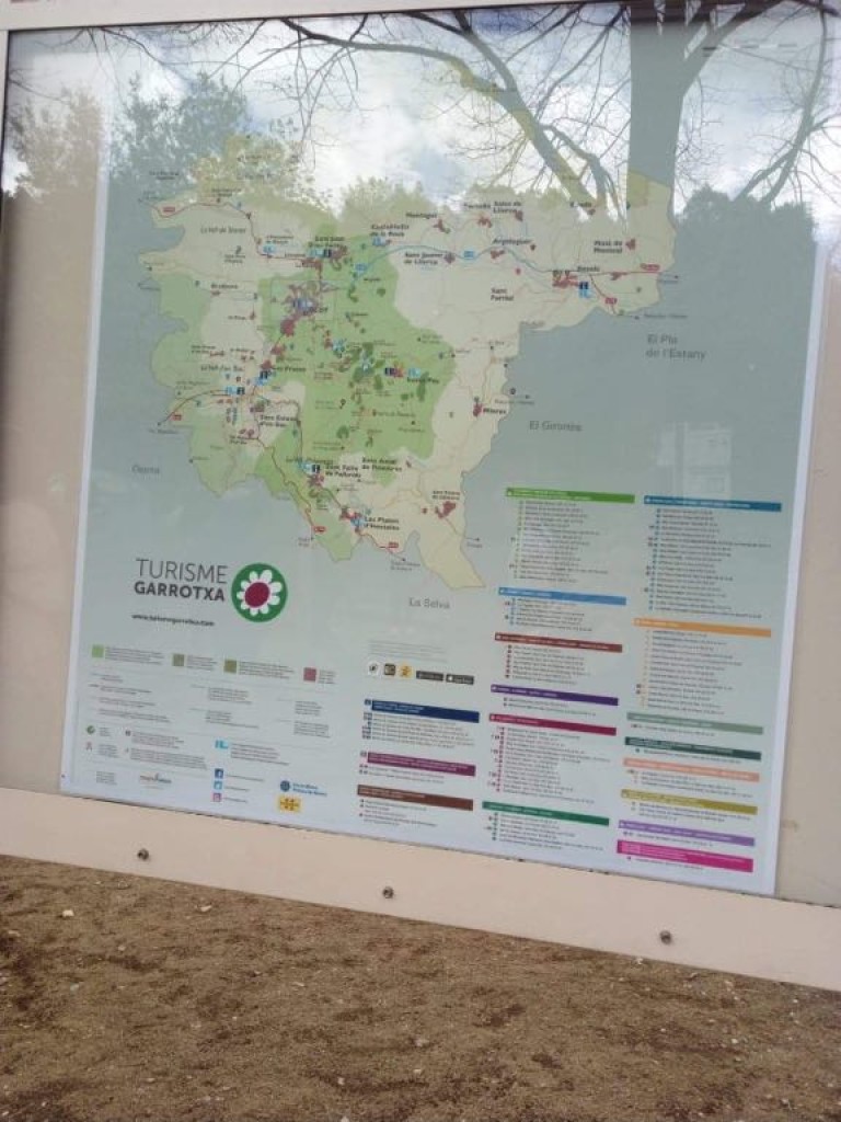
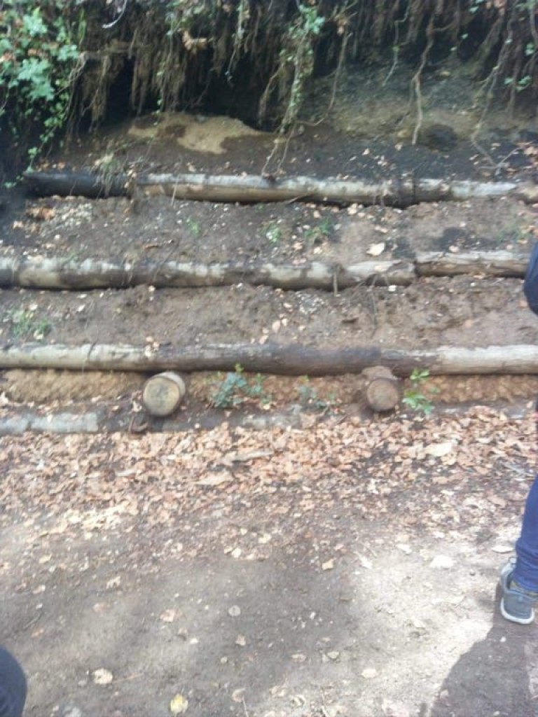
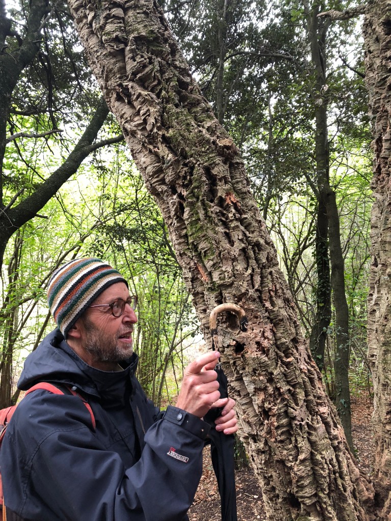
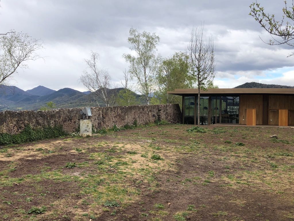
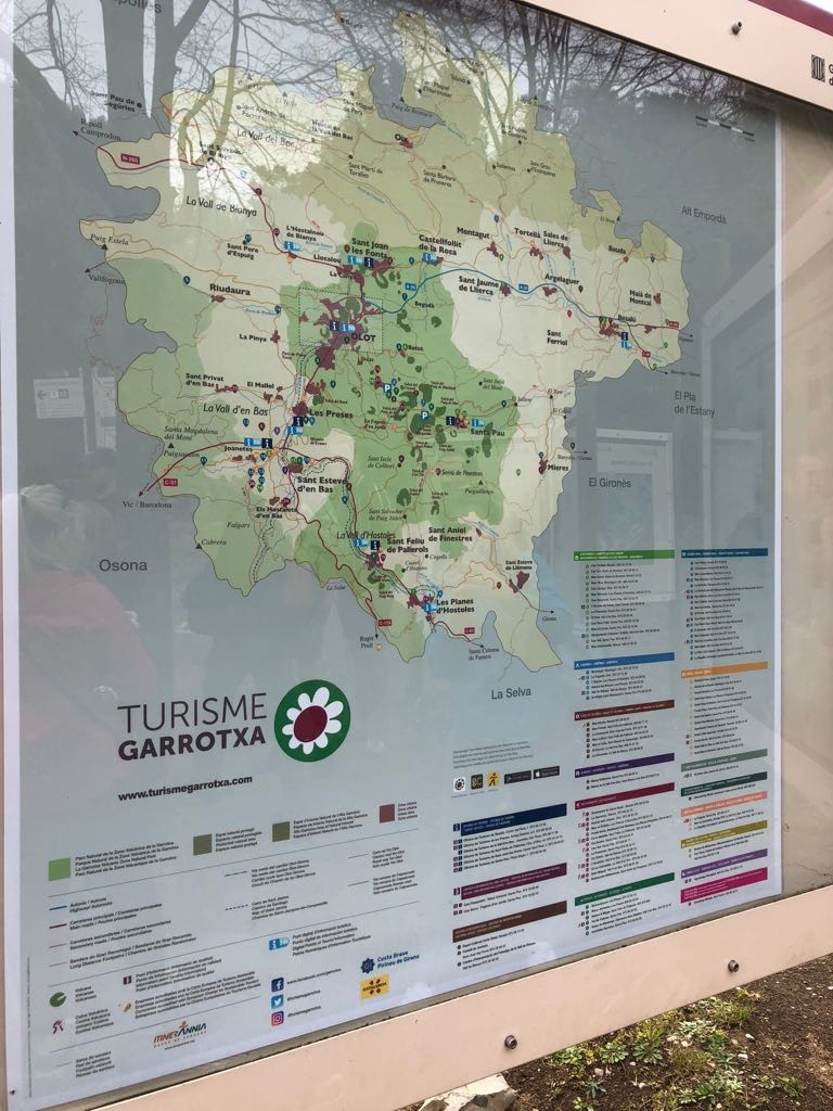
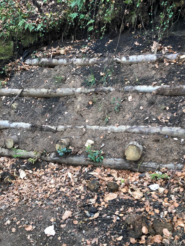
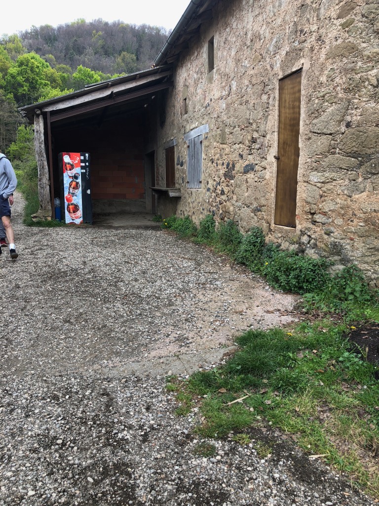
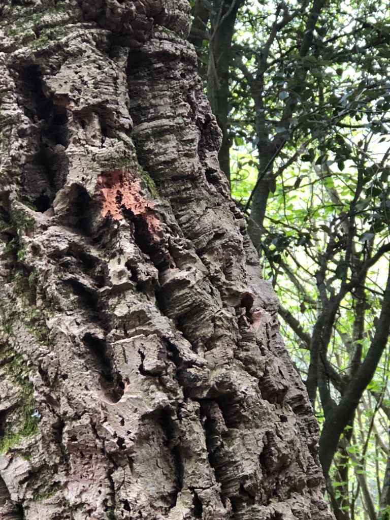
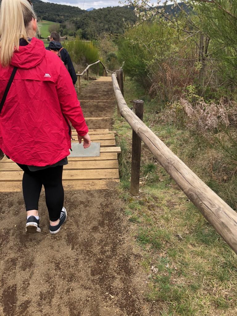
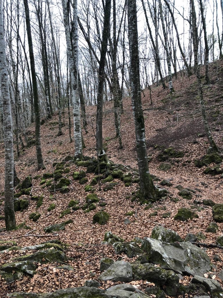
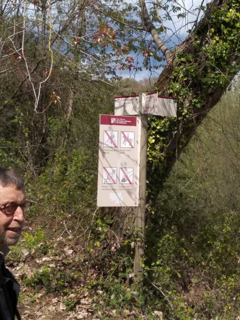
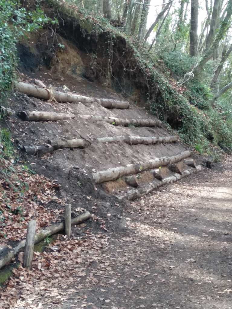
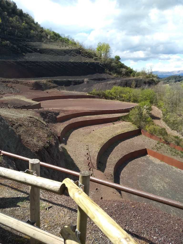
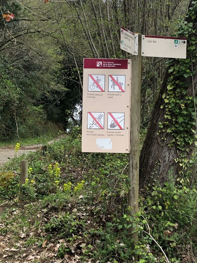
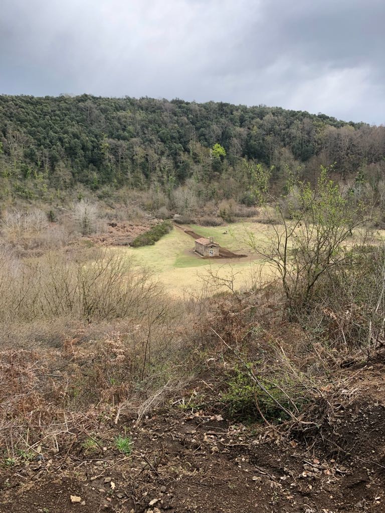
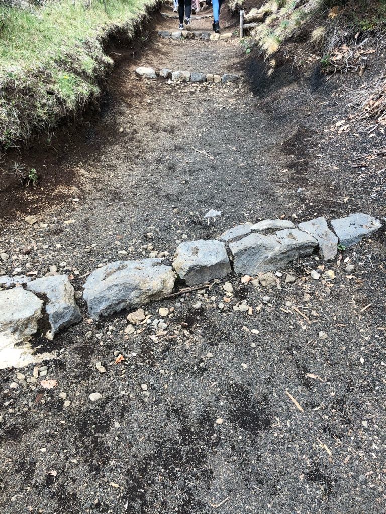
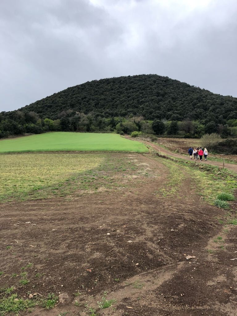
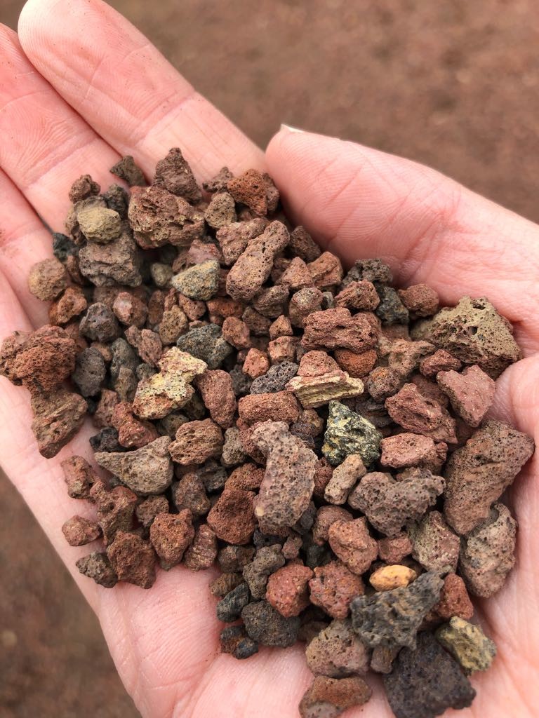
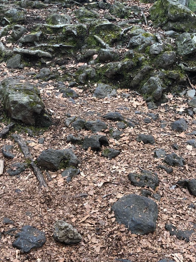
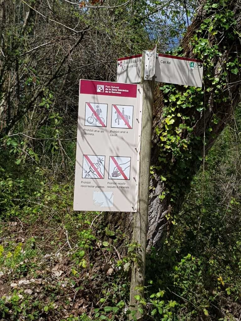
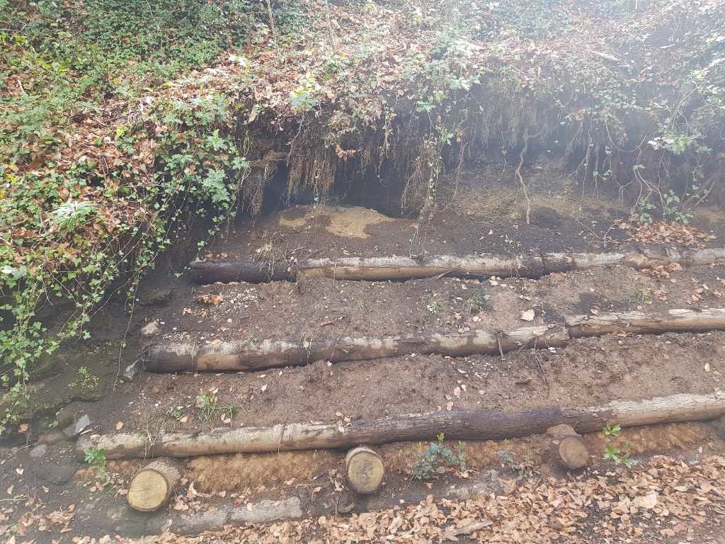
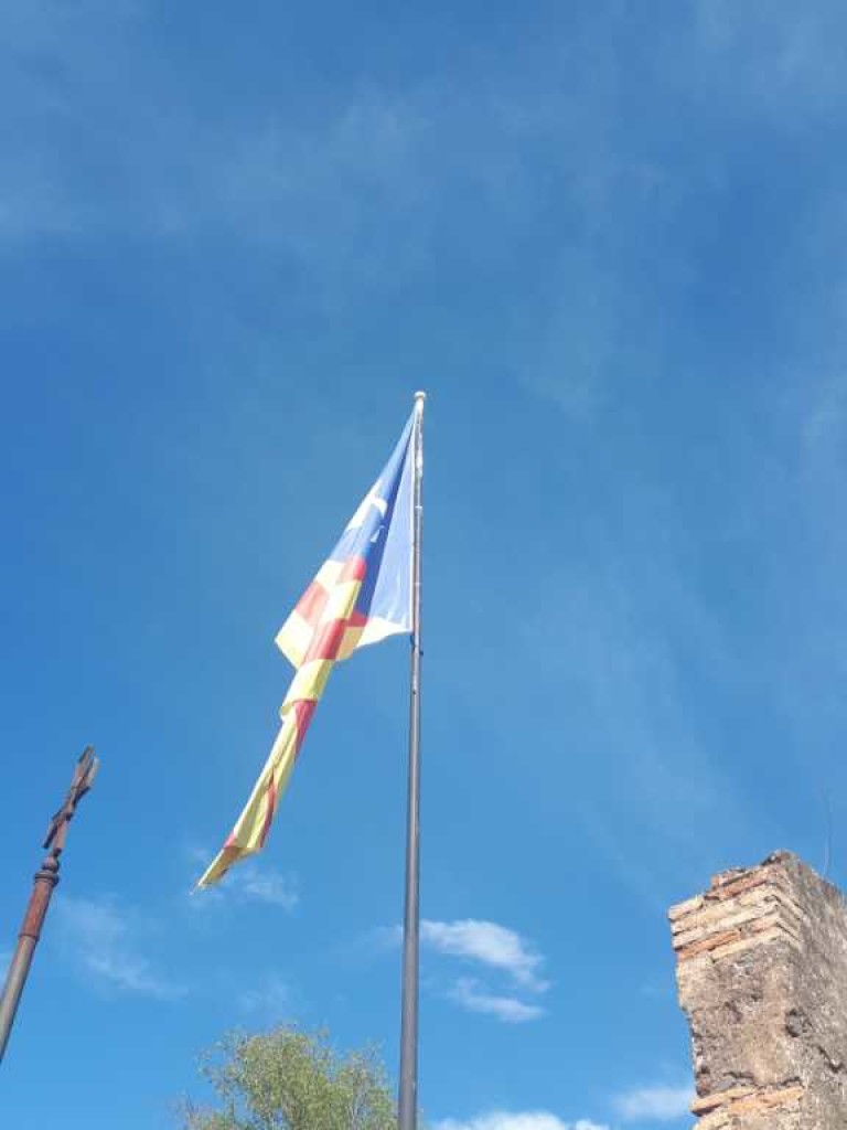
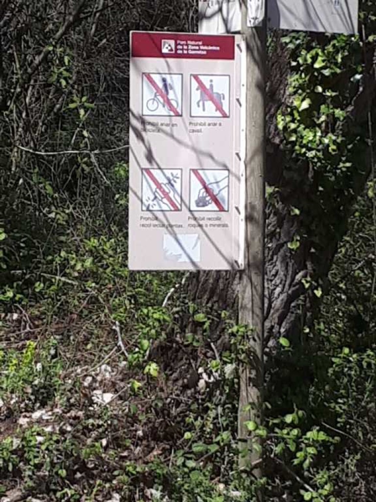
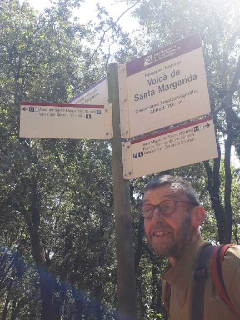
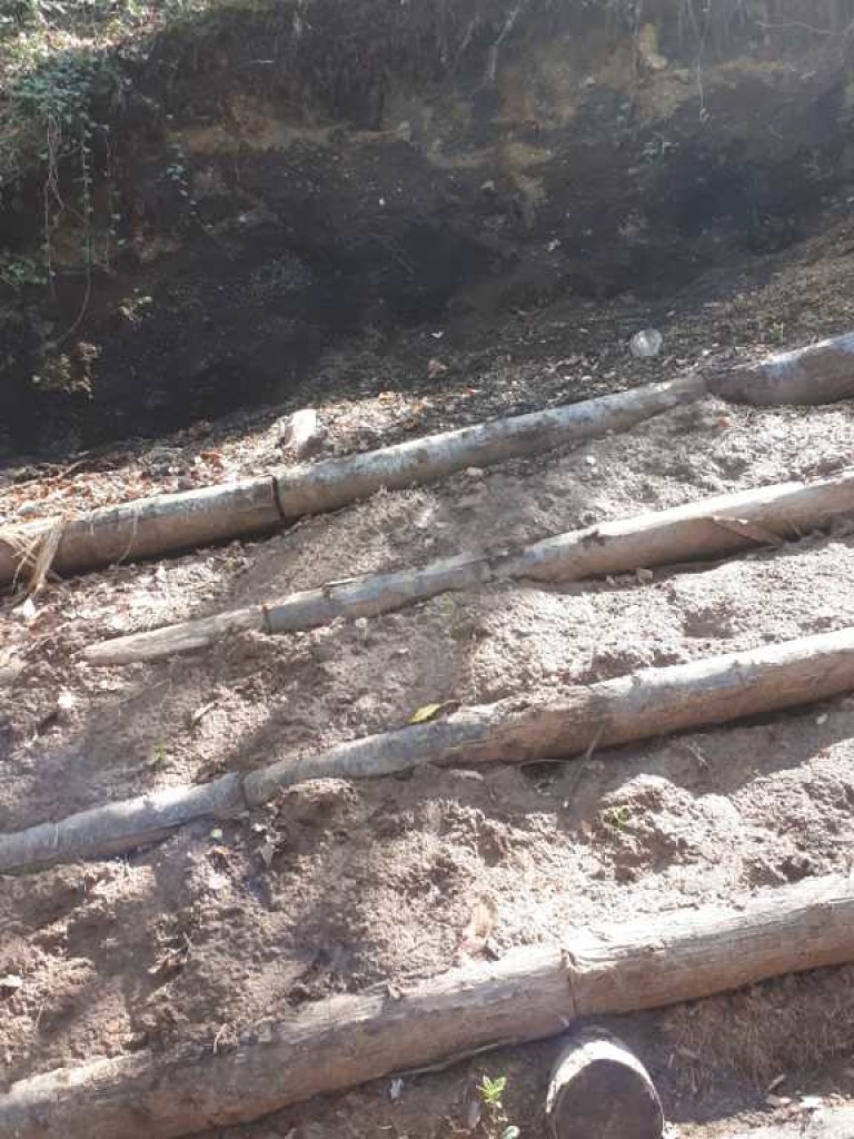
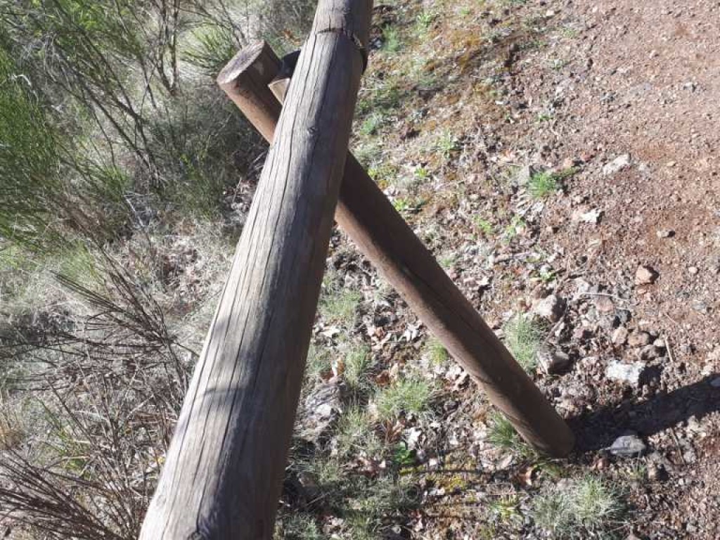
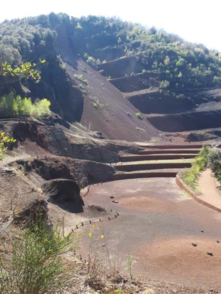
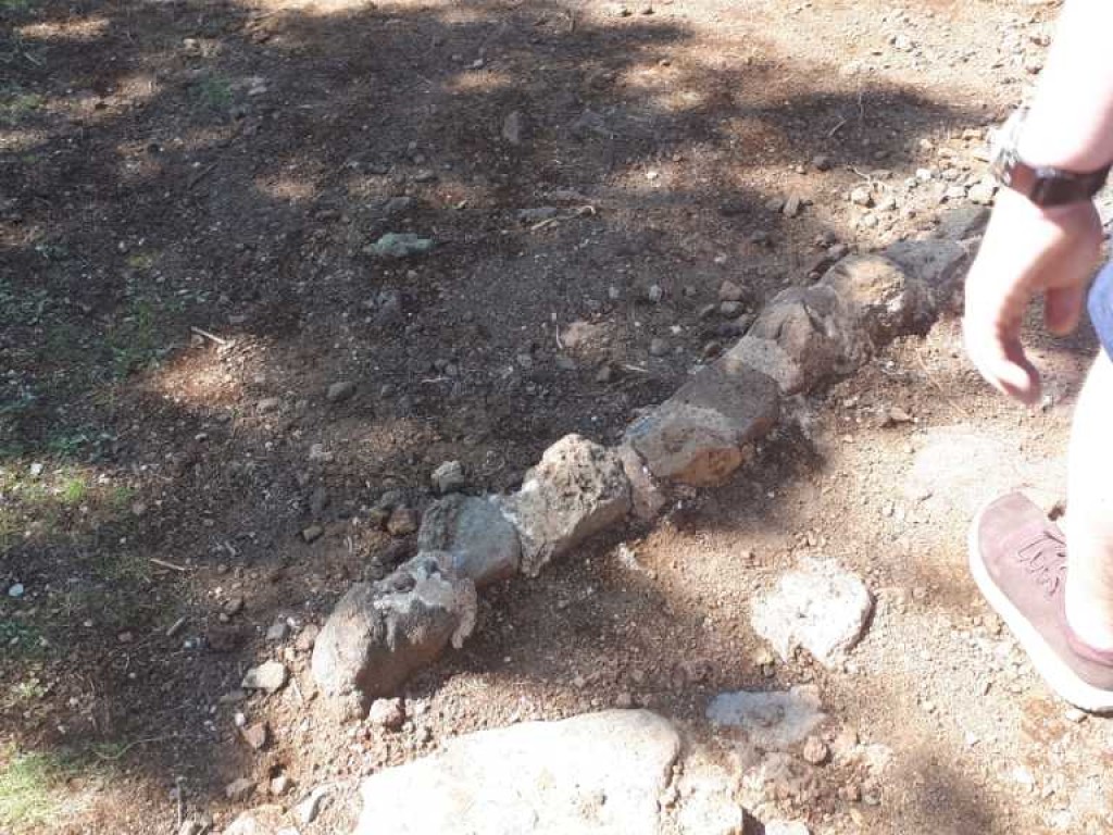
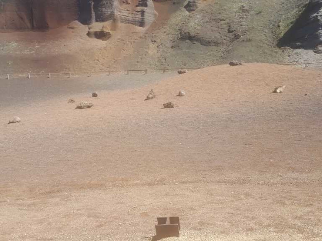
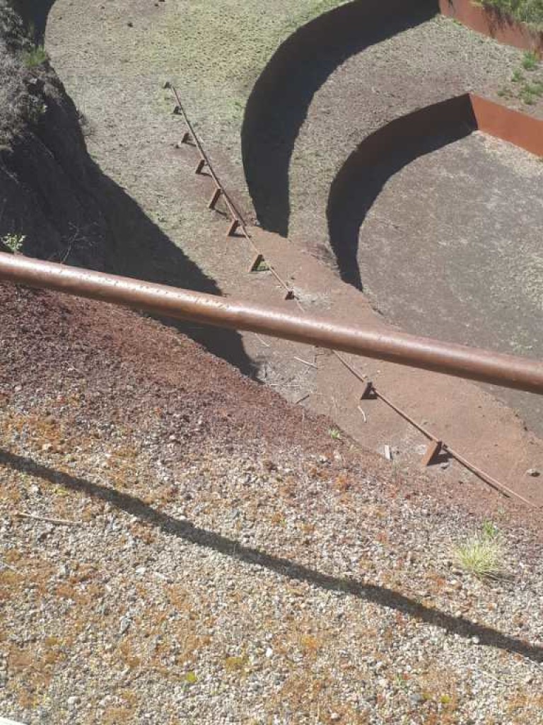
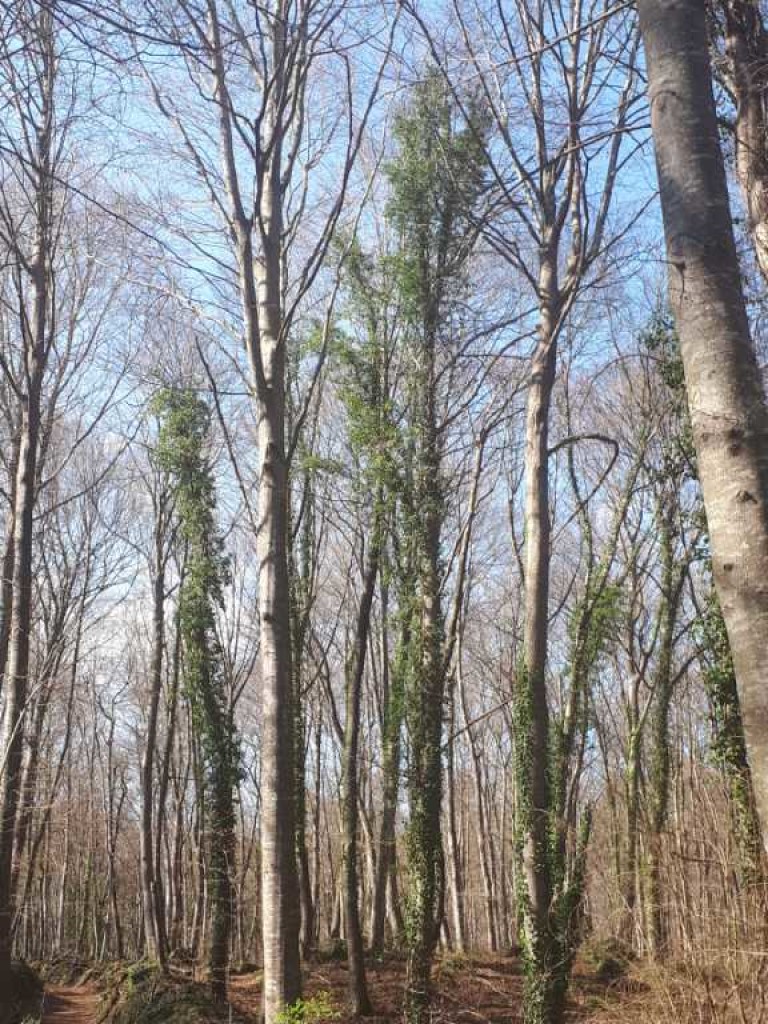
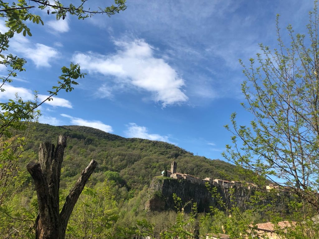
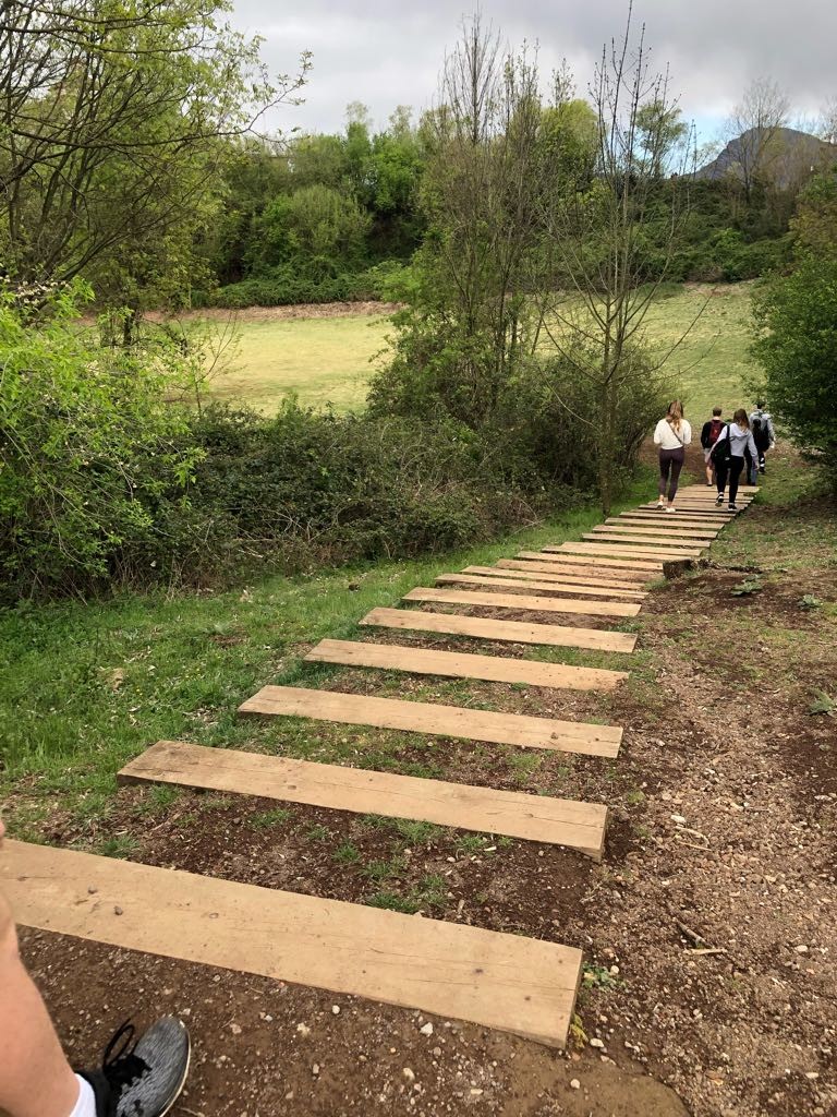
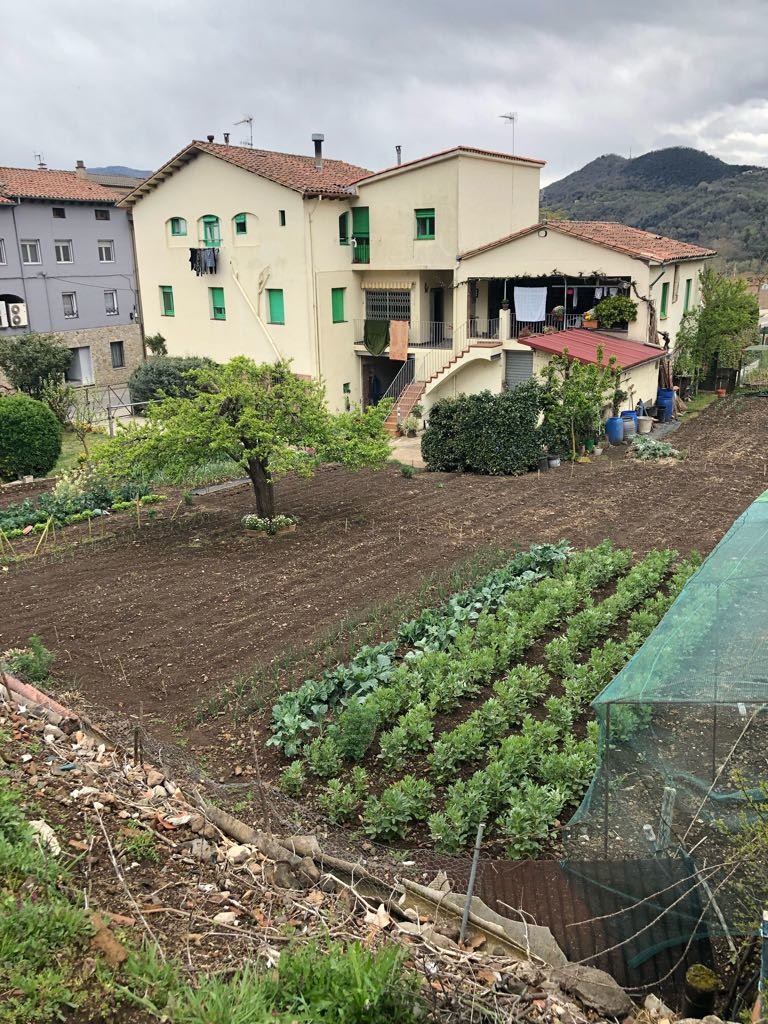
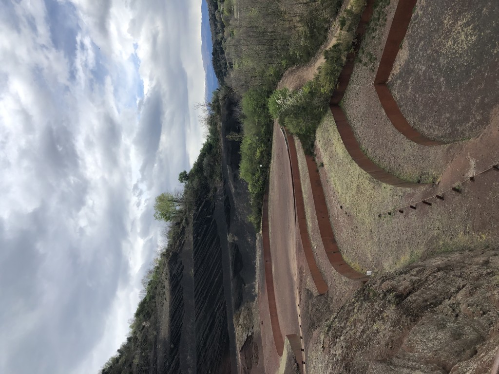
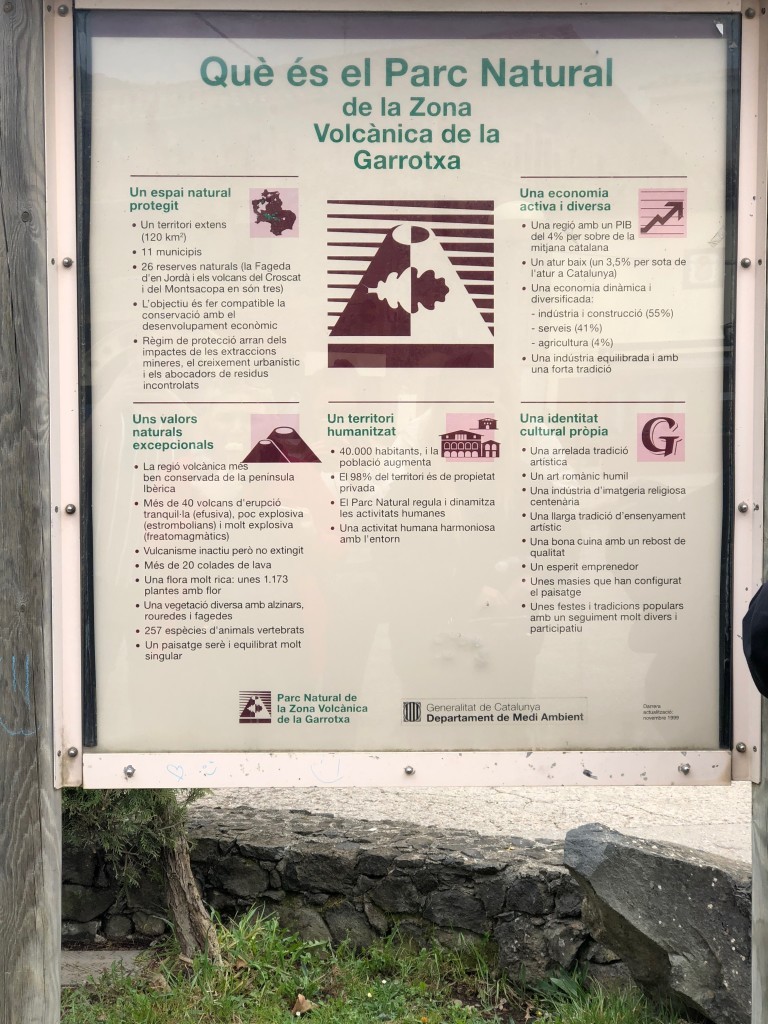
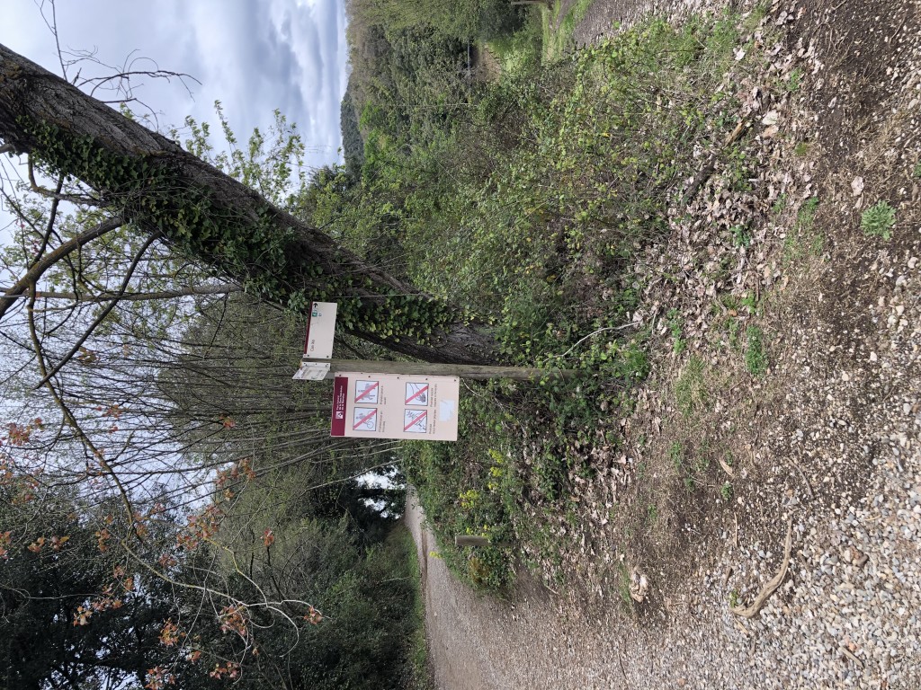
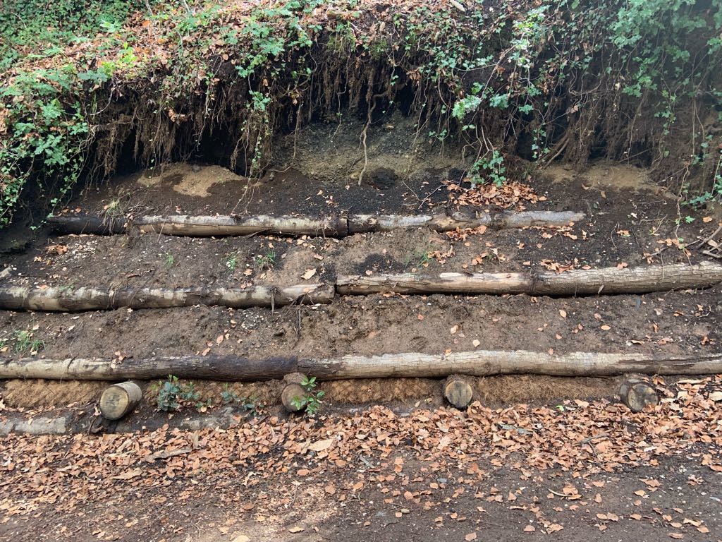
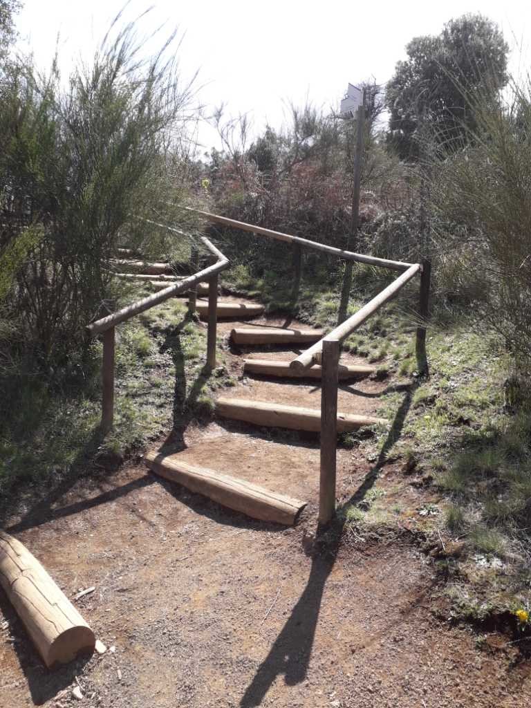
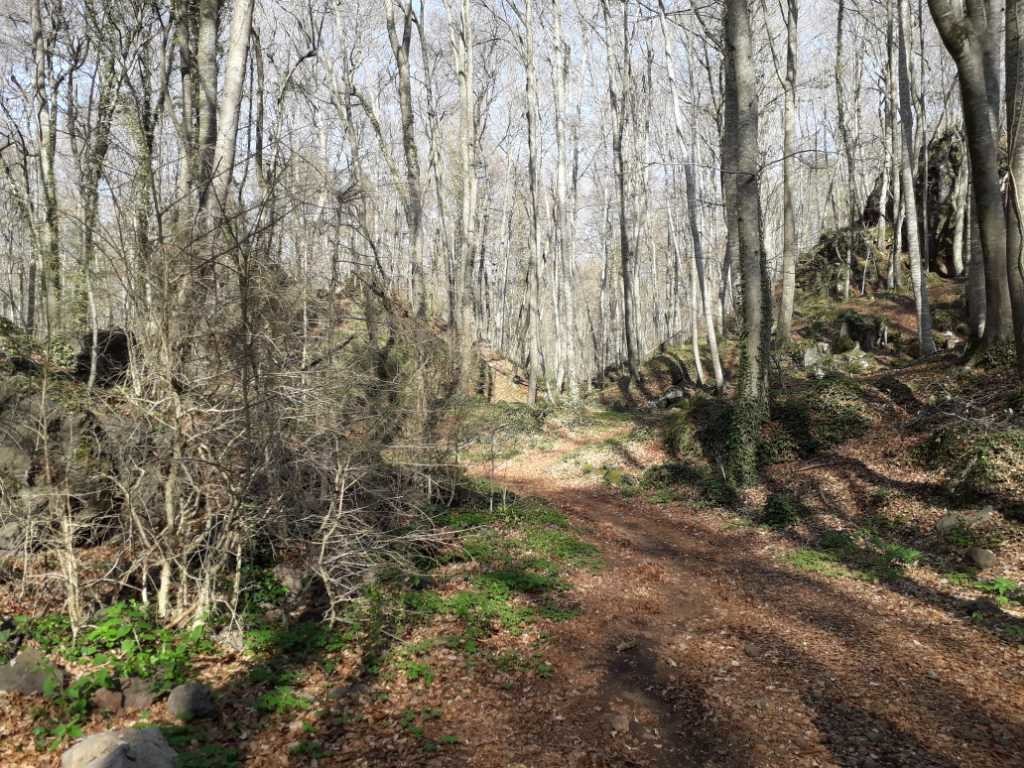
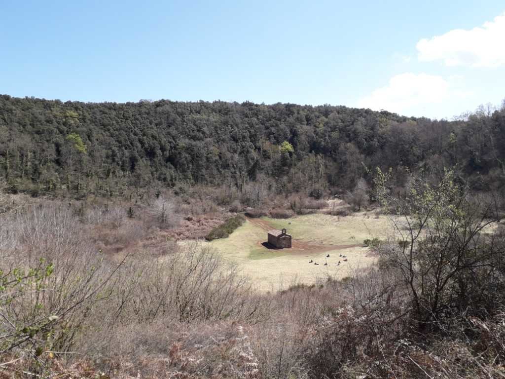
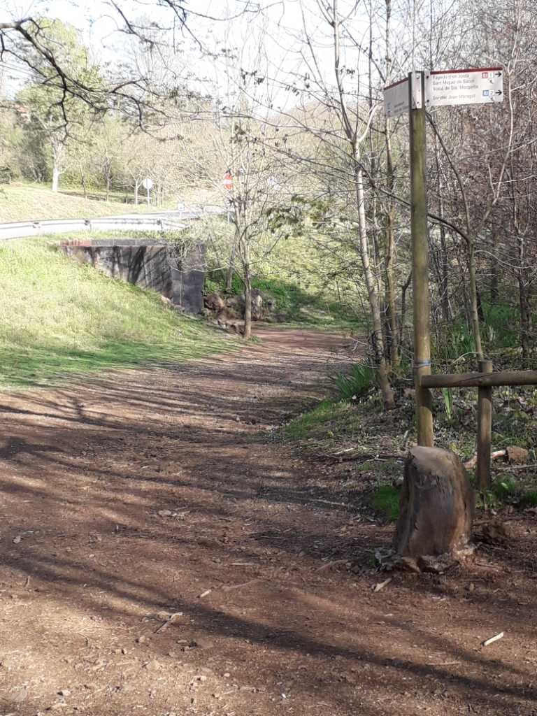
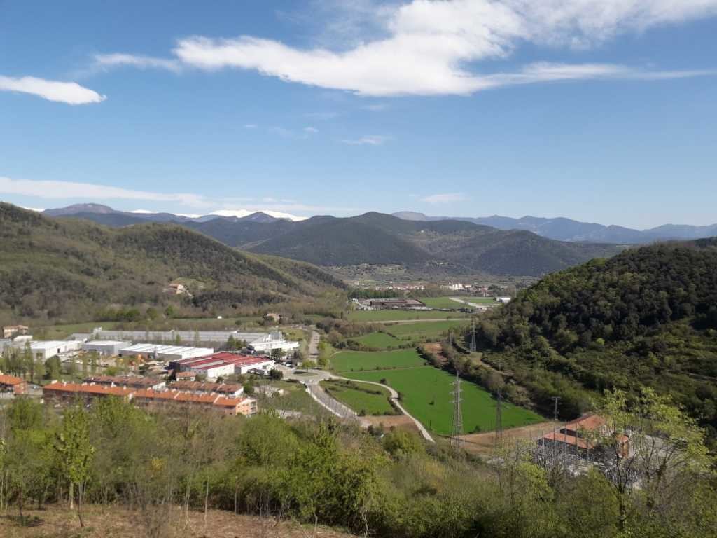
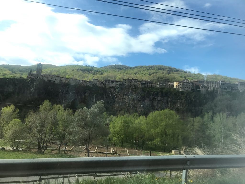
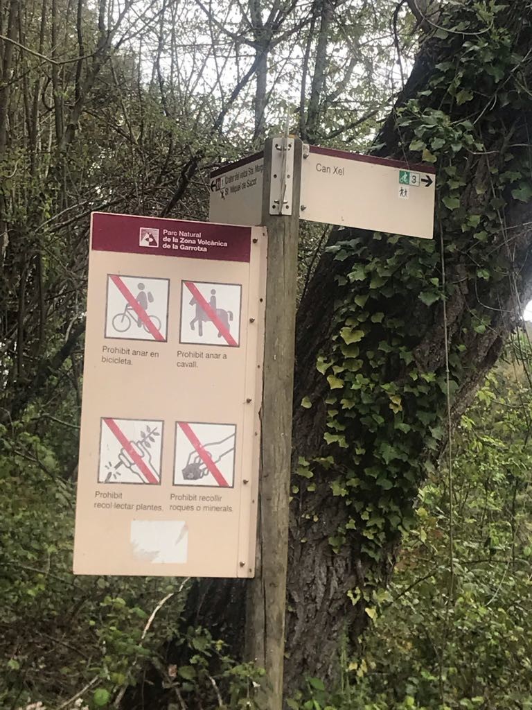
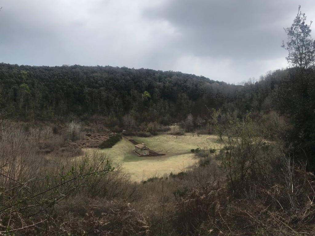
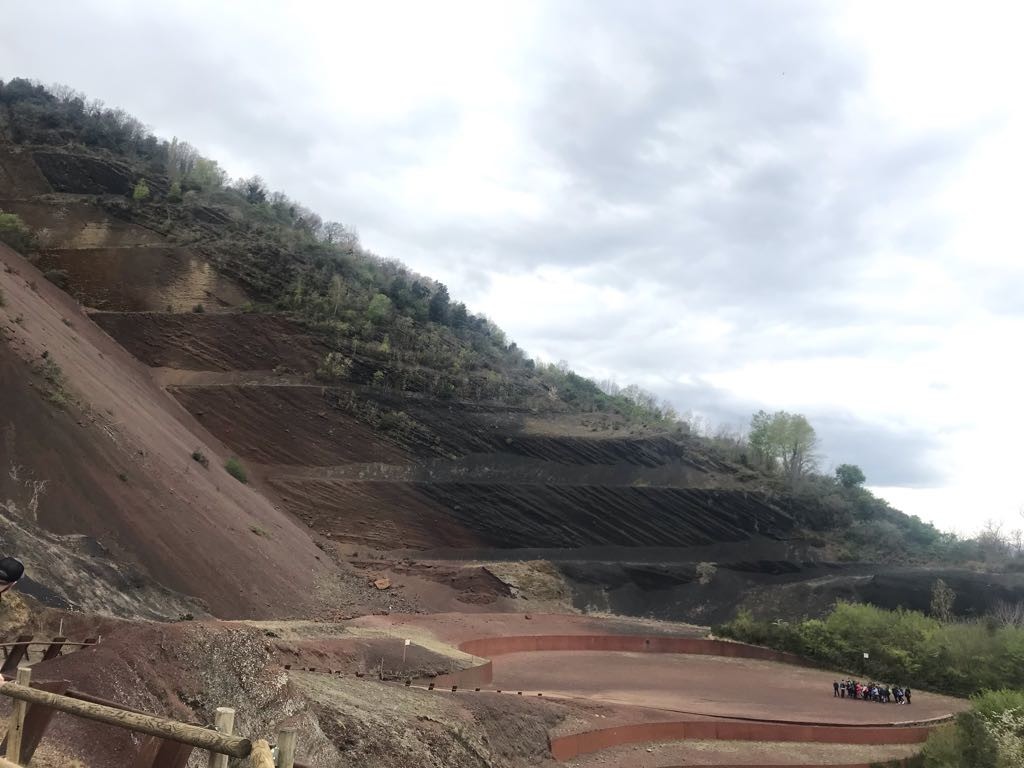
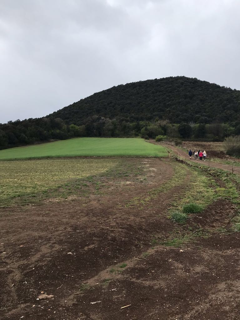
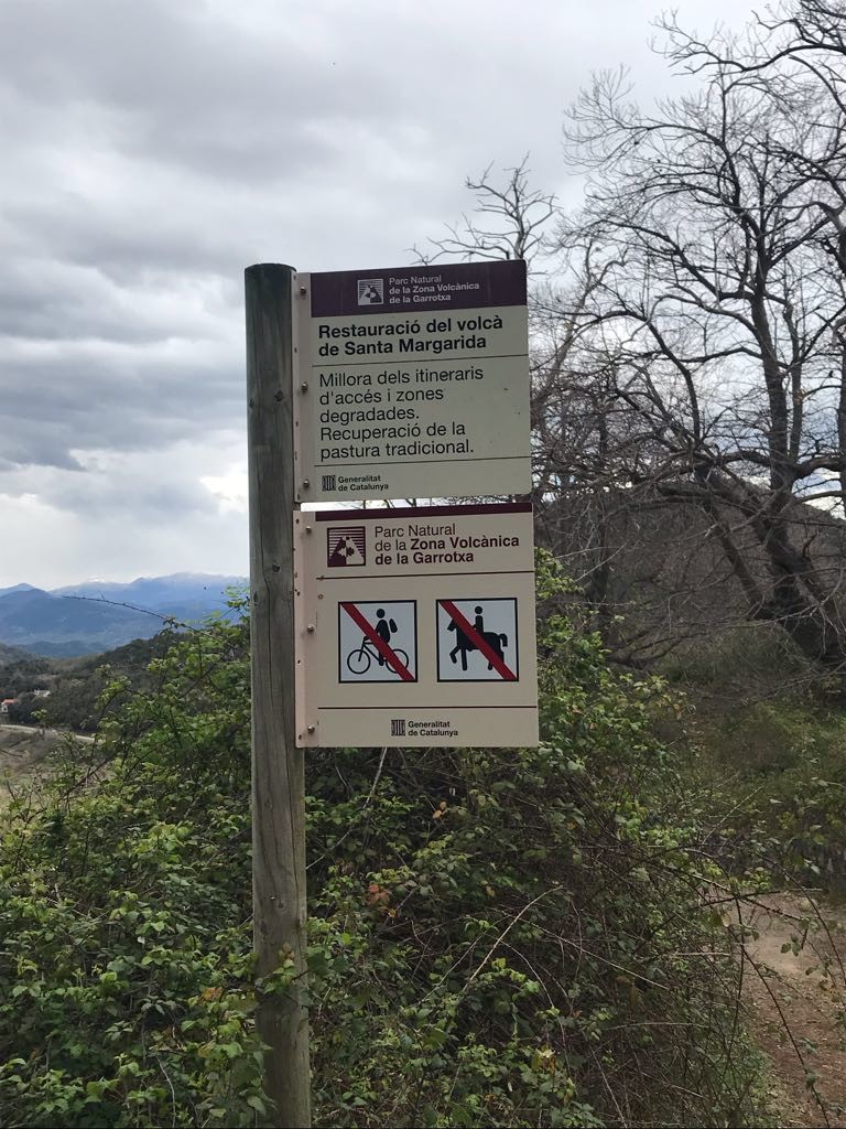
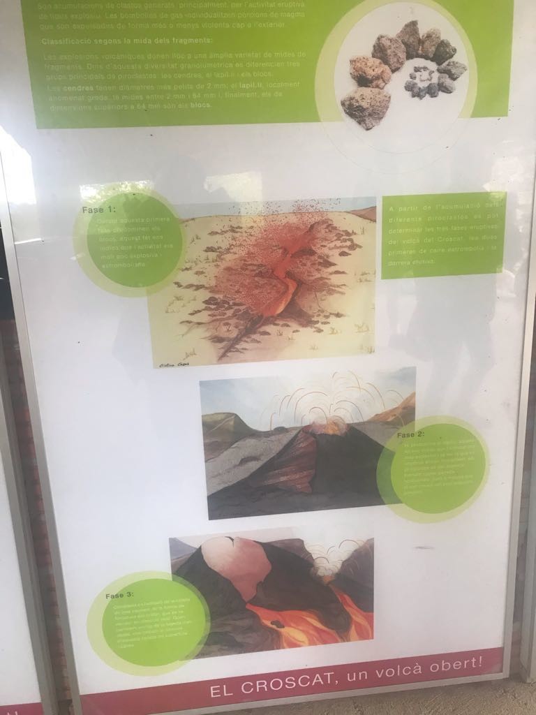
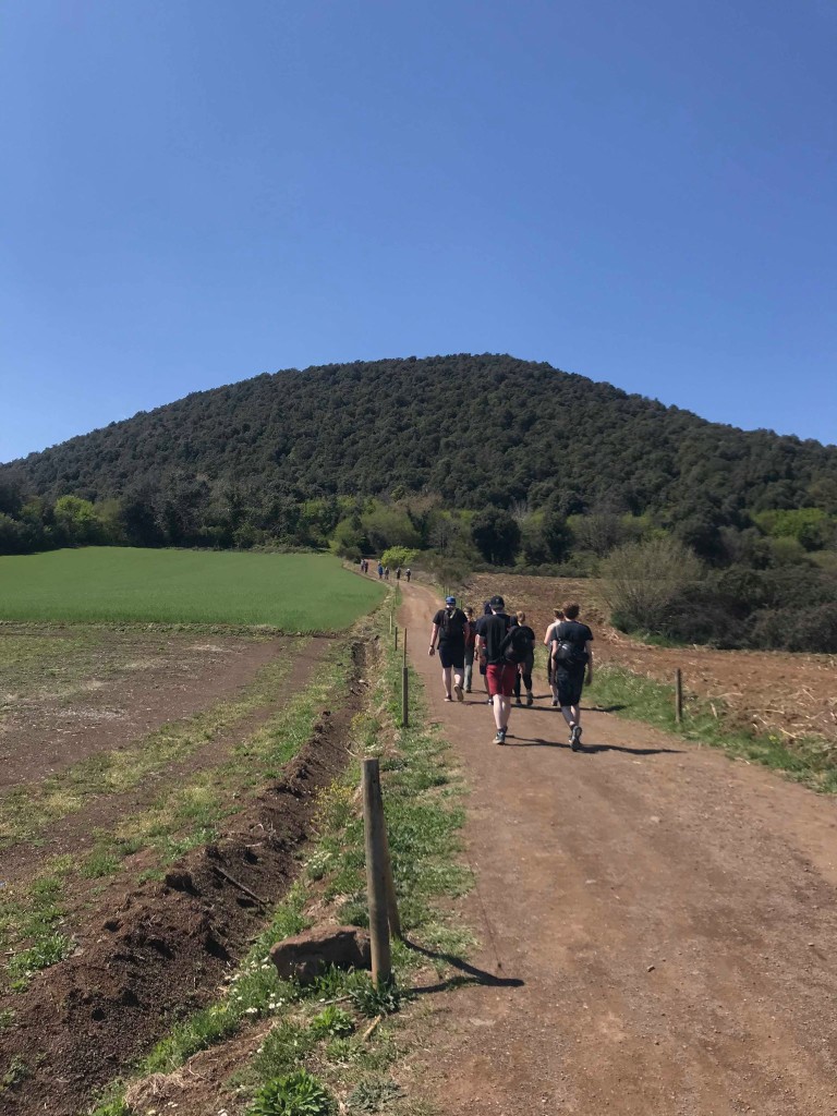
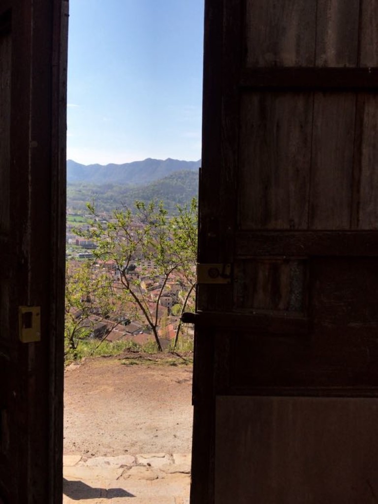
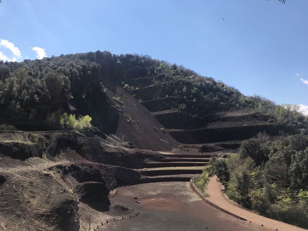
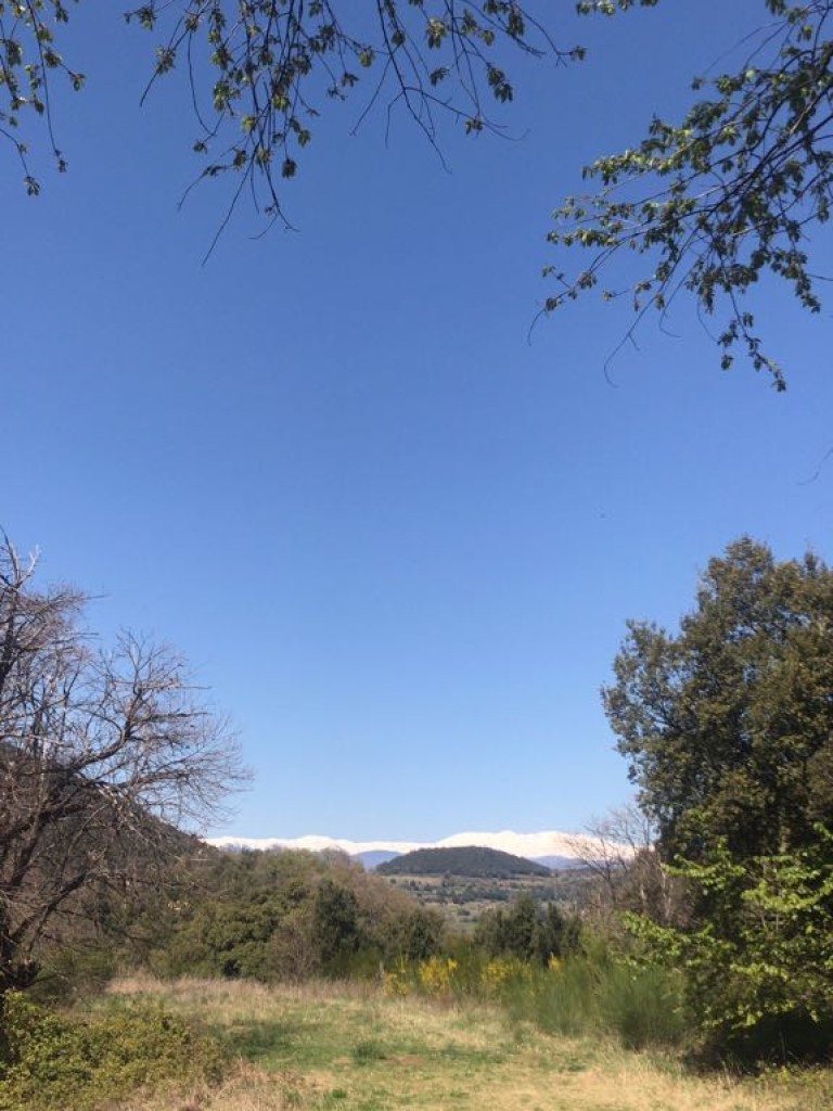
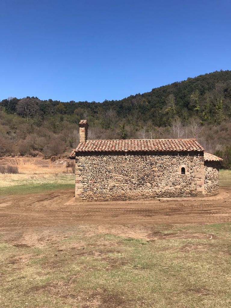
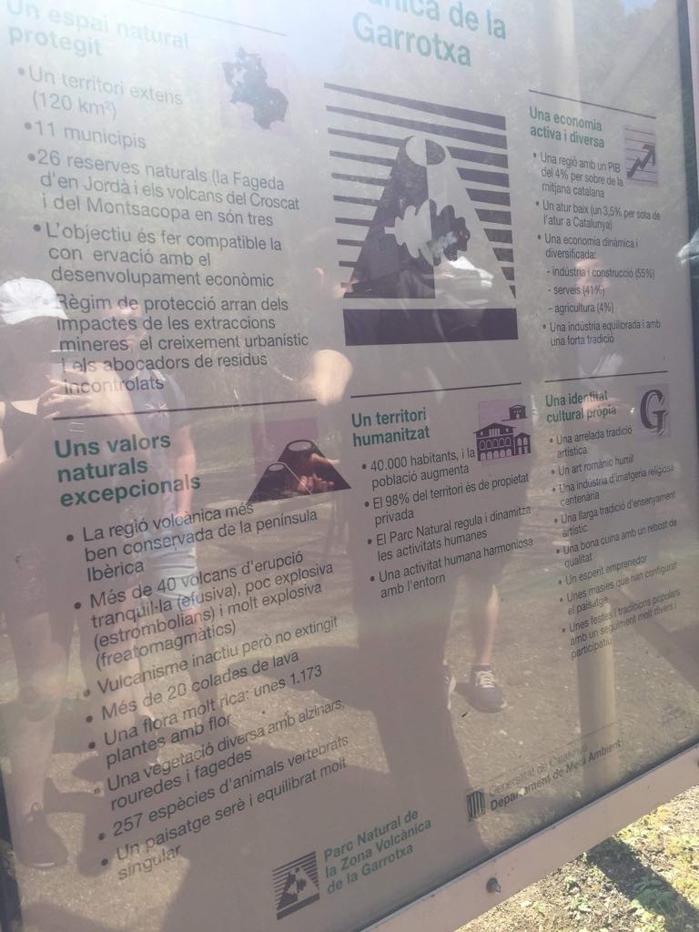
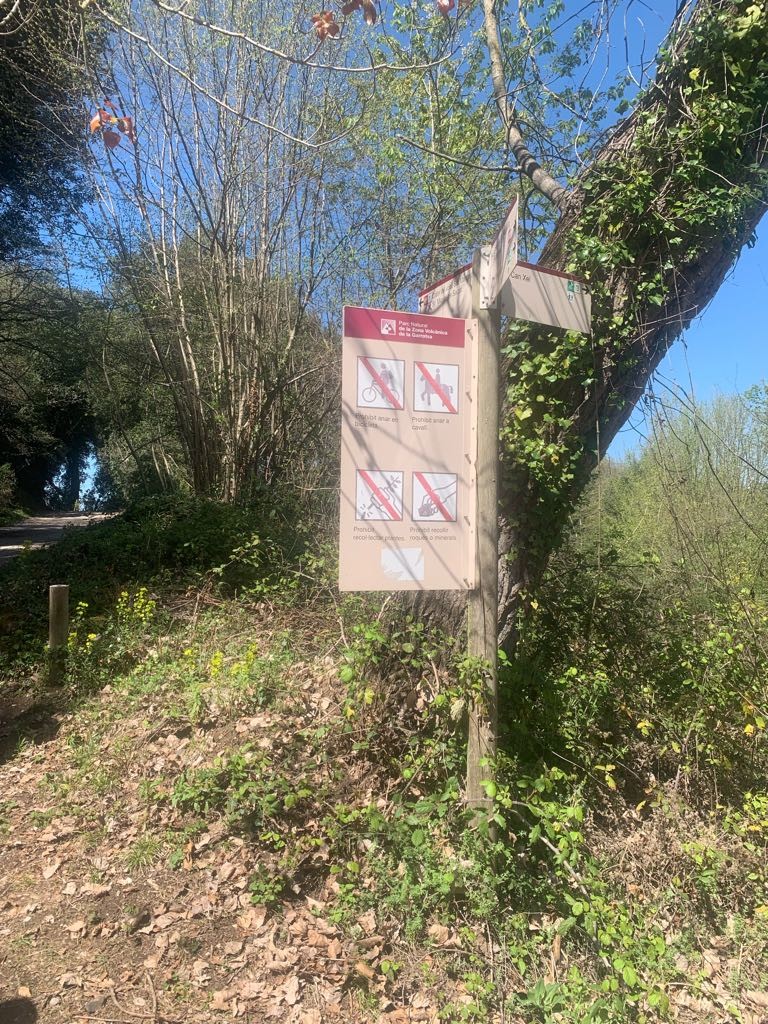
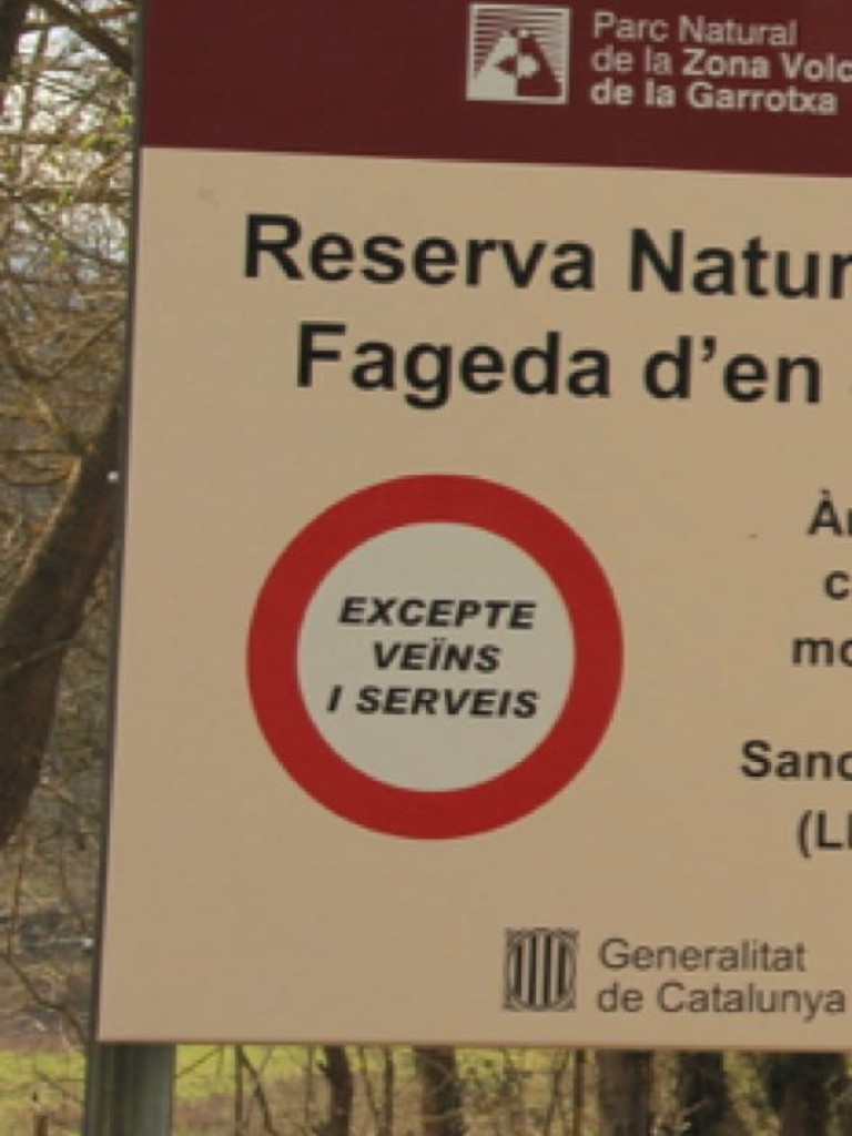
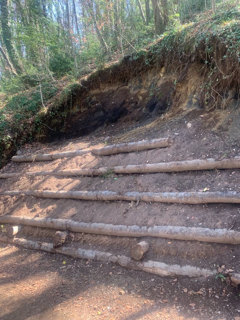
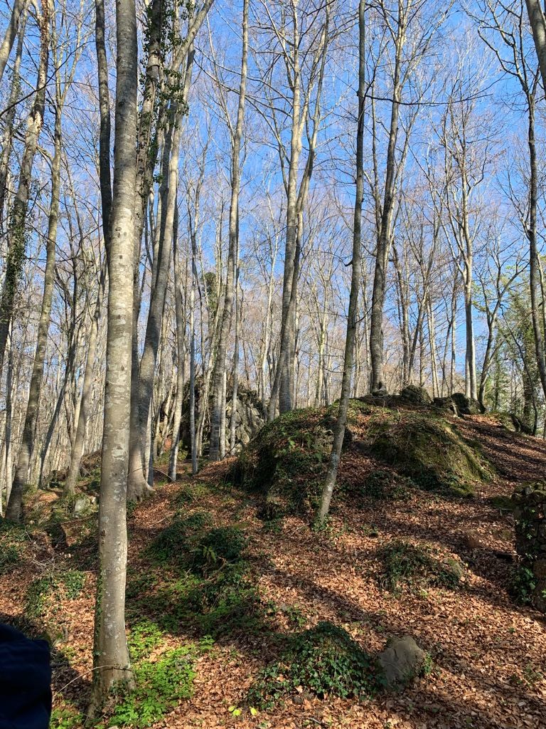
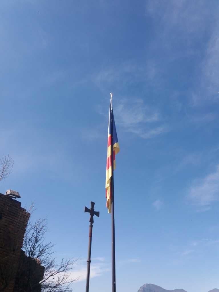
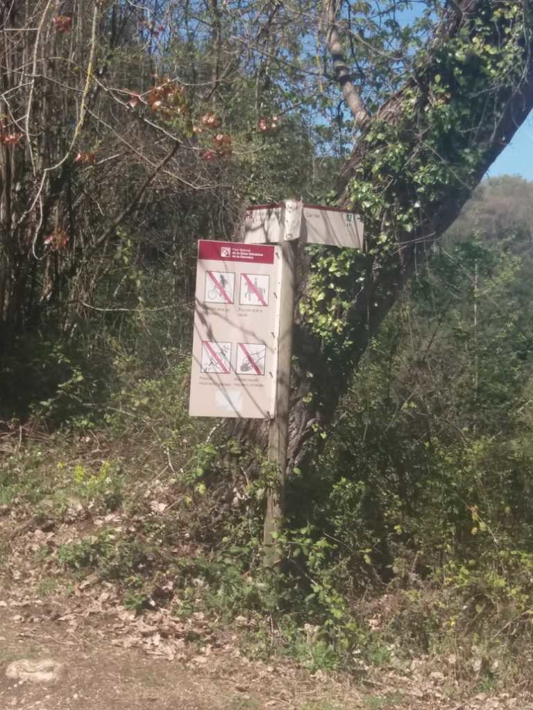
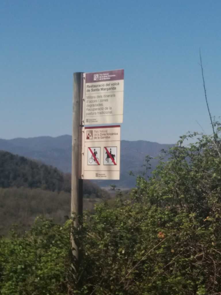
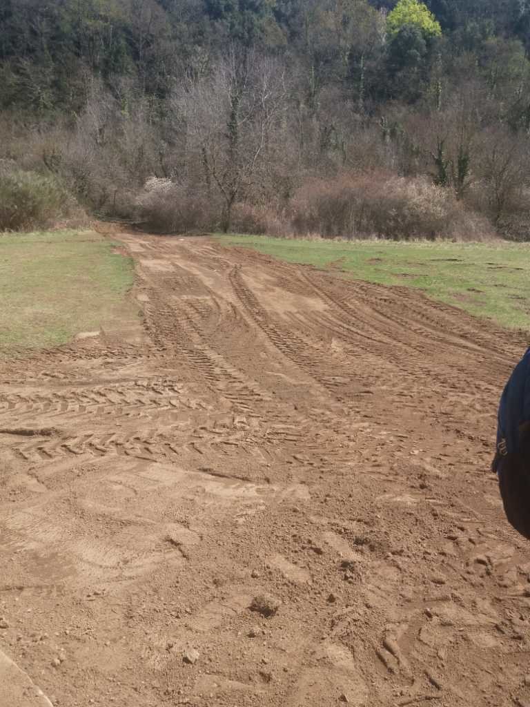
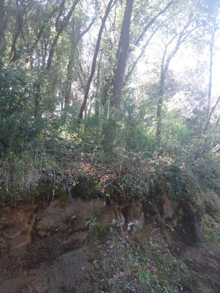
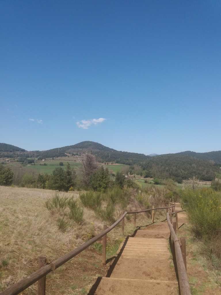
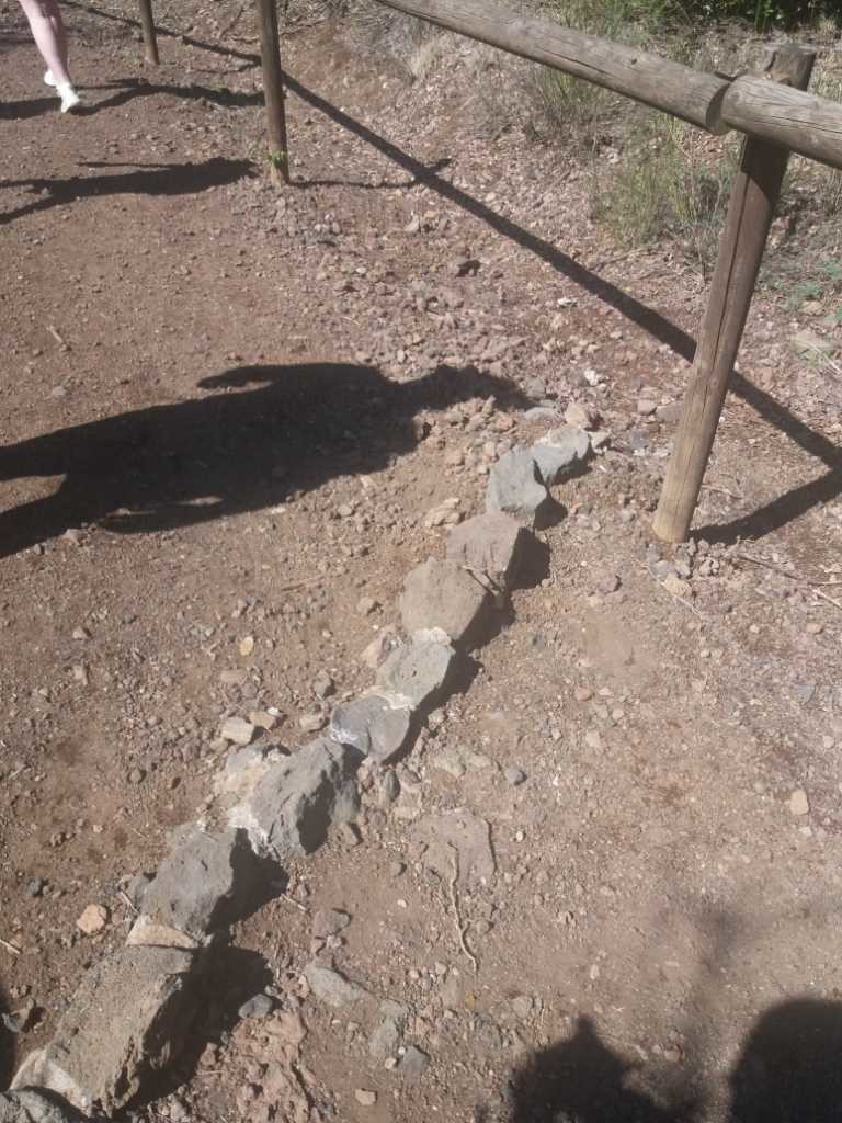
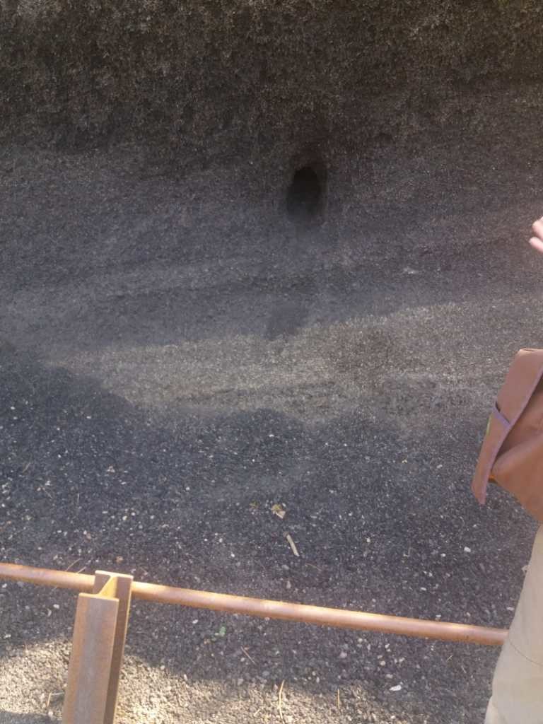
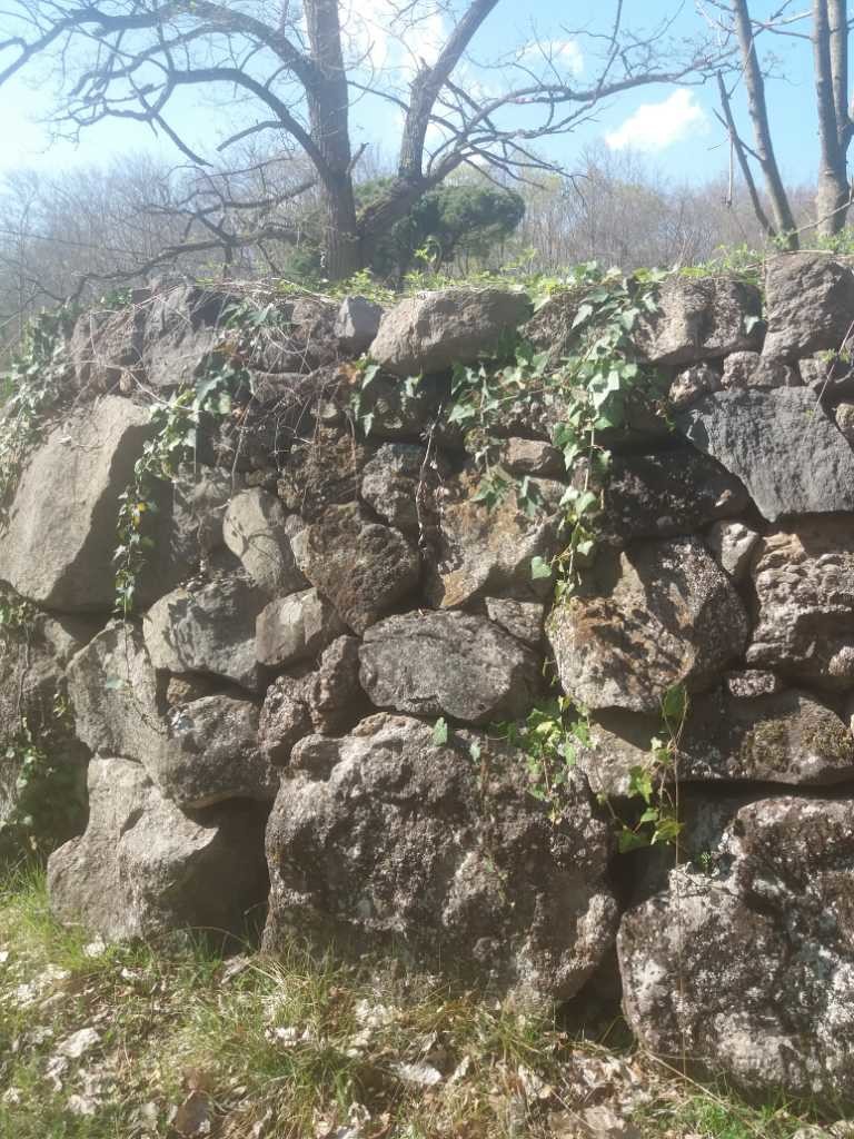
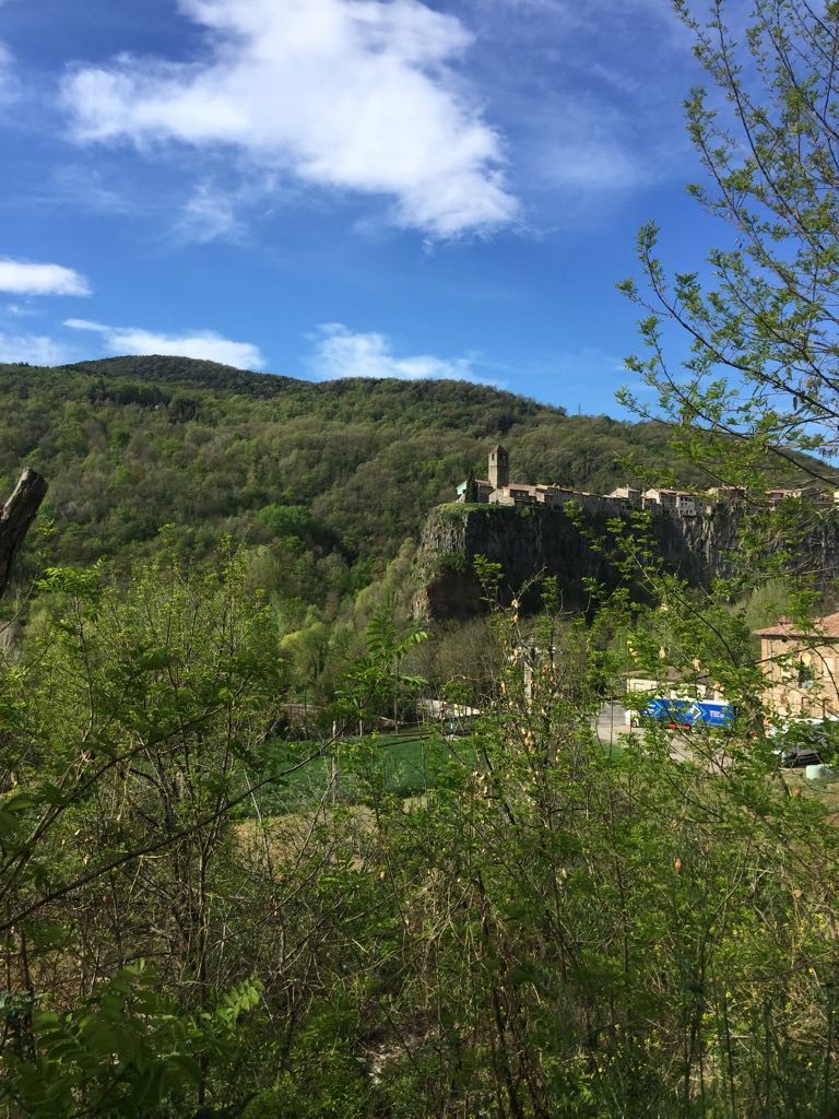
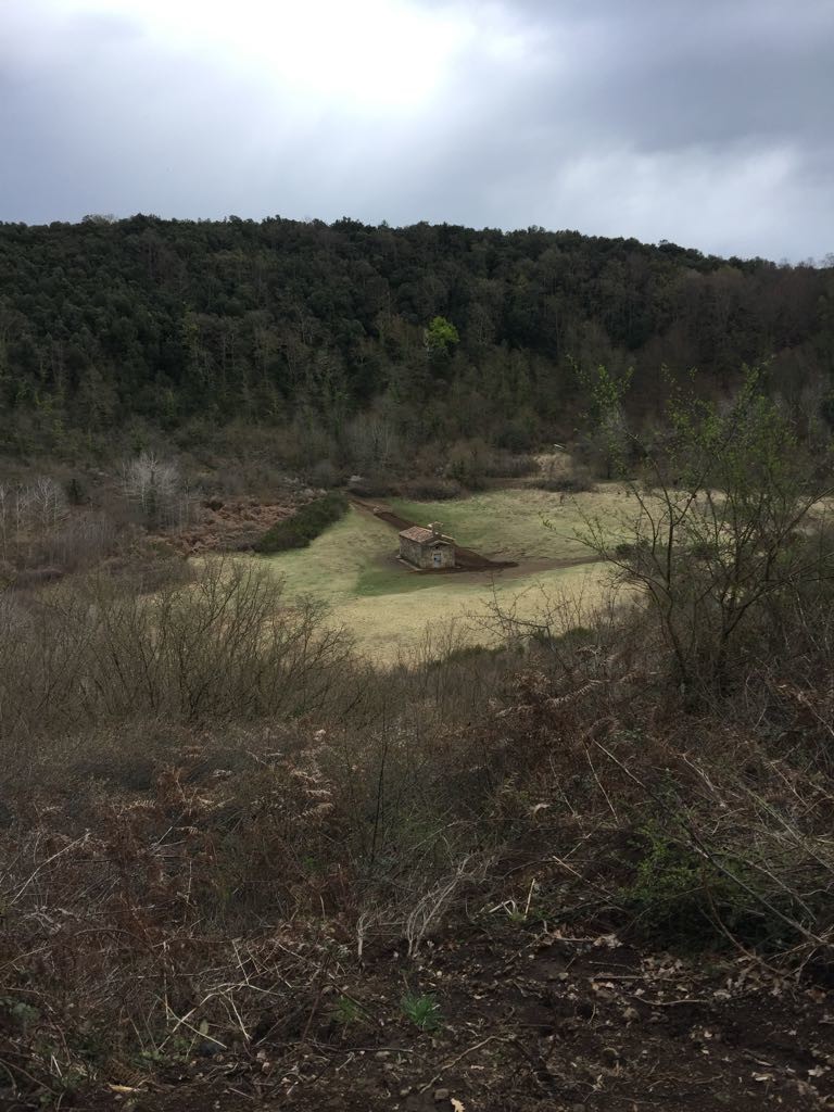
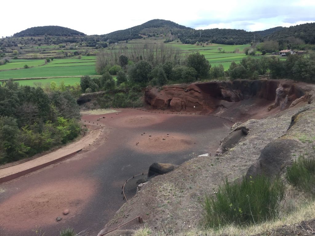
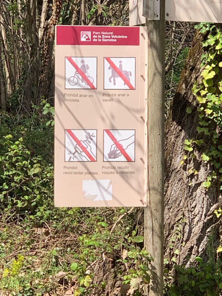
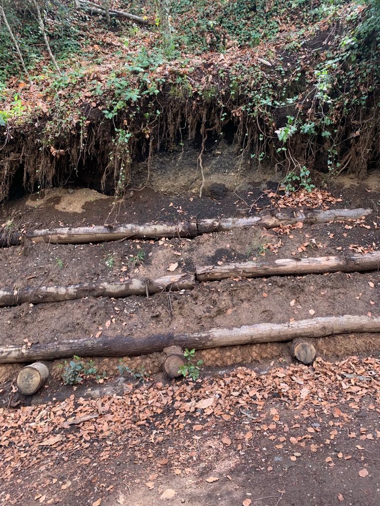
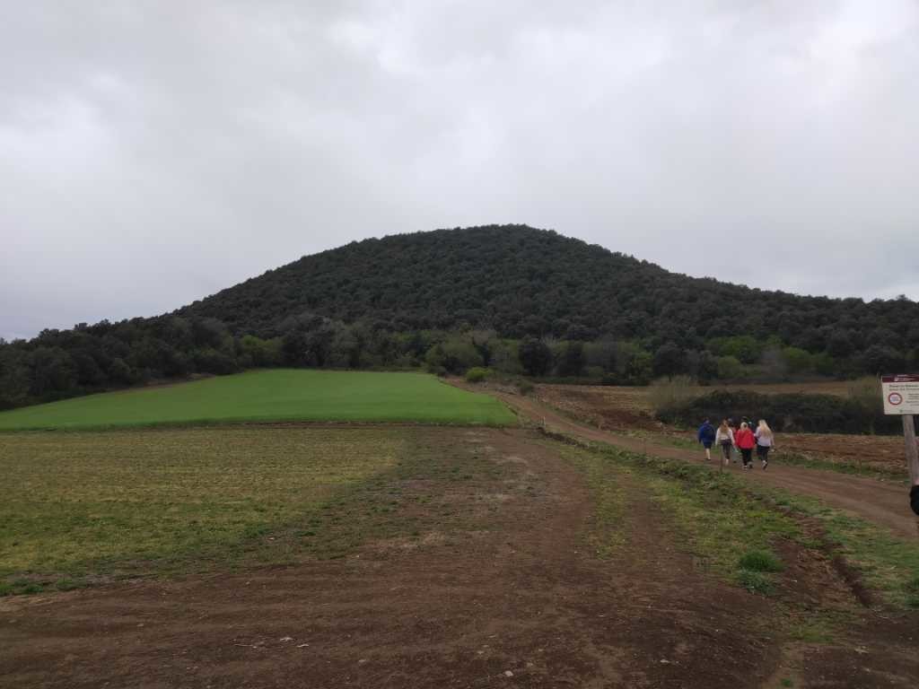
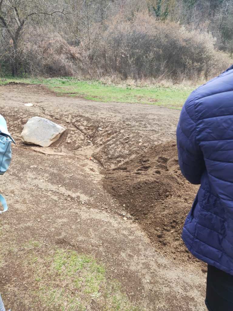
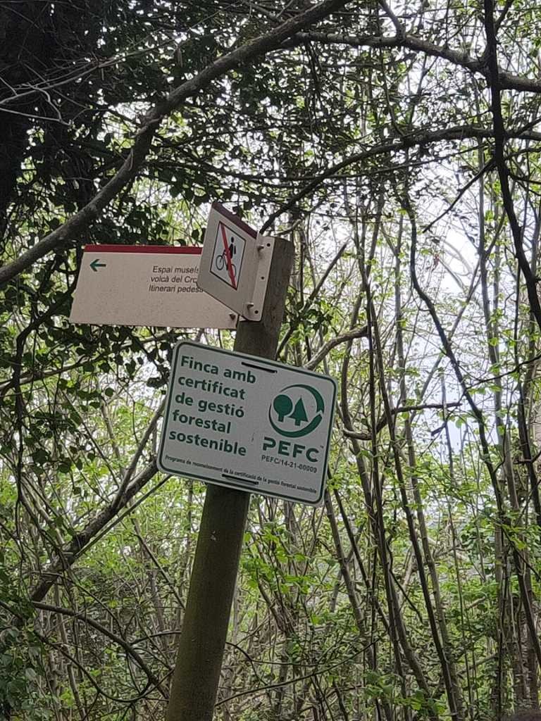
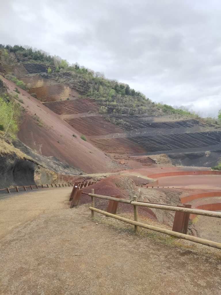
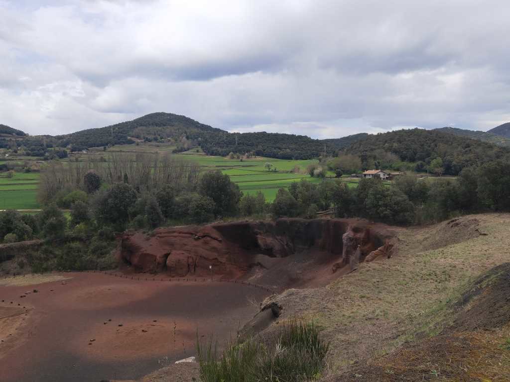
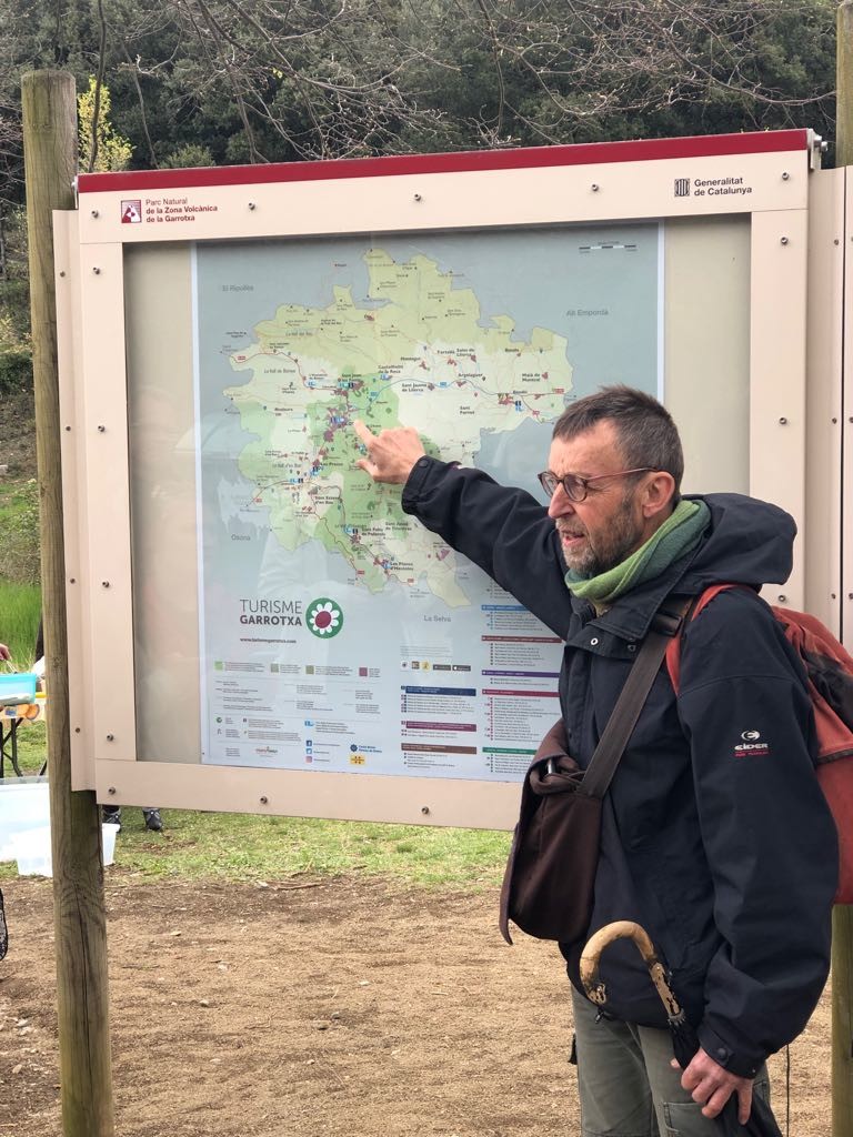
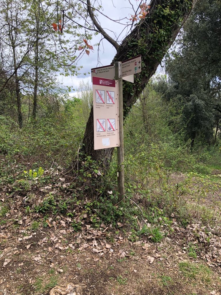
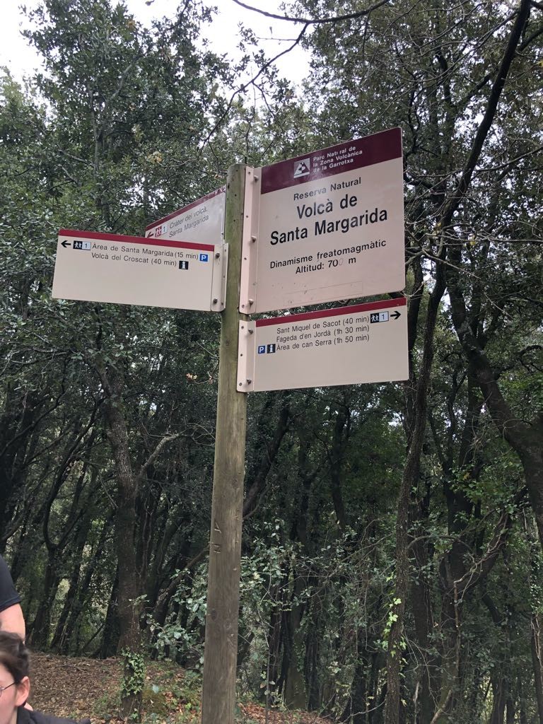
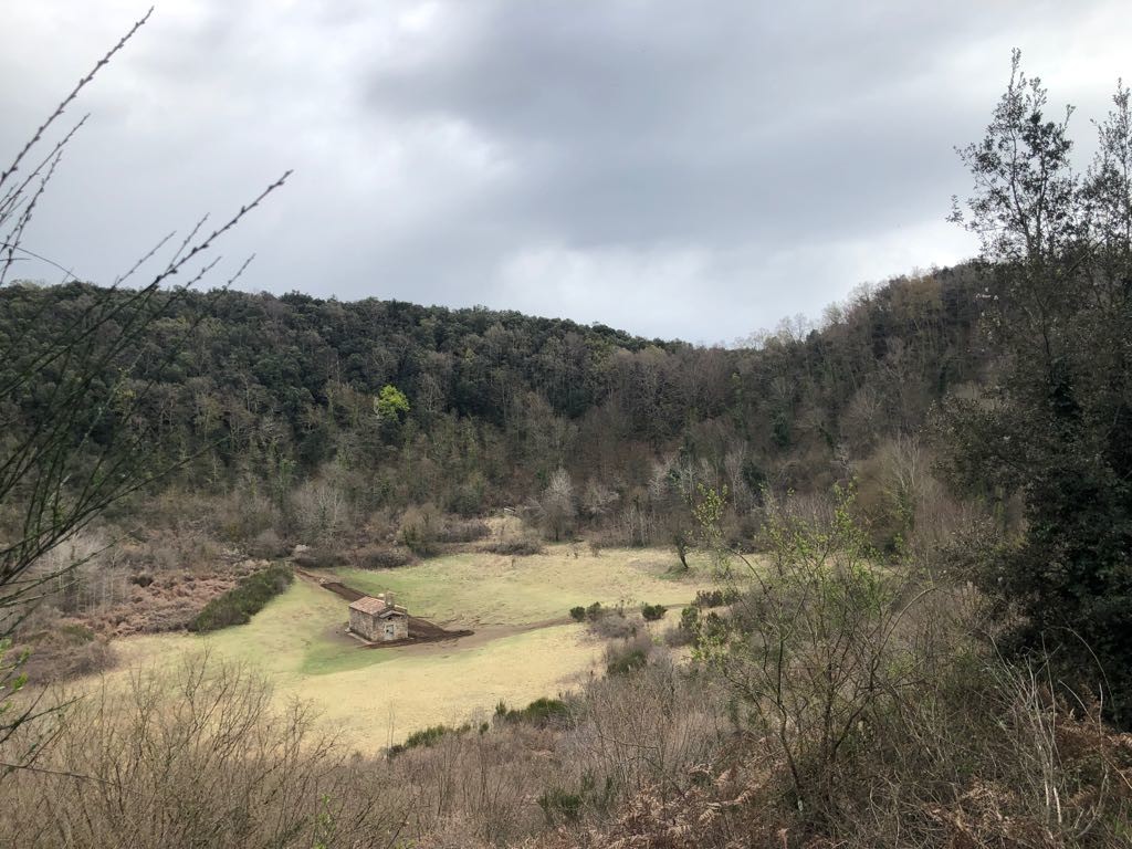
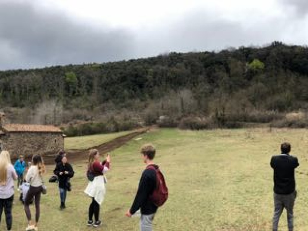
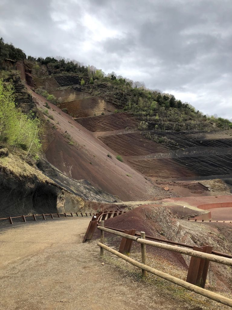
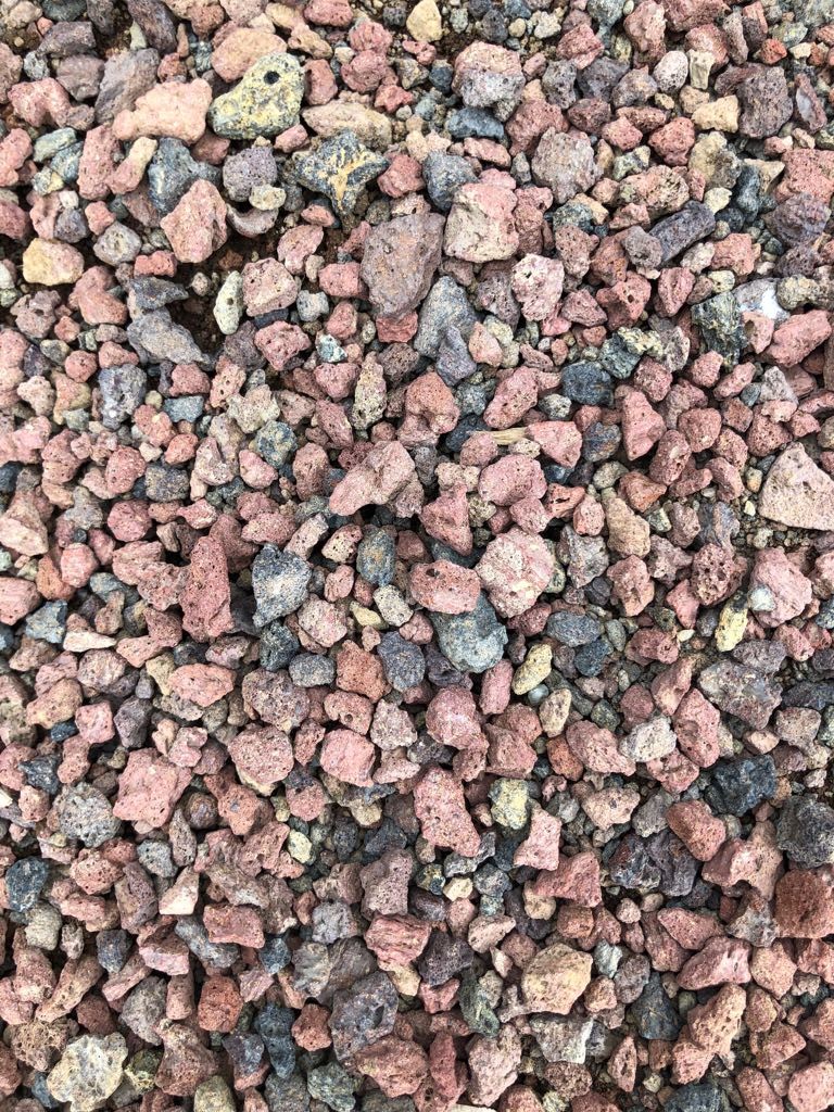
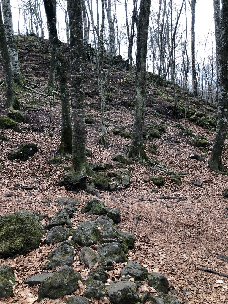
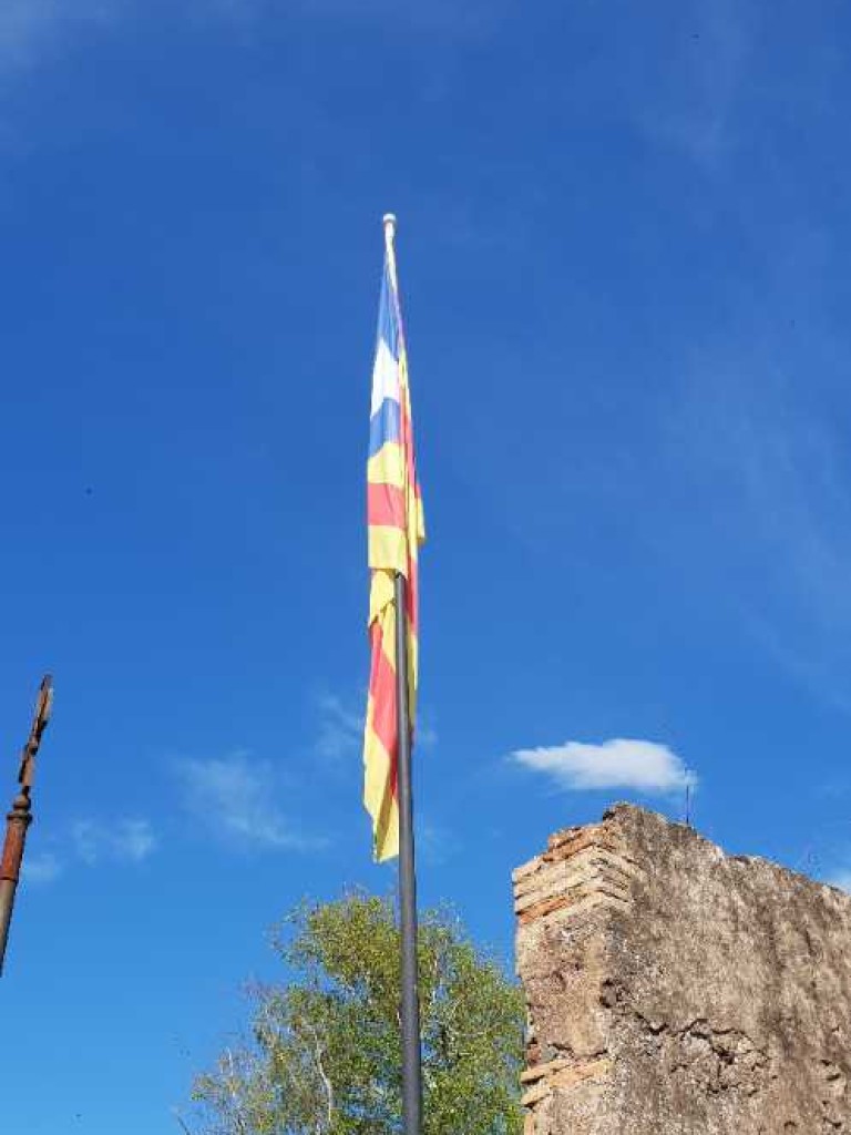
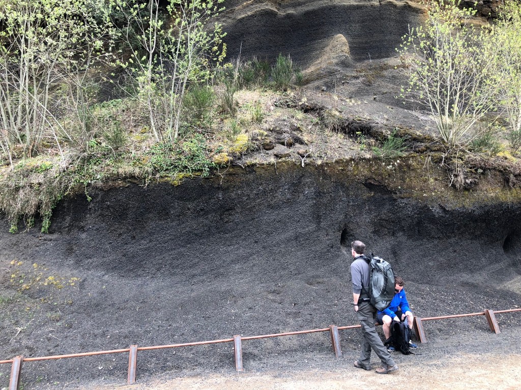
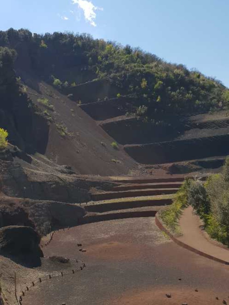
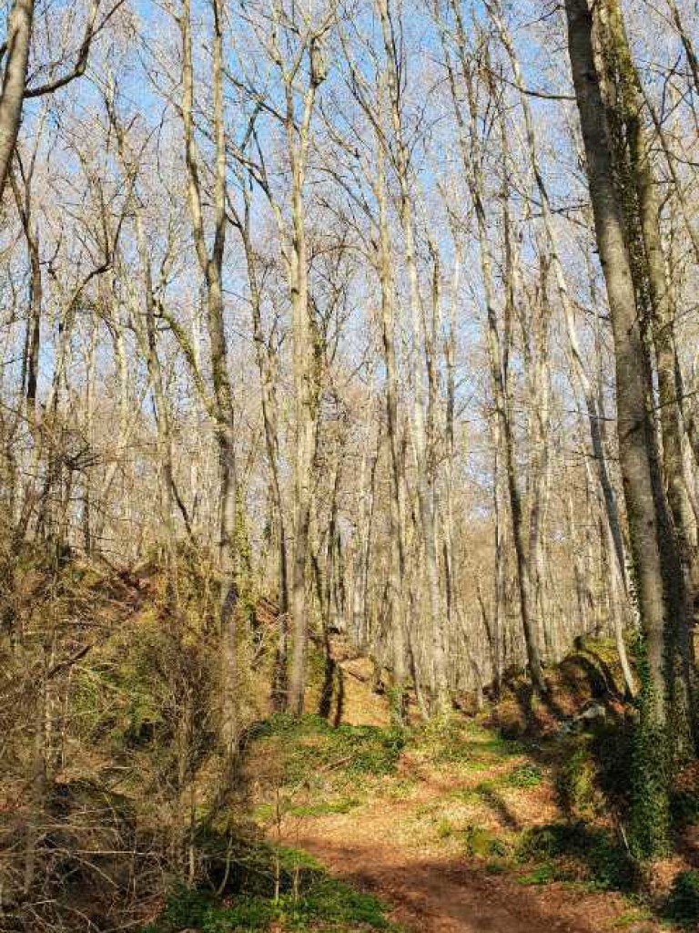
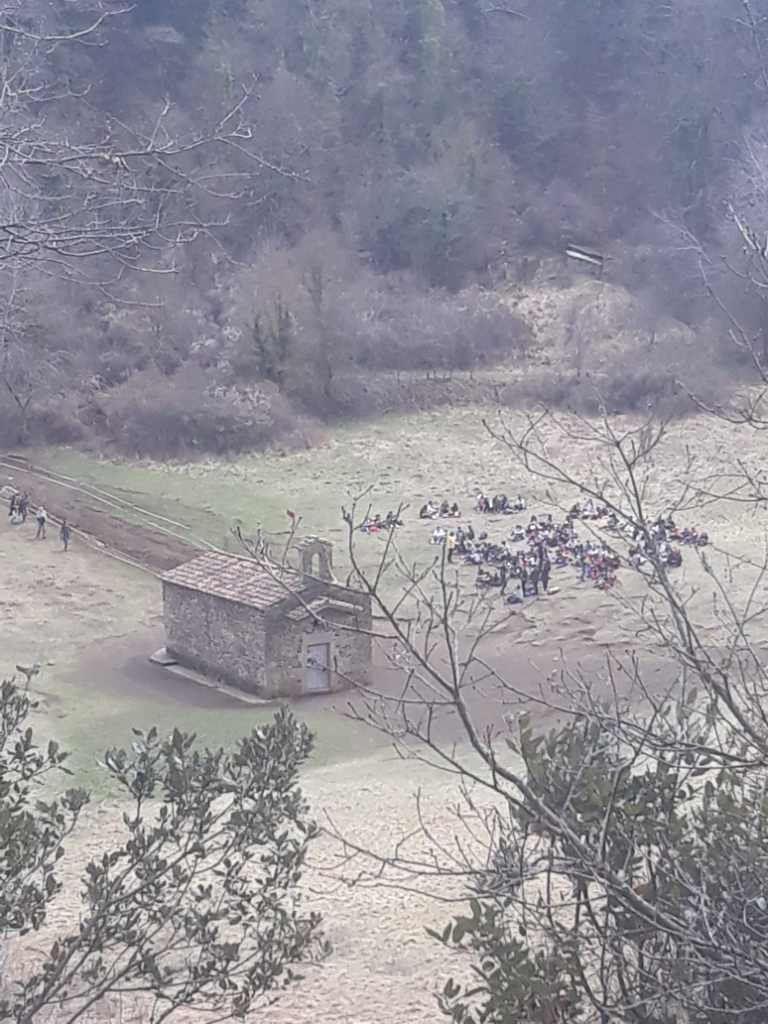
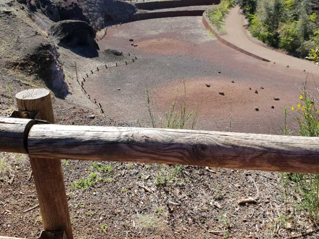
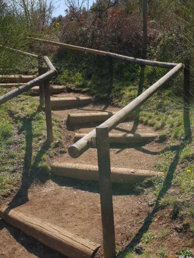
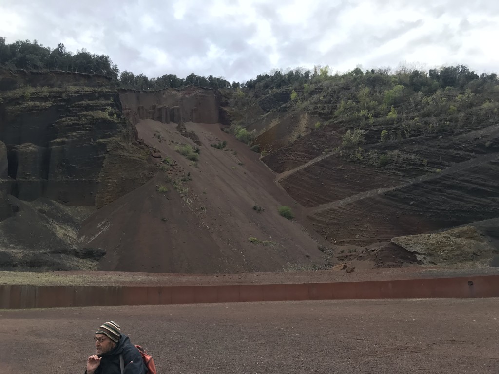
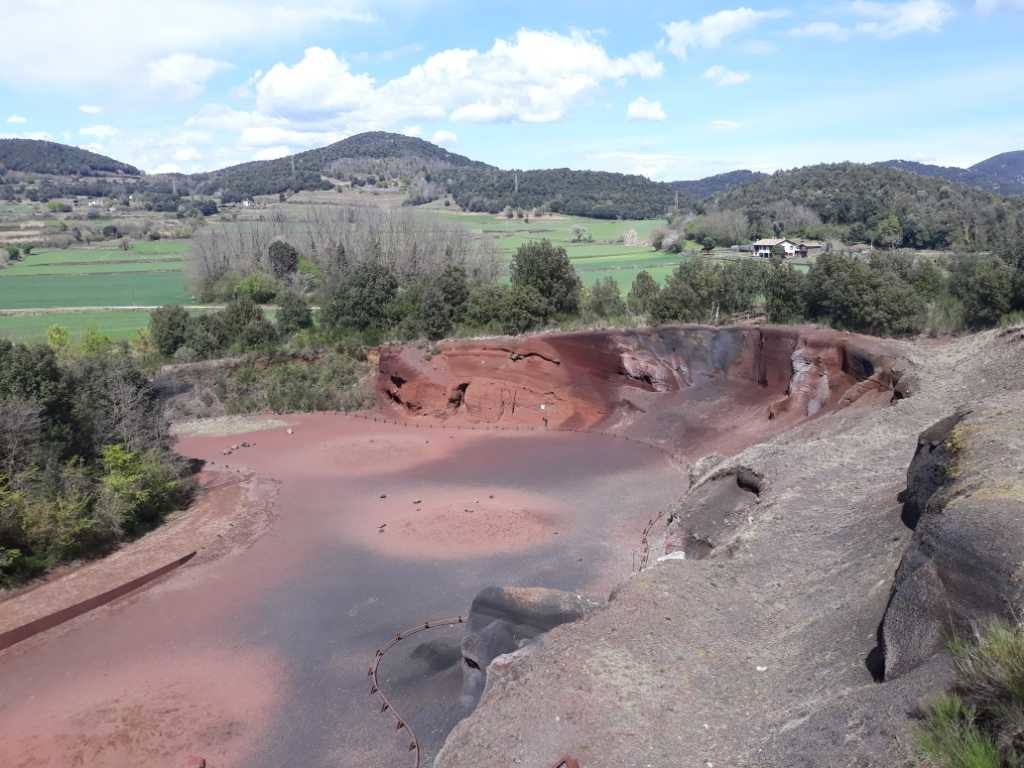